Now that our spring workshops are in full swing, we’ll be posting all of the documents used in the workshops here. That way if you missed a workshop or misplaced a document from the workshop, you can access the information here and even use it to do the workshops on your own time. The documents for […]
Winter Mystery Map Revealed
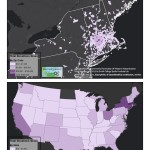
Answer Revealed: As many of you successfully guessed — our winter mystery map, themed: Annual Valley Event, was mapping… Valley Gives Day 2014! Making the Map The first map produced was the one used as the winter mystery map. […]
Drones in the Humanities
Five College Digital Humanities Grant As an emergent technology, it is perhaps not surprising that there is not a clear consensus on what a drone is. Even what constitutes the technology of a drone—or, more accurately for the purposes of this grant, a civilian drone—is up for interrogation. Under FAA regulations, model airplanes, weather balloons, […]
February 2015 Update (16th – 27th)
It has been a busy two weeks in the Spatial Analysis Lab. Read on to learn about our most recent support of GIS work across campus. 1. Class Support 2. Student Support 3. Faculty Support 4. Outreach 5. Campus Connections 1. Class Support We kicked off our work with Professor Camille Washington-Ottombre’s class Environmental Integration II: Collecting […]
Commercial Drones in Our Backyards?
Please join us for our Commercial Drones in Our Backyards event on Wednesday, March 4th, 2015 from 7:00 – 9:00 PM in John M. Greene Hall, Smith College Campus. Consider: Will drones darken our skies? Are we subject to staying indoors if a drone flight is in our neighborhood? Will academics have space and opportunity to teach […]
Winter 2015 Mystery Map
In celebration of the indoors we bring you our latest Mystery Map to help occupy your mind through the last of the winter’s cold! Challenge: Name the Annual Event Bonus: Explain the Pattern click to expand Submit answers here by Friday 3/6 — winner will be announced soon after
Spring Semester Update (Jan 12 – Feb 13)
Snow or shine, the SAL is working hard this semester. See our most recent activity outlined below: 1. Class Support 2. Student Support 3. Faculty Support 4. Outreach 5. Campus Connections 1. Class Support We’ve been working with a Professor Camille Washington-Ottombre to design two new water related GIS labs for Environmental Integration II: Collecting and Analyzing Information (ENV201/202). […]
Spring ’15 Workshop Offerings
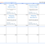
Workshops offered by the SAL in spring 2015 — together they provide an introduction to mapping and GIS (Geographic Information System), and separately provide skills for particular GIS tools and skills — mapping addresses data, using GPS unit to collect data, etc. Note: most of our workshops can be taken as stand-alone workshops, however the workshops that […]
Interterm Course 2015 — Recap
The Spatial Analysis Lab was excited to kick of 2015 with an intro to GIS interterm course in the first week of January Term! 14 students joined us in the SAL for 5 days of GIS exploration with ArcGIS. The course was structured around the development of key GIS skills. Each day focused on one or […]
November in Review
Well, November was quite a busy month. So busy, in fact, that we were unable to spend time writing weekly updates to post. Our review covers the entire month of November and is organized by type of work: Overview Class Support 1. Study of Women and Gender 230 2. Spaces of Mexico (SoMec) 3. ENV201/202 4. Soc232 Student […]


