What and Why we Teach – Interdisciplinary GIS Position

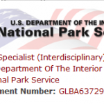
One of Spatial Analysis Lab alums brought this cool job Interdisciplinary GIS Specialist  to my attention.  It certainly has all the ingredients for the type of student we teach at Smith, especially within the Environmental Science and Policy Program. Thanks Naomi !

Finding GIS Careers

Jobs and careers eventually become the focus for many our our students.  I have let slip every now and then that GIS could be thought of as a “Guaranteed Income Source”.  So,  I usually scan the GIS job boards, listerservs, etc. every now and then to get a sense of what industry and organizations are […]

Student Assistant Positions in the SAL

Exciting and Challenging student positions in the Spatial Analysis Lab are now posted and open for applications.  Please visit the JobX website and look for the following positions (hint: search for “spatial”) Mapper Girl Mapper girl is the lead super hero and the position is part of the On Campus Internship Program (OCIP). GeoEvent Girl […]

NYC Housing and Neighborhood Survey – GIS Intern

The NYC Housing and Neighborhood Survey is an experimental study of 3,000 households randomly assigned to receive in-place subsidized housing in one of eleven large-scale new construction rental developments sponsored by the City of New York’s Department of Housing Preservation and Development (HPD). The proposed project will provide an in-depth examination of the association between […]

Wildlife Population Ecologist

Mass DEP is looking for a Wildlife Population Ecologist. The applicant must have strong analytical capabilities relative to population dynamics modeling using statistical models, remote sensing, GPS and GIS applications in the conservation and management of vertebrate species. Primary focus is on the design and production of landscape-level analyses and map products. The position is […]

Spartina Control Monitor Internship

…identification of native and invasive Spartina species and their hybrids, and in the use of ArcPad software on Trimble GPS units to relocate previously-mapped invasive Spartina patches and to record treatment of these patches during treatment activities.

Deputy Director of GIS and Information Management

manage a wide variety of data and information resources to support operations and analytics for Forestry, Horticulture and Natural Resources. Work with managers and cooperating researchers on analyses and data dissemination/coordination.

NOAA summer 2011 internship

Project Description: You’ll work with us to develop a trial storm wave forecasting atlas for use by the National Weather Service to provide emergency wave height information to mariners using a new, GIS-based software tool developed at our Center.