By SAL Assistant Rachel Moskowitz ’18 During the fall semester, Professor Liz Klarich came to the Spatial Analysis Lab to ask for assistance with a series of maps for her book manuscript. She requested help with three publication maps detailing her archaeology research in Pukara (Pucará), near Lake Titicaca in the Peruvian Andes. Professor Klarich […]
Category Archives: Portfolio
Creating a Twitter-Scraper for Tweets about Smith and Northampton
By SAL Assistant Kalynn Kosyka ’19 The goal of the project was to map social media data to look for interesting geographic patterns. We originally wanted to use data from Instagram, but, unfortunately, Instagram changed their restriction policy last summer making it difficult to obtain the data we wanted. However, we were able to access Twitter […]
Update: When In Rome
Our most loyal readers may remember that we announced a collaborative project with the Smith College Museum of Art back in March. We set off last semester to create a Story Map for their autumn exhibition, When In Rome: Prints & Photographs, 1550-1900. In addition to serving as a public, digital archive of the exhibition, […]
Wrapping up Web GIS at UMass
Throughout this semester, we’ve been working with a Five College class at UMass called “Community Service with Web-Based Geographic Information Science and Technology (GIST)” that Jon was co-teaching. The five Smith students in the class worked on two semester-long projects for their community partners. We encountered many bumps along the way, but despite it all […]
Using Story Maps to explore climate change vulnerability at Smith
By Karen Yu ’16 This year, Story Maps have been an increasingly important part of what we do in the SAL – see our recent post Story Maps in the Classroom for an overview of the different ways we’ve been using them. A quick recap for those that don’t know: Story Maps are a user-friendly way to look […]
Smith College Rail System
Geo-artist Elena Terhune ’14 created this awesome map of an imagined Smith College Subway System. Check it out, and read what she has to say about the process of creating it: “Especially in the colder winter weather, we have all idly wished for some way to travel quickly and warmly. Smith’s Spatial Analysis Lab heard you, […]
Alternative Locations for Ford Hall and Future Campus Expansion
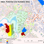
Shu Liu Geo150, spring 2007 Smith College’s Ford Hall is an approximately 140,000-square-foot building that will accommodate its expanding Picker Engineering Program, computer science, chemistry, biochemistry, and molecular biology departments. Named in honor of the Ford Motor Company Fund, the primary donor to the scheme, Ford Hall will be a sustainable, environmentally friendly and academically-inspiring […]
Implications of Proposed Employee Parking Cash Out Program at Smith
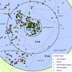
Melissa Kelley Geo150, spring 2007 My map displays the relationship between employee groups at Smith College (faculty, administration, administrative support, course support and service) and place of residence. In particular, my project explores the implications of the proposed employee parking cash out program, included in the new parking master plan released February 8, 2007, under […]
From Pilgrims to Pluralism: America’s Religious Landscape
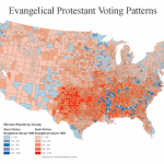
From Pilgrims to Pluralism: America’s Religious Landscape, by Lydia Rainville ’07
Sustainable Wal-Mart Locations and the Demographics Behind Their Construction
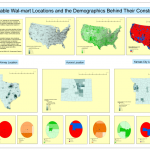
Katherine Jones Geo150, spring 2007 Wal-Mart Stores Inc. has grown in the last forty years to be one of the most successful retailers in the world. In 2007 the company reported having 1,063 regular stores and 2,285 Supercenters in the United States alone1. This success, however, has been subject to great controversy. The retailer has […]


