Sampling of Spatial Analysis Lab Research activity
Select Drone Mapping Missions
ArcGIS Online Format
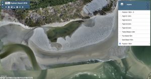
Popham Beach, Phippsburg, ME April 2018
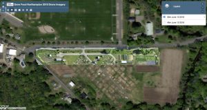
Grow Food Northampton, Northampton, May 2018
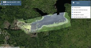
Fitzgerald Lake, Northampton, May/June 2018
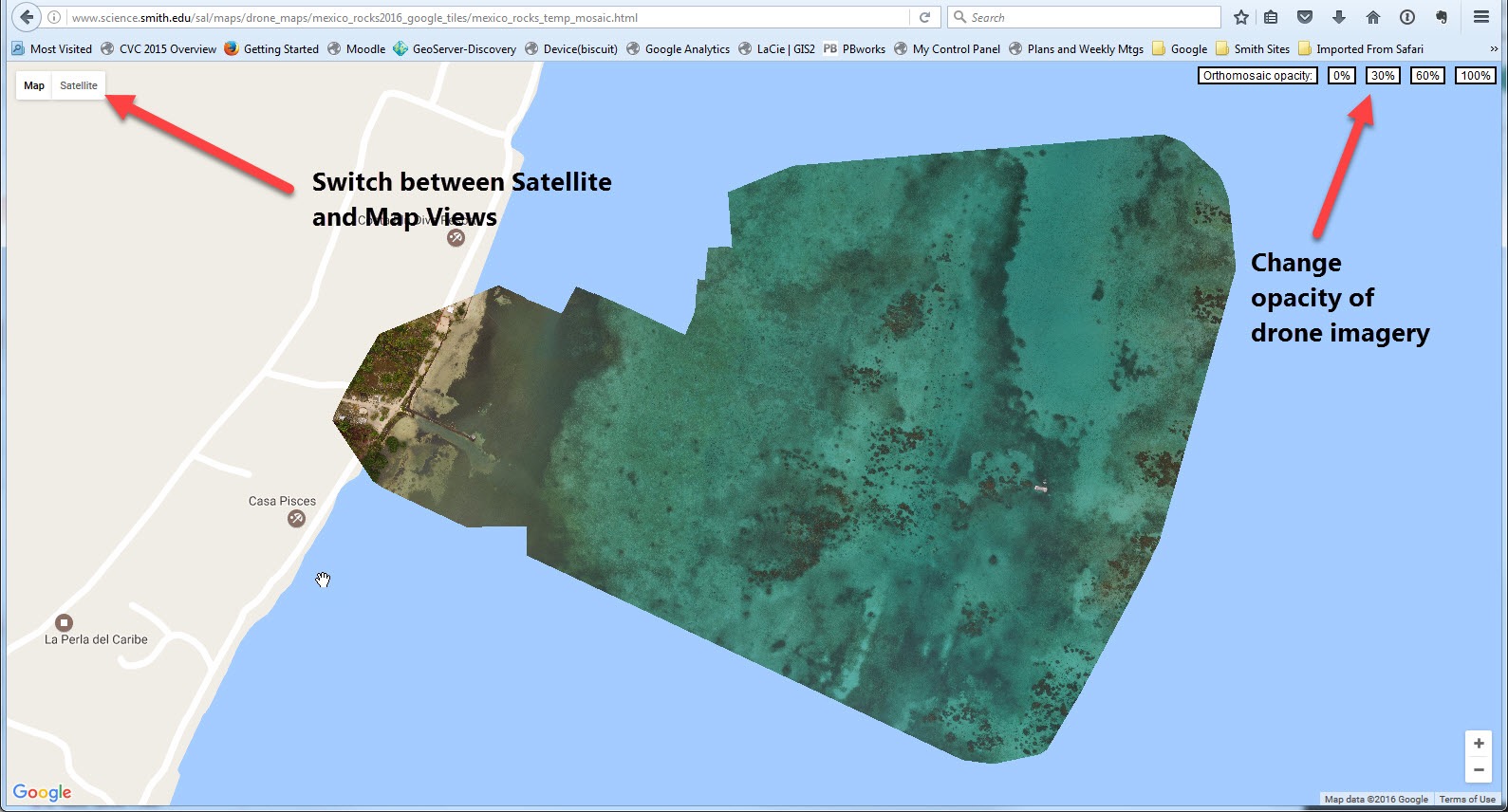
Google Maps Overlays
Instructions for using Google Map Overlays
- Seawall Marsh, Popham Beach, Maine April 25 2016
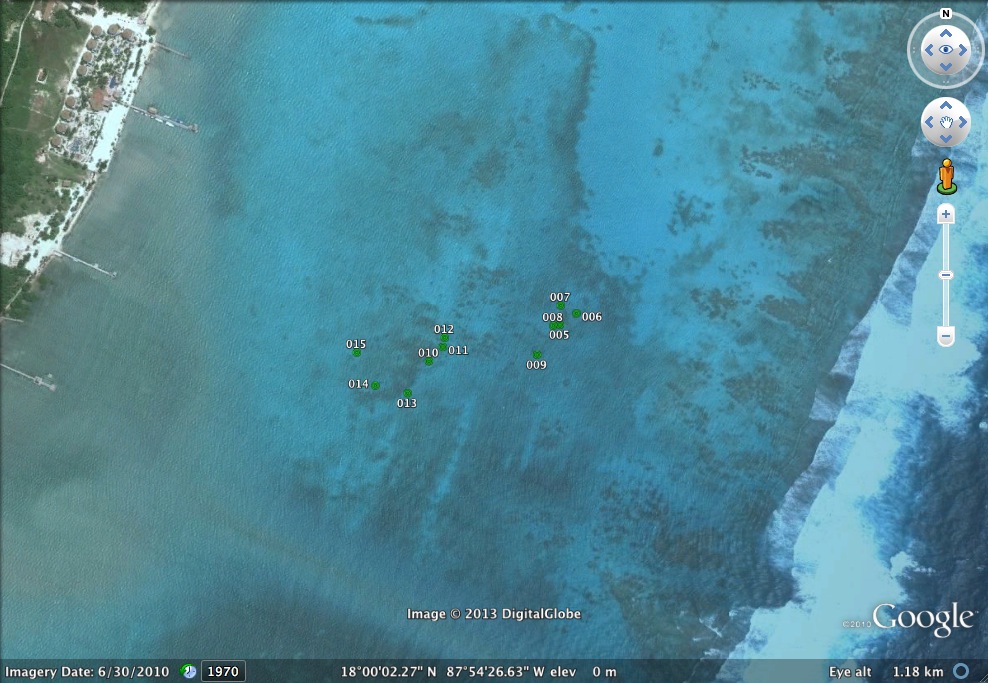
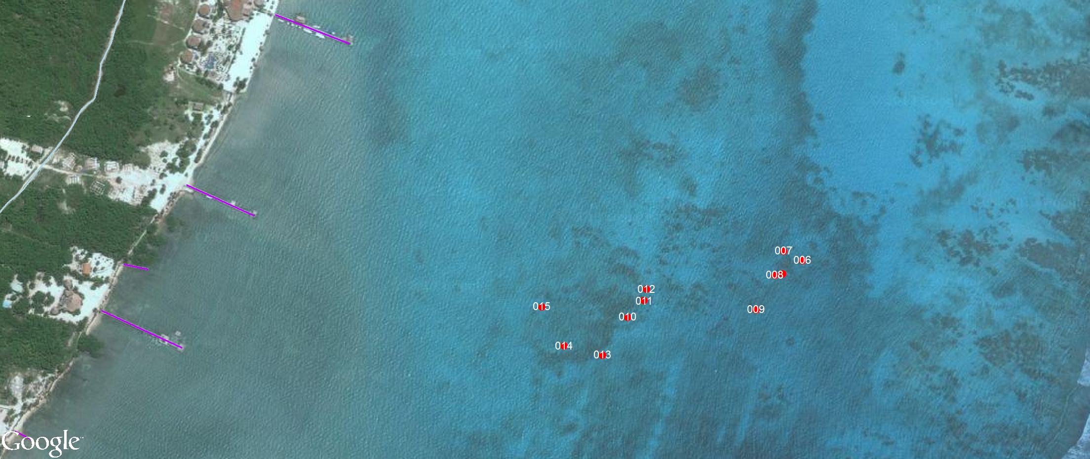
- Mexico Rocks, Belize, June 2016
- Gulf Coast, San Salvador, The Bahamas, January 2016
- North Pigeon Creek, San Salvador, The Bahamas, January 2016
- Salt Pond, San Salvador, The Bahamas, January 2016
- Stream Restoration, MacLeish Field Station, Whately MA, Fall 2016
- Invasive Species, Fitzgerald Lake, Northampton, June 08 2017 (70 meters)
- Bringing Back Paradise – Smith College Paradise Pond
- St. Catherines Island, GA
2012 – 2013 –
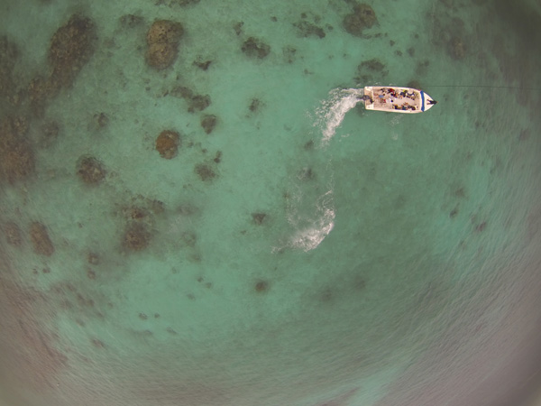
Mapping Coral Reefs – Belize
Sample Images
2011 – 2013
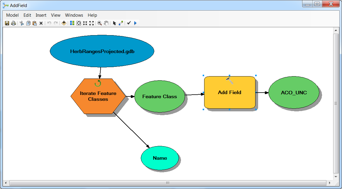
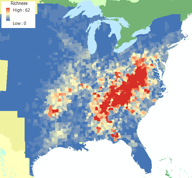
Biogeography of forest plant endemism in eastern North America
Jesse Bellemare, David A. Moeller2, Lilly Dalton ’12, Emily Barbour ’14, Katherine Dymek ’14, and Jon Caris
2 = University of Minnesota, Dept. of Plant Biology
Processed nearly 200 individual species range maps(see models below) from the Biota of North America Program to produce a map highlighting clusters of forest plant locations and diversity.
2009
A Community Divided? 

Sarah Motti ’10 and Jon Caris
2006
Geography Lesson for Legislators
Nat Fortune. Mapping support by Amanda Nyren ’06 and Jon Caris

2005 and 2001
Illustrating the Invisible (Psychology of Space)
Stephanie Keep ’01. Advisors: Peter de Villiers and Jon Caris