The Spatial Analysis Lab is excited to offer another set of workshops– new and old– for Spring 2020! Take a look at the schedule and mark your calendars for more spatial learning. Please give us a heads up by registering for the workshops that interest you. Snacks will be provided! Drone Ethics: Creating a […]
Category Archives: GIS
Where is Everybody? Campus Directory Mapping
By Kalynn Kosyka, Computer Science & Data Science ’19 Currently, Smith College is going through major renovations which resulted in many staff members being relocated. The Campus Directory Map will allow the user to query on name, department, and/or person type (faculty, staff, student) from the college directory. After querying, the user will be directed […]
Mystery Map 2018 Kickoff
The state of affairs for a new year can be uncertain, but your unequivocal love for map mysteries is huge! [advanced_iframe securitykey=”5bc49ba0db168937774fd40d43b1f0f57eecc76d” src= “https://smithgis.carto.com/builder/8fca40dd-aad5-4a0a-b46b-e2e4f507ab8a/embed”] You can launch the full version here. Hint: Not sports-related despite the title, but a clue is embedded in the post. [advanced_iframe securitykey=”5bc49ba0db168937774fd40d43b1f0f57eecc76d” src=”https://docs.google.com/forms/d/e/1FAIpQLSfzE8R5iftl5ihZyff1Z2tk5ihT1epSnhfYXajXkakCfZKVxg/viewform?embedded=true” width=”760″ height=”500″ frameborder=”0″ marginheight=”0″ marginwidth=”0″]
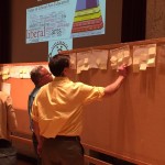
Upcoming Spring 2018 Workshops
The grand reveal: the spring 2018 workshop schedule! All workshops are held in the Lab, Sabin-Reed 104. We like to offer a variety of workshops each semester, so we can also host tailored workshops for your group or department. If interested, please contact sal@smith.edu. Please note that two workshops require pre-registration — you can sign-up […]
J-Term 2018 Review
The SAL offered two courses during interterm: Introduction to GIS and Drone Thinking. Introduction to GIS As foretold by a fortune cookie, “the great aim of education is not knowledge but action…with GIS” — this year’s GIS class emphasized the pedagogical shift to how to learn GIS rather than teach GIS. The materials covered in […]
Today in History as Told by Maps: September 26, 1991 / Site Selection
Biosphere 2 (“Warning. All hell’s breaking loose.” — Bio-Dome) is the largest closed ecological system research facility, modeled after the original biosphere, Earth. This day in 1991 marks the beginning of the first two-year mission to study feasibility of self-sufficient systems for potential human space colonies. A planned vivarium spanning 3.14 acres in Oracle, Arizona, Biosphere […]
Interterm GIS Course
Like most years, the SAL team taught a week-long GIS course during interterm to give a GIS jumpstart to students who want to learn what GIS is all about but can’t take (or haven’t yet taken) the semester-long GIS course. This year, however, we made some big changes to our curriculum that we’re pretty excited […]
May in Review
See what the Spatial Analysis Lab (SAL) has been up to in the great month of May: 1. Student Support 2. Faculty Support 3. Campus Connections 4. Outreach 1. Student Support Senior week workshops (5/12 – 5/15): In the week after finals and leading up to graduation, commonly called Senior Week, we hosted a series of informal […]
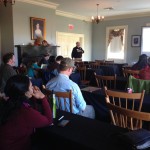
Interterm Course 2015 — Recap
The Spatial Analysis Lab was excited to kick of 2015 with an intro to GIS interterm course in the first week of January Term! 14 students joined us in the SAL for 5 days of GIS exploration with ArcGIS. The course was structured around the development of key GIS skills. Each day focused on one or […]
November in Review
Well, November was quite a busy month. So busy, in fact, that we were unable to spend time writing weekly updates to post. Our review covers the entire month of November and is organized by type of work: Overview Class Support 1. Study of Women and Gender 230 2. Spaces of Mexico (SoMec) 3. ENV201/202 4. Soc232 Student […]