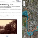
See what work the Spatial Analysis Lab (SAL) supported in the busy month of April 1. Class Support 2. Student Support 3. Campus Connections 4. Outreach 1. Class Support: Environmental Integration II: Collecting and Analyzing Information (ENV201/202): Final Presentations: One of the five student groups in 201/202 decided to focus their final project on looking at […]
Tag Archives: Jobs
Contribute to the Smithie Summer Plans (and beyond!) Webmap
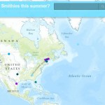
Take a look at our web map to see where Smith students are spending their summer 2015! Explore the interesting research that students will be conducting, the cool jobs students are heading off to work at, the exciting continuing education programs students have been accepted to, the adventurous travel plans students have in store, and the […]
What and Why we Teach – Interdisciplinary GIS Position
One of Spatial Analysis Lab alums brought this cool job Interdisciplinary GIS Specialist to my attention. It certainly has all the ingredients for the type of student we teach at Smith, especially within the Environmental Science and Policy Program. Thanks Naomi !
NYC Housing and Neighborhood Survey – GIS Intern
The NYC Housing and Neighborhood Survey is an experimental study of 3,000 households randomly assigned to receive in-place subsidized housing in one of eleven large-scale new construction rental developments sponsored by the City of New York’s Department of Housing Preservation and Development (HPD). The proposed project will provide an in-depth examination of the association between […]
Wildlife Population Ecologist
Mass DEP is looking for a Wildlife Population Ecologist. The applicant must have strong analytical capabilities relative to population dynamics modeling using statistical models, remote sensing, GPS and GIS applications in the conservation and management of vertebrate species. Primary focus is on the design and production of landscape-level analyses and map products. The position is […]
Reverse Engineer a Map?
Smith students – Help investigate whether prisons are affecting democracy in rural counties across the U.S. by reverse engineering census maps since some counties don’t remember if they used the census prison counts in their districts! Contact me to learn more.
Geospatial Occupations
US Department of Labor/Employment and Training Administration’s Occupational Information Network (O*NET) now lists five new geospatial occupations: “Geospatial Information Scientists and Technologists”, “Remote Sensing Scientists and Technologists”, “Geographic Information Systems Technicians”, “Precision Agriculture Technicians”, and “Geodetic Surveyors”. Search for “geospatial” in the Occupation Quick Search at the O*NET site http://online.onetcenter.org/ Direct link for Geospatial Information […]


