


A new year and some new faces in the Spatial Analysis Lab. We have a great team to support a variety of classes and research projects. Spatial Fellow Our new post-bac Spatial Analysis Fellow, Scott Gilman from Middlebury College, started the last week of September. Scott’s first day began with our Intro to GIS […]
May in Review
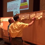
See what the Spatial Analysis Lab (SAL) has been up to in the great month of May: 1. Student Support 2. Faculty Support 3. Campus Connections 4. Outreach 1. Student Support Senior week workshops (5/12 – 5/15): In the week after finals and leading up to graduation, commonly called Senior Week, we hosted a series of informal […]
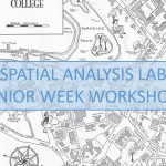
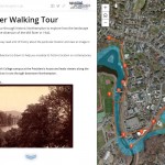
Senior Week Workshops
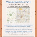
Calling all aspiring cartographers and spatial thinkers! Interested in developing your map-making skills? Have some spare time during Senior Week? The Spatial Analysis Lab would like to invite Smith students, faculty, staff, and community to join us for a series of informal mapping workshops Tuesday – Friday of Senior Week (5/12-5/15). The workshops are open […]
April Update
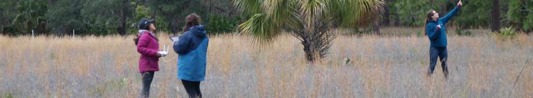
See what work the Spatial Analysis Lab (SAL) supported in the busy month of April 1. Class Support 2. Student Support 3. Campus Connections 4. Outreach 1. Class Support: Environmental Integration II: Collecting and Analyzing Information (ENV201/202): Final Presentations: One of the five student groups in 201/202 decided to focus their final project on looking at […]
Nepal Earthquake Response Mapping Follow-up Workshop
In response to the recent earthquakes in Nepal the Humanitarian OpenStreetMap Team (HOT) has provided an online mapping platform that allows volunteers to help map the infrastructure of the areas in Nepal effected by the earthquakes. Mapping road networks and structures is critically important to help responders navigate the area to provide assistance to those in […]
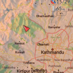
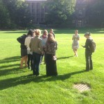
Nepal Earthquake Response Workshop Well Attended in the Week Before Finals
The Humanitarian OpenStreetMap Team has developed a project called MapGive, which allows volunteers to populate maps in parts of the world where mapping resources are limited. The idea originated following the 2010 earthquake in Haiti when mapping the island’s infrastructure through GPS surveying on foot proved too dangerous and not fast enough. As an alternative OpenStreetMap provided a […]
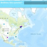
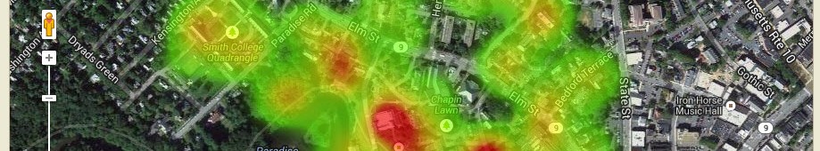
Contribute to the Smithie Summer Plans (and beyond!) Webmap
Take a look at our web map to see where Smith students are spending their summer 2015! Explore the interesting research that students will be conducting, the cool jobs students are heading off to work at, the exciting continuing education programs students have been accepted to, the adventurous travel plans students have in store, and the […]
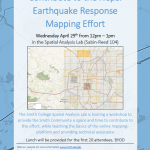
Nepal Earthquake Response Mapping Workshop
In response to Saturday’s earthquake in Nepal the Humanitarian OpenStreetMap Team (HOT) has provided an online mapping platform that allows volunteers to help map the infrastructure of the areas in Nepal effected by the earthquake. Mapping road networks and structures is critically important to help responders navigate the area to provide assistance to those in […]
GPS Workshops for Summer Research
The Smith College Spatial Analysis Lab (SAL) will be hosting two GPS workshops to help students, faculty, and staff brush-up on GPS skills in preparation for summer work and research. Workshops are available to all, no previous experience necessary. Feel free to attend one or both workshops. Please sign-up in advance GPS Data Collection with […]
March Update
Spatial Analysis Lab work in March 2015 1. Class Support 2. Campus Connections 3. Outreach 1. Class Support ENV201/202: In the first two weeks of March we hosted Professor Camille Washington-Ottombre’s class Environmental Integration II: Collecting and Analyzing Information (ENV201/202) for a series of class sessions. The six class sessions were split into two labs, one per […]