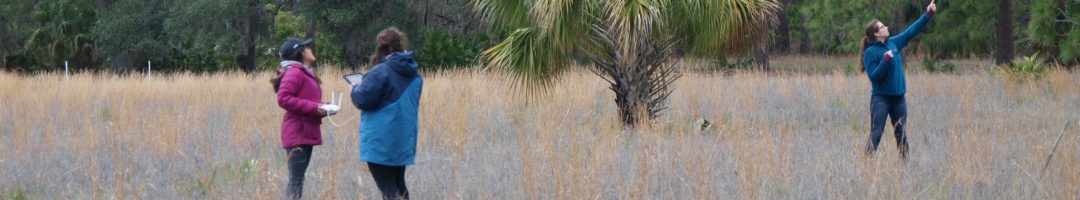


Two weeks ago, on April 21, we hosted a mapathon to help humanitarian relief efforts in Ecuador and Japan, which both suffered major earthquakes on April 16. Between 10am and 1pm, a total of twelve volunteers, including students from Ecuador and Japan, used satellite imagery to identify and trace roads, buildings, and landslides in OpenStreetMap, an open-source […]
Final Mystery Map of the Semester!
We know how much our faithful readers rely on our Mystery Maps to avoid doing what they’re supposed to be doing (and we’re mostly talking about faculty/staff here, folks!). We wouldn’t want to let you down at this point in the year, when responsibilities to be avoided are at their peak! So, we present to you […]
April Mystery Map Solved!
Our past two mystery maps (showing the locations of carillons in North America and showing the path of zika) were solved within 24hrs after unleashing them into the wild. With this Mystery Map, we were hoping to stump our blog readers, but alas, this map was no match for your spatial thinking prowess. The first […]
Learning from the Favorite Places Project
By Karen Yu ’16 One of the older projects that we have worked on at the SAL is the Favorite Places Map on our website. The goal of this project was to see where students, alums, and others saw as their favorite places on campus. Are there parts of campus that students aggregate more towards […]
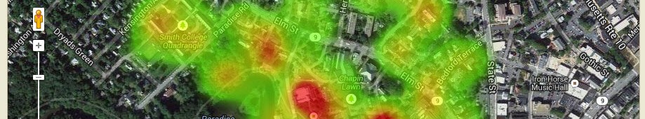
April Mystery Map
Put on your spatial thinking caps – the next Mystery Map Competition is a go! Click on the image below to see the full, interactive version. Two hints to get you started: First, this maps relates to an event which took place in early March. Second, we could have shown data for the US in this […]
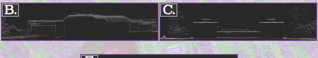
Collaboration with the Art Museum!
by Karen Yu, Spatial Analysis Lab Assistant Despite its physical appearance, the Spatial Analysis Lab (SAL) is more than just a computer lab in Sabin Reed. Behind the scenes, we’re often busy with new projects, teaching, and always thinking spatially. Recently, the Art Museum reached out to collaborate with the SAL on a new exhibit […]
Two upcoming workshops on web mapping
Tomorrow, 3/22 from 4:15 to 5:30pm, we’ll offer our workshop “Teaching with Story Maps” for a second time this semester. The workshop will introduce ArcGIS Online’s Story Maps platform and strategies for using it in the classroom. Whether you’ve used Story Maps or have never heard of it, you’ll leave with a better understanding of how […]
March Mystery Map Solution
With almost 600 views, our most recent Mystery Map proved to be one of our most popular. And perhaps one of our easiest as well – of the 14 submissions received, all correctly identified the theme of the map as the spread of the zika virus. Here’s our official winner list, in order of submission: […]
What’s it like to work in the SAL?
If you find yourself one afternoon with nothing to do – I know this never actually happens at Smith, but bear with me – I would highly suggest spending a few hours in the SAL, people-watching. At first glance, this may sound like a rather boring activity. Who would want to watch students furiously clicking for […]
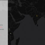
March Mystery Map
We’re excited to announce our first Mystery Map Competition of 2016! Like the carillon map, we used CartoDB to make this an interactive mystery map. Click on the image below to see the full thing. Once you have an idea of what this map might be showing, use the form below to submit your guess. Good luck! [123-contact-form […]