


Papers presented at the University at Albany School of Public Health 7th annual GIS and Public Health conference are now available and include: “All Public Health is Local” : The Community Perspective on GIS and Public Health Russell Kirby, University of South Florida Creating Community Health Indicators Using Spatial Smoothing, Aggregation and Masking Thomas Talbot, […]
NYC Housing and Neighborhood Survey – GIS Intern
The NYC Housing and Neighborhood Survey is an experimental study of 3,000 households randomly assigned to receive in-place subsidized housing in one of eleven large-scale new construction rental developments sponsored by the City of New York’s Department of Housing Preservation and Development (HPD). The proposed project will provide an in-depth examination of the association between […]
Wildlife Population Ecologist
Mass DEP is looking for a Wildlife Population Ecologist. The applicant must have strong analytical capabilities relative to population dynamics modeling using statistical models, remote sensing, GPS and GIS applications in the conservation and management of vertebrate species. Primary focus is on the design and production of landscape-level analyses and map products. The position is […]
Landsat Imagery Services
These image services enable fast and easy access to 30 years of Landsat imagery as part of ArcGIS Online.
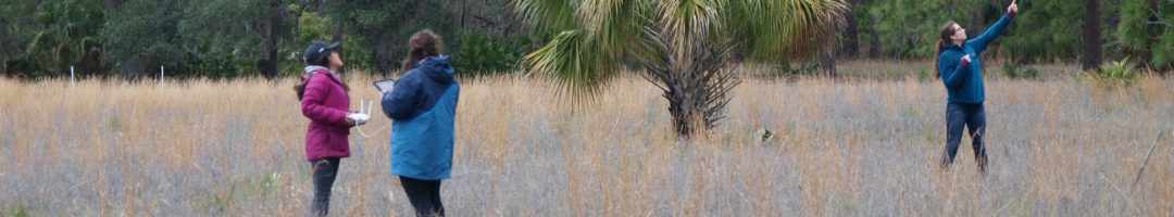
Spartina Control Monitor Internship
…identification of native and invasive Spartina species and their hybrids, and in the use of ArcPad software on Trimble GPS units to relocate previously-mapped invasive Spartina patches and to record treatment of these patches during treatment activities.
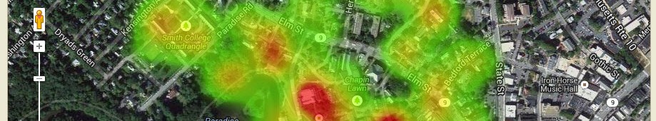
Food Bank Mapping
The Food Bank of Western Massachusetts sought mapping and analysis support from the Spatial Analysis Lab during the summer of 2010. The project is currently on hold, but you can view some of the initial map products below. Sarah Motti ’10 provided assistance on the project during her summer employment in the SAL. In many […]
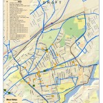
Bike Trail Mapping
The Spatial Analysis Lab (SAL) recently finished the 2011 version of the “Easthampton ~ Northampton Trail & Bicycle Map” for the Friends of Northampton (MA) Trails and Greenways (FNTG) organization. The 2011 series marks the third iteration of the map series which started back in 2006. The Bike Map series represents countless hours of effort […]
Healthy Communities
The Spatial Analysis Lab provided mapping and spatial analysis to Cooley Dickinson Hospital (Northampton, MA) as part of their 2011 Community Health Assessment report.
All Orthophotos Available on GEO
The latest Orthophotos (2008-2009) are now available locally on GEO. You may now load the images from: Q:dataimages2008-2009Orthophotos or gishomedataimages2008-2009Orthophotos Remember, it is much easier to load and use the orthophoto images with image or raster catalogs. Two raster catalogs are available: IMGCAT_COQ2008_2009SID_30CM.dbf {for 30 cm images} and IMGCAT_COQ2008_2009SID_15CM.dbf {for 15cm images in select […]
Deputy Director of GIS and Information Management
manage a wide variety of data and information resources to support operations and analytics for Forestry, Horticulture and Natural Resources. Work with managers and cooperating researchers on analyses and data dissemination/coordination.