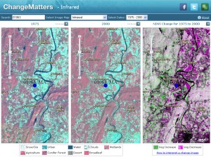
ESRI just enabled more than 8 terabytes of Landsat Satellite Imagery in an easy access and free viewer system. I recall paying hundreds of dollars for a single Landsat scene back in the late 90’s. Cheers to ESRI!
Esri is pleased to announce the release of the Landsat imagery services. These image services enable fast and easy access to 30 years of Landsat imagery as part of ArcGIS Online. Esri is providing this data (more than 8 TB) on ArcGIS Online and serving it as over 20 different dynamic, multispectral, multitemporal image services that provide access to the full image information content, along with change detection capabilities. In addition, Esri has created web maps and an interactive web application that leverage these image services, providing even greater access.
ChangeMatters Viewer
Pan and zoom around the maps to understand earth changes that have happened over time. Advanced change detection tools are also available by clicking any full screen button.
The entire Landsat image services collection is available through ArcGIS Online at no cost.
