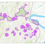
In celebration of the indoors we bring you our latest Mystery Map to help occupy your mind through the last of the winter’s cold! Challenge: Name the Annual Event Bonus: Explain the Pattern click to expand Submit answers here by Friday 3/6 — winner will be announced soon after
Category Archives: Mystery Map
November Mystery Map Revealed — Mystery Migrations
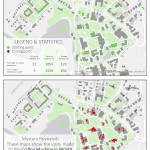
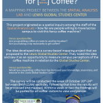
Answer Revealed This mystery map challenged viewers to anticipate movements on campus based on a set of starting points and ending points. What quest is shown on the map?? The journey to the Lewis Global Studies coffee machine! The map was inspired by a mapping survey conducted at this coffee machine in Wright Hall. The survey gathered […]
Coffee Mapping Project Results
The results from the coffee mapping project are in! Click here to visit the online interactive map application Click here to view compiled maps in PDF form The results contain maps like: Line Density of Travel including Coffee Machine Specific Visits to Coffee Machine Combined Visits — organized by campus affiliation Combined Visits — colored […]
Mystery Map Challenge — November 2014
To Submit an Answer Click Here
Fall Mystery Map Solution Revealed
The Fall Mystery Map challenged viewers to consider the regulation of space. Each of the three maps represented a unique regulation zone that participants were asked to identify based on context clues within the maps. This led viewers to through a series of questions to determine what regulation is represented by each zone: what type of […]
Fall 2014 Mystery Map
The Spatial Analysis Lab’s Mystery Map Contest returns with its Fall 2014 challenge: Regulated Space Study the image (map) below (click to expand) to solve the mystery of the regulated space depicted in each of the three maps! The first correct answer* wins a choice of: An on-line GIS course ($100 value) Admission to one of SAL’s Instructor-Led […]
February Mystery Map: Solution Revealed!
And the answer is… The February Mystery Map challenged you to match four different maps of the world with the quantitative variables they showed, and prompted all interested spatial thinkers and pattern detectives to question things like: “Which areas are more heavily represented in the Winter Olympics, and which areas are more represented in the Summer […]
November Mystery Map Solved!
The answer is: The November Mystery Map showed the locations that non-motorists (pedestrians, bicyclists, etc) have been hit by cars in downtown Northampton. In this case, the data is from the year 2010, showing a complete snapshot of collisions during that year. In 2010, there were 23 reported collisions between motor vehicles and non-motorists, and according […]
November Mystery Map
November Mystery Map: “Doctor, Doctor” Come one, come all! Can you guess the mystery variable shown on this month’s Mystery Map? Update 11/15/12: First hint released! The theme of this month’s map was decided when two similar yet rare events occurred in downtown Northampton within five days of each other (between Oct. 31 and Nov. 4). […]
October Mystery Map Solved!
October Mystery Map: “Fifty Nifty United States” What do the eleven orange states have in common? The answer is: There are no students in the Smith College Class of 2016 from any of the orange states (Alabama, Delaware, Hawaii, Idaho, Mississippi, North Dakota, Nebraska, Nevada, South Dakota, West Virginia, and Wyoming). The map below shows […]

