Snow or shine, the SAL is working hard this semester. See our most recent activity outlined below: 1. Class Support 2. Student Support 3. Faculty Support 4. Outreach 5. Campus Connections 1. Class Support We’ve been working with a Professor Camille Washington-Ottombre to design two new water related GIS labs for Environmental Integration II: Collecting and Analyzing Information (ENV201/202). […]
Author Archive: jcaris
Spring ’15 Workshop Offerings
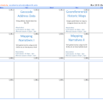
Workshops offered by the SAL in spring 2015 — together they provide an introduction to mapping and GIS (Geographic Information System), and separately provide skills for particular GIS tools and skills — mapping addresses data, using GPS unit to collect data, etc. Note: most of our workshops can be taken as stand-alone workshops, however the workshops that […]
Interterm Course 2015 — Recap
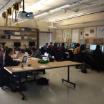
The Spatial Analysis Lab was excited to kick of 2015 with an intro to GIS interterm course in the first week of January Term! 14 students joined us in the SAL for 5 days of GIS exploration with ArcGIS. The course was structured around the development of key GIS skills. Each day focused on one or […]
November in Review
Well, November was quite a busy month. So busy, in fact, that we were unable to spend time writing weekly updates to post. Our review covers the entire month of November and is organized by type of work: Overview Class Support 1. Study of Women and Gender 230 2. Spaces of Mexico (SoMec) 3. ENV201/202 4. Soc232 Student […]
HAPPY GIS DAY 2014!
Each year on November 19th we like to reflect on the GIS successes, failure, trials, tribulations, joys, and tears we’ve experienced. We do this in honor of GIS day — an Esri holiday — as a reminder of how fortunate we are to be able to explore the world in such depth from a chair […]
November Mystery Map Revealed — Mystery Migrations
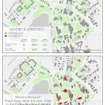
Answer Revealed This mystery map challenged viewers to anticipate movements on campus based on a set of starting points and ending points. What quest is shown on the map?? The journey to the Lewis Global Studies coffee machine! The map was inspired by a mapping survey conducted at this coffee machine in Wright Hall. The survey gathered […]
Coffee Mapping Project Results
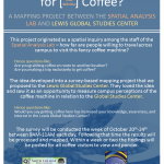
The results from the coffee mapping project are in! Click here to visit the online interactive map application Click here to view compiled maps in PDF form The results contain maps like: Line Density of Travel including Coffee Machine Specific Visits to Coffee Machine Combined Visits — organized by campus affiliation Combined Visits — colored […]
2015 Interterm Course Offering
In 2015 the Spatial Analysis Lab will instruct a one week Interterm class open to all students, faculty, staff, and Northampton community members. The course will be taught in the first week of Interterm (Jan 5th – Jan 9th) from 1-3pm each day. The structure will be somewhat informal and may end early or stretch […]
Mystery Map Challenge — November 2014
To Submit an Answer Click Here
Last week in Review (October 27-31)
Recap: ENV 201 GIS Lab 1 ENV 311 Lying with Maps Lab Bird Window Collision Mapping Project Halloween in the SAL Details: ENV 201 GIS Lab 1 EVN201/202 met in the Spatial Analysis Lab for its second mapping session of the semester. This time we explored vector data with tools like Field Calculator, Buffer, and […]

