Director Note: SAL Associate, Kate Nash ’23 follows in a fine tradition of students collaborating with faculty to prepare maps for print publication. This practice dates back to 2007 when the SAL worked with Ann Zulawski, now Professor Emerita of History and of Latin American Studies, for her book, Unequal Cures: Public Health and Political Change in Bolivia, 1900–1950 . That effort seemed to trigger something in the Anthropology department which ranks #1 in SAL student / faculty map collaborations with multiple maps finding their way into 5 book publications.
In this post, Kate peels back the veneer and shares some of the thinking behind the maps. It is a good reflection that maps are more than a finished product.
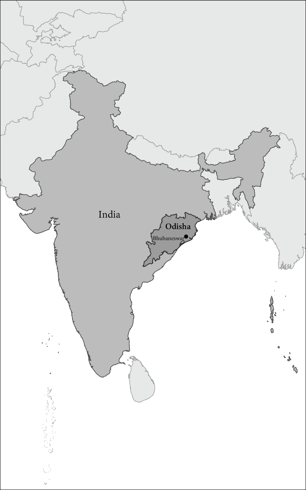
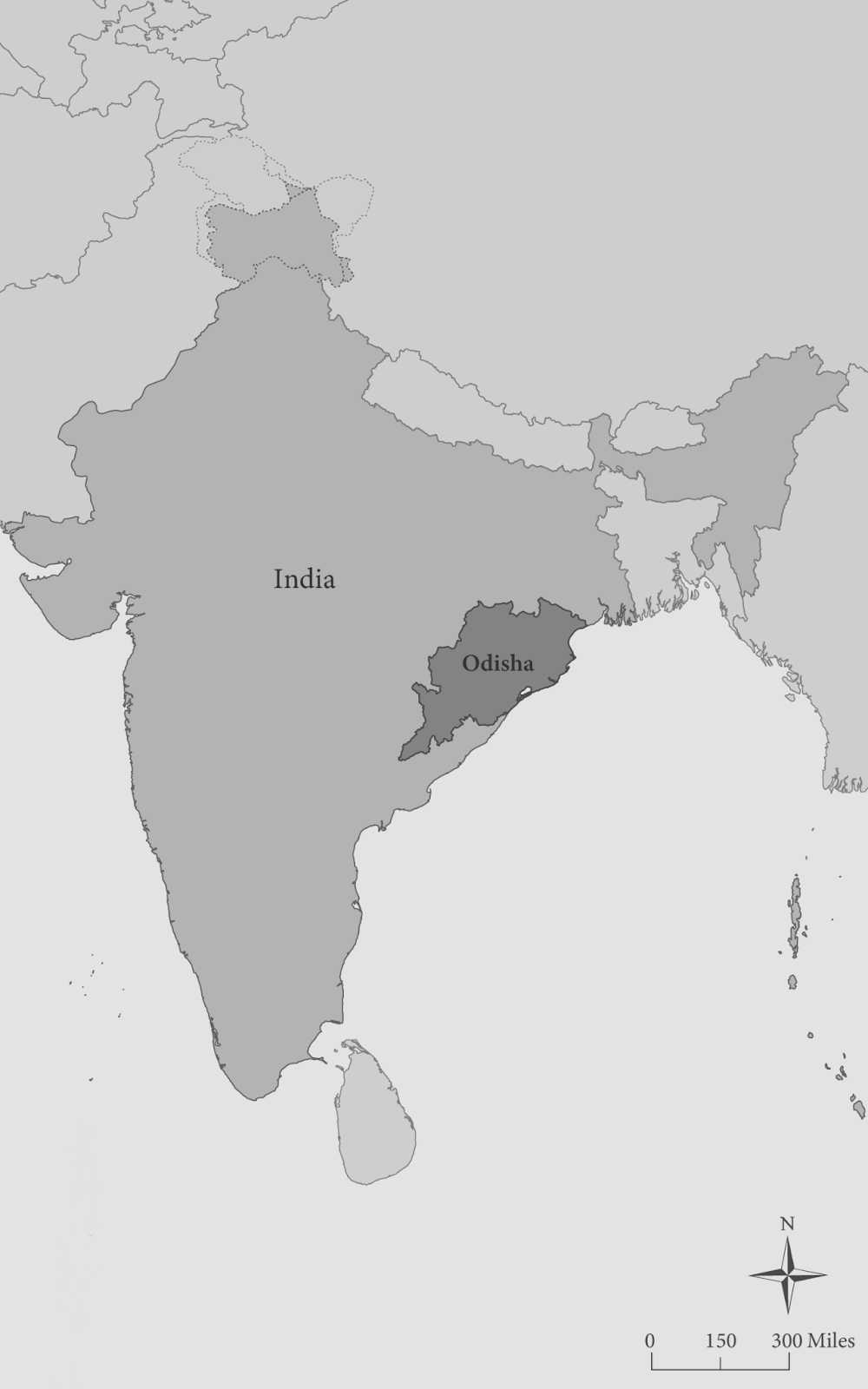
This fall, I was called upon to design maps of India and the Odisha state for Anthropology Professor, Pinky Hota’s upcoming book, The Violence of Recognition: Adivasi Indigeneity and Anti-Dalitness in India. This project aimed to create straightforward maps to give context to the areas and geographies discussed in the book. The biggest challenge with this mapping endeavor was how to show the complex geopolitical context that shapes many maps made of India. Many of India’s borders have long been disputed. The placement of human-created and often arbitrary lines that are located without regard for communities and culture have shaped the mapping of India. Currently India and its neighbors, particularly China and Pakistan, dispute land across India’s northern regions.
The largest and longest dispute is in the northern tip of India, especially in the Kashmir region. Pakistan, India, and China claim sections of this area, and no one has agreed on the exact borders. This creates difficulty when mapping, where I am tasked to lay down lines delineating borders. At first, I chose borders reflecting India’s claims since the map was focused on India. However, after further consultation and conversation with Professor Hota, we decided to use dotted lines, which are a cartographic technique to denote uncertainty, and the most internationally agreed-upon borders for the fill colors. This led to a more politically neutral map that communicates the uncertain borders without directly taking a stance on the politics of this region.
The first draft of full India map with borders drawn with Natural Earth data from India’s POV
In the end, choosing to draw the borders this way will focus the viewers’ attention on the region of interest in Professor Hota’s book, which is in the southwest region of the country, while still acknowledging the conflict and dispute occurring to the north.
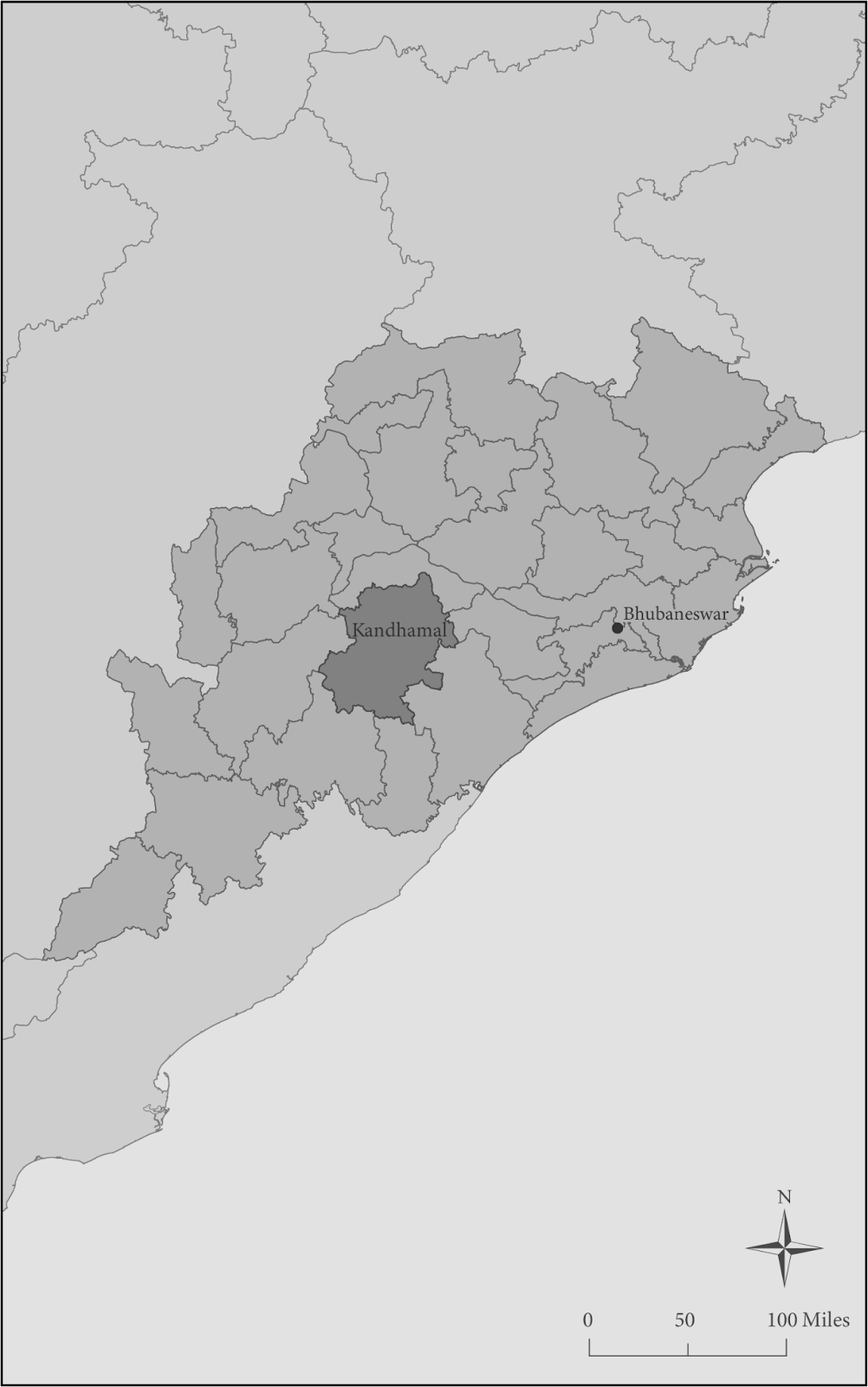
Final map of the Odisha state
Final full map of India including the dotted border lines discussed above.
Kate Nash, ’23