By Wayne Ndlovu ’22
Over the past weeks I worked on creating a map that shows the Jandon Center’s community partners. The Jandon Center, which is located at Smith’s Wright Hall works with the Smith community and other organisations on a number of social change projects. Please take the time to visit their website.
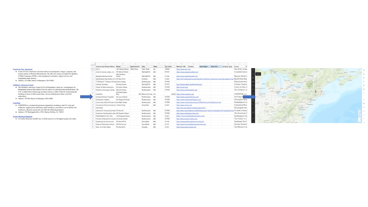
The main goal of this project was transforming human readable street addresses into geographic coordinates – geocoding. My task was to use these addresses to create a web map that shows where each organization is located and its mission. The first step was transferring the data to a .csv file and splitting it as shown below. This makes it easier to import the file into the ArcGIS Online server as a data layer when creating web maps. After importing the .csv file as a data layer, I had to publish it as a hosted feature layer.
I created this map using the new map viewer which at first glance just looks like a prettier version of the classic map viewer. However, do check out the differences and functionalities of the classic and new viewer when working on your next project.

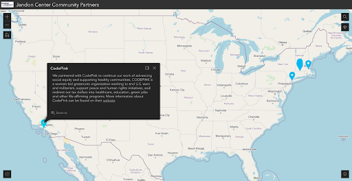
I used the World Navigation Map as the base map and added the OpenStreetMap layer. The OpenStreetMap layer gives the user a more detailed visual that shows where these organisations are located and other services/businesses in close proximity. I configured the pop-ups by using the Text option under Configure pop-ups. This option allowed me to add each organisation’s website link. For other pop-ups that do not require special formatting, the information can be added directly into the Description bar by either selecting a field from the imported data layer or typing it. I chose a basic blue location indicator icon using the Styles option.
After saving the map, I created an instant map using the interactive legend template. At this stage, the map creator gets to choose the theme of the map (light or dark) and also organize the positions of the widgets before publishing the map.
