For the first half of the summer, I spent time researching the ethics of drones, data, and technology more broadly in order to inform ethical practices at the Spatial Analysis Lab. Through this research, I thought about how our position at Smith might interact with practices at other institutions, in industry, and in humanitarian efforts. This led me to develop updated ethical guidelines for working with drones at the SAL, which were also informed by existing drone ethics efforts at the SAL. To promote student thinking on drone ethics within the IDP 109 course, I developed interactive scenarios to engage students in hypothetical situations that might test their commitments to ethical drone practices.
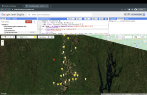
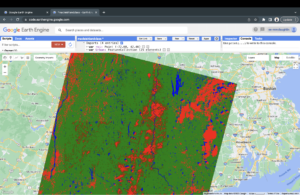
Through the second half of the summer, I focused on applications of machine learning and AI for drone technology, with the goal of developing a lab exercise for the IDP 109 course. I researched applications of this technology for drones, and I found that object and land use classification of drone imagery are major areas where machine learning is applicable to drones. From this, I learned how to use Google Earth Engine, which was an entirely new tool for me, to import both satellite and drone imagery in order to run land cover classification models. I developed a lab exercise where students will run a land cover classification algorithm on a satellite image and two drone images taken over the area of the MacLeish Field Station to compare a model’s ability to classify land cover in these images.
Both parts of my summer work at the SAL were extremely rewarding for my own academic interests, and I was able to learn a lot about both ethics and algorithmic image classification. I am also glad that the work I accomplished this summer will benefit the students in IDP 109 this fall as they think about drone ethics and applications of drone technology.
Mags McLaughlin, ’25
Fall 2023 Update
We have seen a successful debut of Mags wonderful work over summer. Halfway through the Fall semester, Mags joined the 2023 cohort of IDP 109 students and introduced the marvelous land classification lab built out in GEE. Through the GEE lab developed by Mags, students gained practical experience in automated land cover classification and learned of the various advantages and disadvantages of satellite vs drone acquired imagery.
Just one week later, in collaboration with the ENV 201/202 class taught by Heather Rosenfeld, we took a deep dive into the ethical guidelines prompting further discussion on how we can ethically incorporate these tiny robots into our work. The very same day, students were grouped together and engaged with the interactive scenarios built out by Mags. The scenarios developed by Mags prompted intriguing discourse around how, when, and why drones should be used.

