The highlights of last week’s work in the Spatial Analysis Lab, with additional details provided below:
– Meeting with Margaret Bruzelius and STRIDE students
– Zebra Fish project updates
– Omeka and Scalar research
– OpenStreetMap Workshop for Ebola Relief Workers
– Data Science guest lecturing
Margaret Bruzelius and STRIDE students:
Our spatial fellow, Victoria Beckley, met with professor Bruzelius and her two STRIDE students to introduce them to the ArcGIS Online mapping platform that will be used for the project. The students began to create their first webmaps and applications to visualize Terry Practchett’s novel Monstrous Regiment.
Zebra Fish:
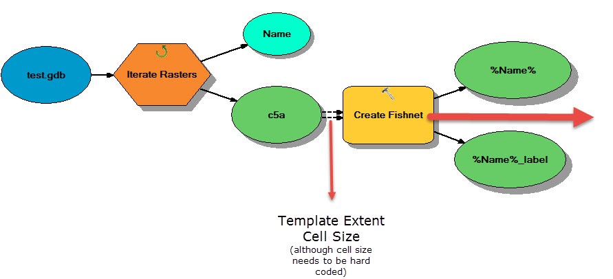
This week the Spatial Analysis Lab finalized its model builder model for iterating through a database in our Zebra Fish mapping project.
Omeka and Scalar:
The Spatial Analysis Lab is researching Omeka and Scalar as platforms to carry out the Spaces of Mexico (SoMec) Digital Humanities project collaboration between Smith professor Dana Liebsohn of the Art department and Fordham professor Barbara Murray of Art History and Music. More on this project here.
Ebola OpenStreetMap Workshop:
The Spatial Analysis Lab hosted guest Theresa Clary last Wednesday, who instructed a group of 38 volunteers to begin populating maps of West African Ebola-stricken countries via OpenStreetMap’s humanitarian relief online mapping program. Workshop details here.
Data Science:
Provided an introduction to GIS and Mapping to the Data Science class last Friday. The presentation included information about projection systems, spatial data types, visualization techniques, and the importance of effective color schemes.
