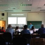
On Monday and Tuesday, August 13-14, the Smith Spatial Analysis Lab teamed up with Amherst College to host a workshop for Five College faculty entitled Spatial Techniques for the Digital Humanities. We had a great two days of discussion, learning, and collaboration, as workshop participants and instructors alike worked through eight themed sessions focusing on a variety of resources and methodologies in the spatial humanities. The event was attended by 22 20 faculty members with research interests ranging from ancient architecture to Chinese literature to new media. Additionally, Lex Berman from the Harvard Center for Geographic Analysis joined us to share his thoughts on the history and future directions of spatial thinking in the Digital Humanities, as well as his own research experience with the China Historical GIS project, as the keynote speaker for the event.
Monday’s sessions focused on online, collaborative platforms for spatial thinking, both on the web and via mobile apps. We began the day with demos of two collaborative mapping projects. Hélène Visentin presented her work with Smith and Amherst Colleges’ CityScapes project, which allows users to view georeferenced historical maps of Paris and Tokyo through time, and we also gave a demonstration of UCLA’s HyperCities project. After a short break (more coffee, please!), we took advantage of the summer weather by heading outside to familiarize ourselves with mobile spatial data collection using iOS and Android: participants took GPS locations and photos of notable art and architecture on the Amherst campus, using FulcrumApp on iPads or their own mobile devices,
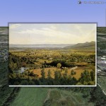
then shared these data among the group to generate a more comprehensive map of the campus landmarks. After lunch, we returned to the computers to explore Google’s web tools, bringing a set of Amherst historic sites from spreadsheet, to google doc, to a fusion table, to a map with embedded images. The final session of the day covered geospatial visualization, and included creating tours, photoreferencing, and georeferencing in Google Earth. After all of that, it was a relief to sit back and enjoy Lex’s keynote address!
On Tuesday, we really got into the more technical side of spatial techniques: we asked the workshop participants to tackle ArcGIS. In the first session, we discussed some of the nuts and bolts of ArcGIS, exploring spatial data formats and the program’s basic tools, including zooming and panning, checking out the attribute table, and re-symbolizing a layer based on different fields to better understand spatial patterns. Armed with this all-too-brief introduction, the brave ArcMap novices deftly maneuvered through some very complicated procedures, as we spent the day developing a dataset in ArcGIS. Using a historical map of Amherst township from 1833, and a spreadsheet of addresses from the National Historic Register, we learned how to geocode addresses, georeference a scanned image, and use the editor toolbar to create spatial layers based on data from the newly positioned map. After spending so much time up close and personal with a variety of maps and default symbologies in mapping programs, we closed the workshop with a discussion of cartographic conventions, evaluating famous maps to question what makes a map effective and/or attractive versus confusing and/or misleading.
Overall, it was an excellent few days. We are grateful to the Five Colleges Digital Humanities initiative for making the workshop possible, and to all of the participants for their patience and creative energy! This workshop definitely laid the groundwork for more exciting projects in the Digital Humanities, both here at the Spatial Analysis Lab and around the Five Colleges.

