Field geologists mapping metamorphic rocks observe that certain minerals or mineral assemblages are restricted to particular regions in their map. One of the first geologists to notice this was George Barrow (1893) who was mapping metamorphic rocks in the south-eastern Highlands of Scotland. Based on the "...presence or abundance" of certain minerals, Barrow labeled areas on his map staurolite zone, kyanite zone, or sillimanite zone. Twenty-two years later, C.E. Tilley (1925) mapped chlorite, biotite, and garnet zones in the south-eastern Highlands adjacent to Barrow's staurolite, kyanite, and sillimanite zones. You can see Barrow's and Tilley's zones on Dave Waters' map.
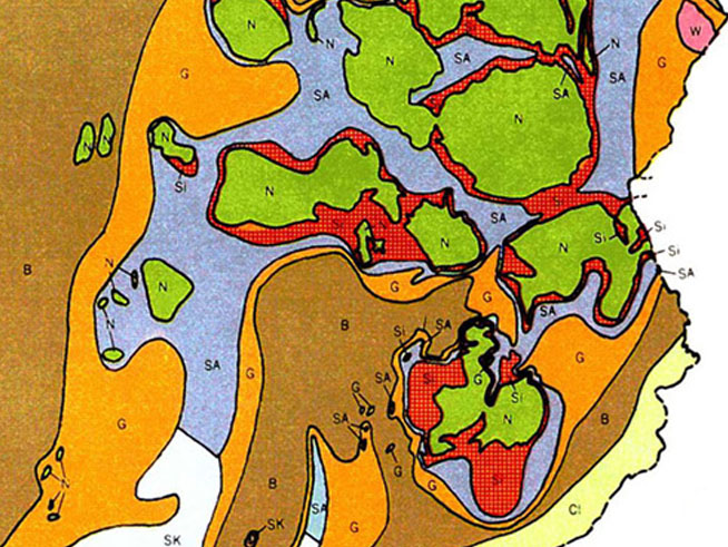
Figure 3.05. Metamorphic zones of Vermont. Click on the image to see a larger, zoomable version where you can read the zone definitions in the map key.
Barrow's idea of mapable metamorphic zones has proven to be quite useful, both for organizing the rocks of a particular metamorphic belt but also for the comparison of similar zones in different metamorphic belts. Metamorphic zones can be found on many published geologic maps, such as the map of Vermont shown in Figure 3.05. As with Barrow's (1893) map, the metamorphic zones on the Vermont map are based on the first appearances of index minerals in pelitic schists (metamorphosed shales): chlorite, biotite, garnet, kyanite, andalusite, or sillimanite, or on the mineral assemblage chloritoid + kyanite. The metamorphic zones of Vermont include the zones that Barrow and Tilley mapped. Indeed, these same zones have been observed in many metamorphic belts, and in the same order.