Snow or shine, the SAL is working hard this semester. See our most recent activity outlined below:
1. Class Support
2. Student Support
3. Faculty Support
4. Outreach
5. Campus Connections
1. Class Support
- We’ve been working with a Professor Camille Washington-Ottombre to design two new water related GIS labs for Environmental Integration II: Collecting and Analyzing Information (ENV201/202). One lab looks at land-use on campus by investigating various surface types and the permeability of different materials. We asks students to identify places on campus where a change in surface material would increase permeability, allowing more natural water drainage and improved water quality. Our second lab uses a watershed modeling extension in ArcMap to study the Mill River watershed. The modeler generates water flow data based on the following inputs:
- Watershed flow and direction
- Soil
- Slope
- Land-cover
- Weather station data
- We kicked off Professor Bob Newton’s Geomorphology (Geo251) GIS labs last week with a lab World Physiography: Landscapes on a Global Scale. The lab used a global DEM with the interpolate line tool to create profile graphs of areas with exceptionally high and low elevation across the world. These included the Alps, the Himalayas, and the deepest parts of the ocean.
- We visited Hillyer Hall again to work with the Advanced Architecture: Complex Places, Multiple Spaces (ARS388) class to support an assignment asking students to examine influences and forces surrounding a parcel of land adjacent to the High Line in Chelsea District of Manhattan. The assignment is very open ended and requires students to use both desktop and online mapping platforms to develop their particular story about the site and future development.
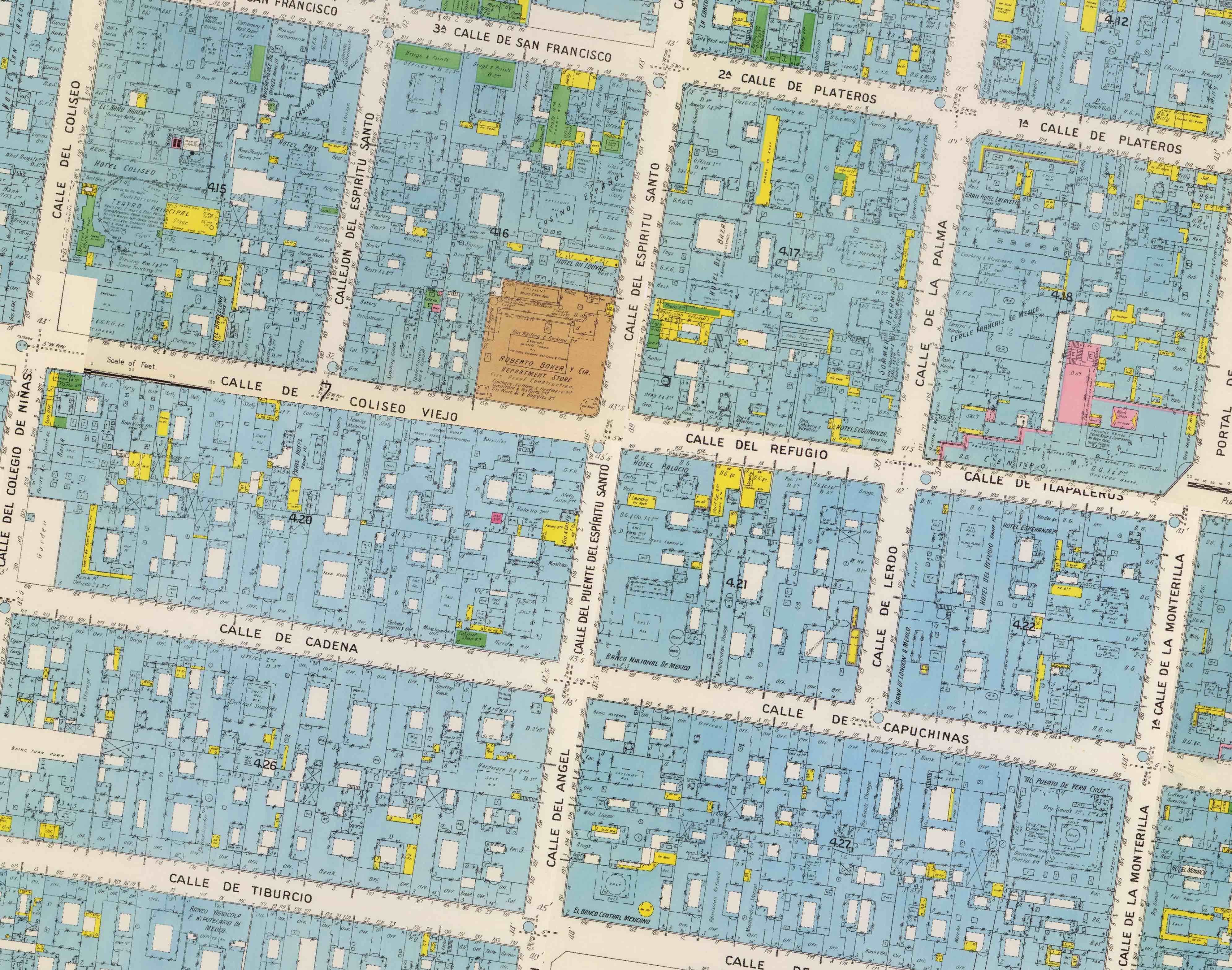
- The SAL is collaborating with Dana Leibsohn and others on a Digital Humanities project titled Spaces of Mexico City, which includes teaching Collecting the Past (ARH292) this spring. Students are learning how to create “born digital” research exhibits featuring cartography in the central role.

Portion of 1905 Sanborn Map, Mexico City Federal District
2. Student Support
- A group of seniors from the Engineering Design Clinic are working with the SAL to use our Trimble GPS units to collect field data about tree locations in Leeds. The students will gather data to contribute to the designing of a new access ramp for the Northampton Rail Trail.
- A student from Economics is expanding a mapping project from the fall into a senior honors thesis looking at the relationship between proximity of open space to homes and home values in Northampton.
- We are supporting a senior CS student with an Honors Thesis that endeavors to develop an application to track disease outbreaks (e.g. measles) on campus.
- Continued support for the Zebrafish forebrain analysis (previously updated here).
- Stride students Alex and Christine continue to design, modify, and build UAVs for research in Belize this summer. They are updating their progress at the IBM Student’s for a Smarter Planet blog.
- Ren and Sol, our two Geo Programmer Assistants, continue to refine their Campus Events Map. The proof of concept began in 2014, and now is almost ready to present to campus stakeholders. The application parses the RSS feed from the College’s Calendar and is built upon CartoDB, with custom HTML, CSS. We hope to have a link to the application soon.
3. Faculty Support
- Our student intern, Stephaine, is putting together a map of Ghana circa 1960 for history Professor Jeffery Ahlman’s upcoming book Living with Nkrumahism: Nation, State, and Pan-Africanism in Ghana.
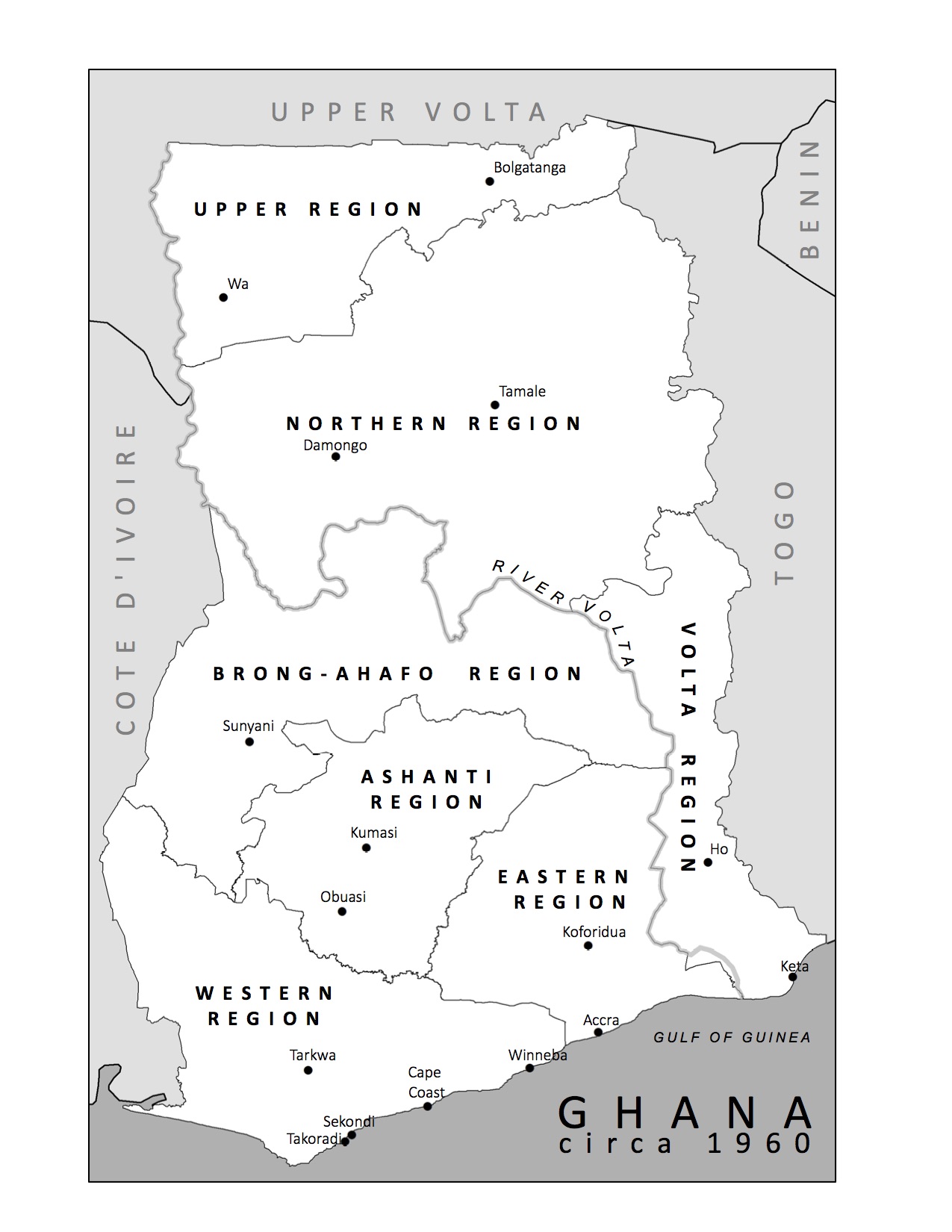
Ghana – circa 1960
4. Outreach
- We are continuing to work with the Friends of Northampton to update the Northampton and Easthampton Rail Trail maps. The maps will be updated and printed in time for the warm weather and bikeable paths …if that ever happens.
- We are working with the organization that put together, Valley Gives Day, a 24-hour collaborative pledge drive for organizations in the Pioneer Valley. Valley Gives Day 2014 raised over 2.6 million dollars from donors all over the Valley as well as from all over the United States. We are producing maps to show the amount raised by each organization as well as the total amounts donated at the town-level. Even though Valley Gives Day only involved organizations in the Pioneer Valley, there were donations sent in from 49 different states! So we’ve also made a map to visualize this phenomenon. Hopefully North Dakota will be a little more generous next year…
- In Fall 2014 the SAL worked quite extensively with Professor Lisa Armstrong’s class Gender, Land, and Food Movement (SWG230) to create a series of story maps visualizing a narrative of food access and resource distribution for a community in Springfield that is working to expand access through urban gardening. A few of the students from the class continue the conversation this semester in a special studies with Lisa. As a part of the special studies, the students have invited the Springfield community members to participate in a series of mapping workshops in the SAL to learn the online platform (ArcGIS Online) and data we used for the project. We hope these workshops will make the mapping project more accessible for community contribution in years to come.
5. Campus Connections
- As announced in our previous post, we have recently assembled our workshop offerings for this semester. We kick-off our 9 part workshop series this week with two workshops on GPS data collection! Each of our workshops are offered at two times (12:15pm and 4:15pm) to accommodate as many different schedules as possible. To view the descriptions and sign-up please click here — students, faculty, staff, and community members welcome.
- Last, but not least — we recently gathered our Smart Campus group to continue to discuss and advance our efforts to integrate our Facilities Management and Botanic Gardens with other spatial data resources on campus in an effort to improve communication and efficiency across campus. Feels good to get together again.