
Where is Spanish spoken?
- Spanish is one of the most widely spoken languages in the world with over 360 million native speakers. The vast majority of Spanish speakers live in Central and South America (map below). Spanish is the official language in 21 countries including Mexico, Colombia, Argentina, Spain, Venezuela, Peru, Chile, Ecuador, Cuba, Guatemala, Bolivia, the Dominican Republic, El Salvador, Honduras, Nicaragua, Paraguay, Uruguay, Panama, Equatorial Guinea, Puerto Rico, and Costa Rica. Outside of these countries, a significant number of Spanish speakers live in the United States, Morocco, and Western Sahara.
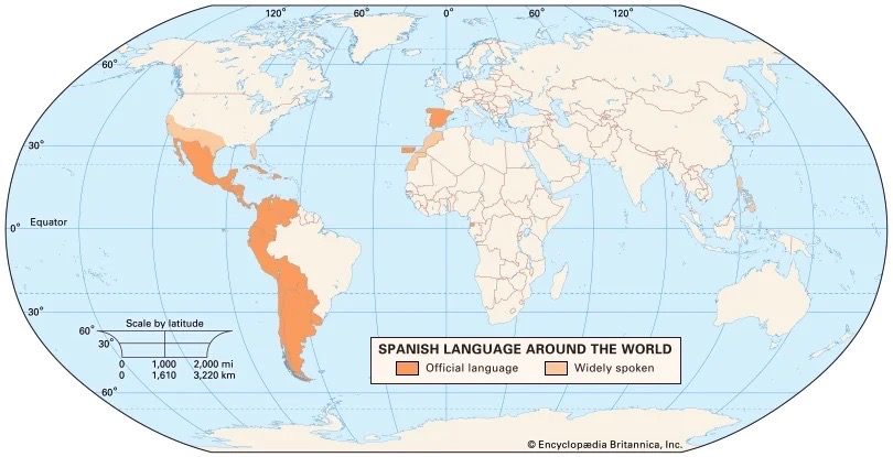
Map of countries, in orange, where Spanish is listed as an official language, and, in tan, where Spanish is widely spoken. Most Spanish-speaking countries are located in Central America, South America, and the Caribbean. The only exceptions are Spain in Europe and Equatorial Guinea in Africa (from Posner, 2023).
Climate education in selected Spanish-speaking countries
- You can learn more about climate education in these and other Spanish-speaking countries through the Monitoring and Evaluating Climate Communication and Education (MECCE) Project here.
Mexico (Estados Unidos Mexicanos)
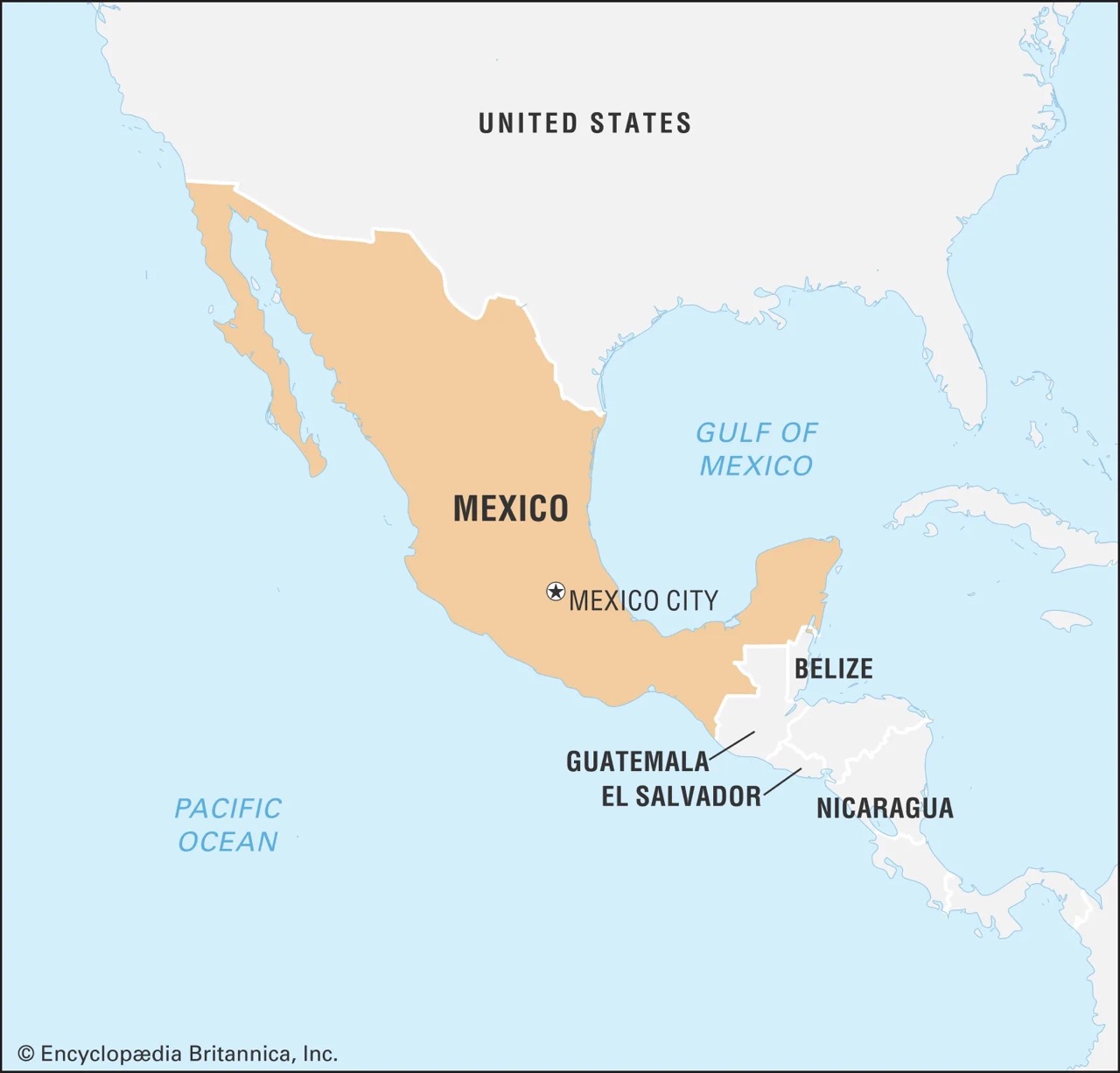
Map of Mexico, located in southern North America, east of the Pacific Ocean and west of the Gulf of Mexico (from David Bernstein et al., 2023).
- Mexico’s greatest climate change threats are tropical cyclones, heat waves, and floods. Aging energy, transportation, and water infrastructure are vulnerable to extreme weather events, especially in coastal regions. Furthermore, extreme temperatures and inconsistent precipitation brought on by climate change are creating problems for agriculture in rural Mexico.
- Recent surveys indicate that a significant portion of Mexican citizens are aware of climate change, but a much smaller proportion understand it on a deeper level. A 2017 public opinion poll revealed that while 89% of participants heard of climate change, only 30% felt compelled to take individual action against the climate crisis.
- In terms of education policy, Mexico has several national-scale climate education laws supporting sustainability awareness among youths. The National Climate Change Strategy (2013) for example, promotes environmental education and awareness in an effort to develop climate-conscious mindsets in students. In primary and secondary schools, climate education is incorporated into core subjects such as the natural sciences and geography. The National Curriculum Framework for Basic Education (2011) teaches topics on sustainability through multiple disciplines, with a focus on climate justice. In secondary schools, students are taught to think critically about sustainability practices.
- Much of Mexico’s climate education in primary and secondary schools is framed in terms of Indigenous perspectives. More than one in five Mexicans are Indigenous and about 6% speak Indigenous languages. The General Directorate of Indigenous, Intercultural, and Bilingual Education is a government department dedicated to fostering equitable climate education by providing resources in Indigenous languages.
- At the higher education level, there are fewer curriculum policies implementing climate education. However, the Mexican Consortium of Higher Education Institutions for Sustainability, a collection of 19 higher institutions across the country, encourages climate education. This organization is a collaborative network that allows institutions to share resources and develop sustainable education frameworks.
Dominican Republic (República Dominicana)
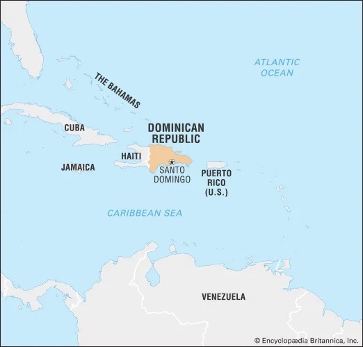
Map of the Dominican Republic, located in the Caribbean Sea, between North and South America (from González and Wiarda, 2023).
- The Dominican Republic was ranked the 11th most vulnerable country to climate change in 2017. Some of the greatest threats to the island nation include coastal flooding, drought, and hurricanes. Located on the island of Hispaniola in the Caribbean, the Dominican Republic sits in the center of a North Atlantic hurricane belt. As a result, the Dominican Republic suffers from storm damage to its infrastructure, fisheries, and crops.
- A significant portion of Dominican Republic citizens are aware of climate change, with 98% of interviewees stating they believed in climate change in 2012. At that time, the citizens ranked climate change as the 8th most important issue that should be addressed by the national government, behind education and citizen security as the top two priorities.
- Environmental education is mandatory in the Dominican Republic’s national school system, mandated by the National Curriculum Framework (2016). Climate and sustainability awareness is emphasized in the national curriculum at the primary and secondary levels.
- The National Curriculum Framework promotes education on the dangers of climate-caused natural disasters, management of natural resource use, and renewable energy. In primary school, students are taught about climate through the Environmental Crisis subject, which covers climate change, pollution, biodiversity loss, and more. At the secondary level, climate change is incorporated into multiple disciplines like social studies and the natural sciences.
- While some higher education institutions in the Dominican Republic offer diplomas in climate and public policy, climate education is not available at all schools. The Dominican Republican government is working towards providing environmental or climate-related opportunities in all higher education institutions by 2030.
Colombia (República de Colombia)
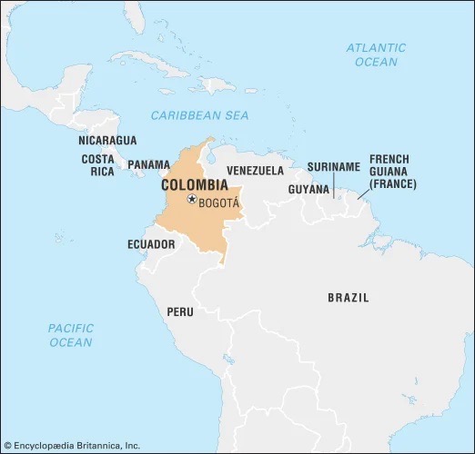
Map of Colombia in northwestern South America (from Louis Gilmore et al., 2023).
- Colombia’s greatest climate change threats are drought, land degradation, and coastal flooding. The majority of Colombians live in the Andes mountains region, which is being affected by rising temperatures and infrequent rains. Climatologists predict that drought in Colombia will exacerbate water shortages, create agricultural decline, and reduce the productivity of hydropower electricity generation.
- Climate awareness is especially high in Colombia, with 98% of surveyed residents stating they were aware climate change is occurring. The vast majority of polled Colombian citizens also agreed that climate change is an urgent problem that needs to be addressed.
- While many climate policies identify education as an important sector for raising climate awareness and training, fleshed-out frameworks are missing. Colombia has implemented policies supporting environmental education since the mid-1990s but is working towards climate-specific education to help its citizens build resilience.
- In primary and secondary schools, Colombian education guidelines do not require climate-specific education but instead offer guidelines for general environmental instruction. However, Colombian educators do have access to outside resources from the national Ministry of Education and non-governmental organizations to educate their students on climate change.
- Colombian institutions of higher education are working towards climate change awareness and mitigation. In 2019, 37% of public and private Colombian universities were involved in climate change action, mostly working on educating students and the general public. The country also has an alliance of sustainability-focused institutions called the University Union in Sustainable Production and Consumption. This union aims to increase environmental sustainability across higher education with a focus on reducing greenhouse gas emissions.
Climate and culture in selected Spanish-speaking countries
Spain (España)
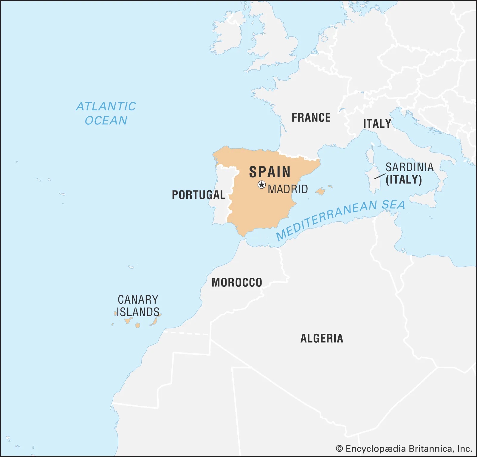
Map of Spain, located in southwestern Europe, along the coast of the Atlantic Ocean and Mediterranean Sea (from Rodriguez, 2023).
- Castilian, a dialect of Spanish originating in northern Spain, is the official language of Spain. The country is home to over 43 million native Spanish speakers.
- Located on the Iberian Peninsula in southwestern Europe (map above), Spain has several climatic zones due to its expansive geography. Northern Spain, which borders the Atlantic Ocean, is generally humid with plentiful rainfall and an average annual temperature between 6°C (43°F) and 20°C (68°F). Southern Spain is more arid, with less precipitation, and an average temperature between 10°C (50°F) and 26°C (79°F).
- Agriculture is an important part of Spanish culture for traditional foods and festivals. For example, olive oil has been essential to Spanish cuisine for three thousand years. It is used in many popular dishes including paella, tortilla española, pan con tomate, and more. Spain produces more olive oil than any other country in the world, and the average Spaniard consumes over 9 liters (2.4 gallons) of olive oil a year. Spain’s warm, dry, and sunny climate fosters the growth of olive trees, which are native to the Mediterranean region.
- Destructive agricultural practices, rising temperatures, and declining precipitation contribute to shrinking wetlands in south and central Spain. These factors threaten Spain’s agriculture and food production.
- In 2022, researchers found that the Iberian Peninsula is experiencing its driest climate in over 1,000 years. Normally, Spain receives most of its precipitation during the winter when low-pressure systems form in the Atlantic Ocean. However, Azores high (image below), a high-pressure system that forms in the winter and blocks moisture from reaching Spain, is becoming increasingly common as a result of global warming. Before industrial carbon emissions, Azores highs would occur once every ten years, but since the 1980s, that frequency has increased to once every four years. Azores highs are creating drier conditions that, in combination with more frequent heat waves, are threatening Spanish agriculture.
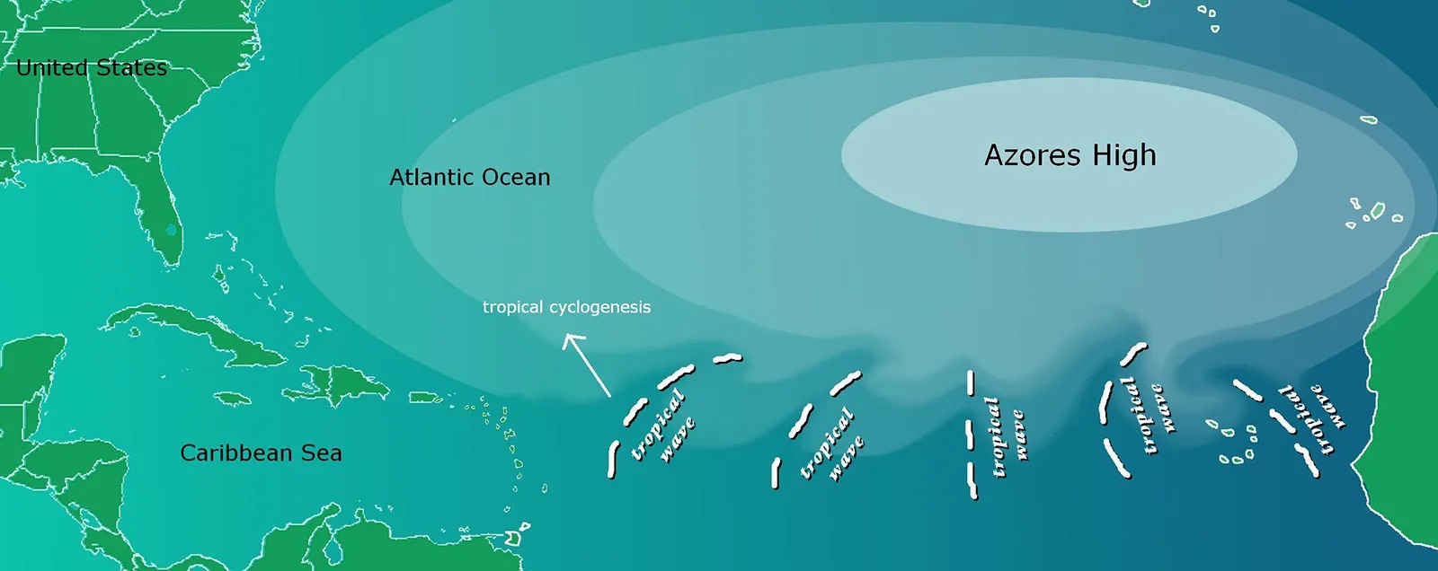
Map of Azores high, a high-pressure system that can form during winter in the eastern Atlantic Ocean (from The Editors of Encyclopedia Britannica, 2012). When it occurs, the Azores high prevents moisture from reaching Spain (not pictured, but located northeast of the Azores High), creating drought conditions.
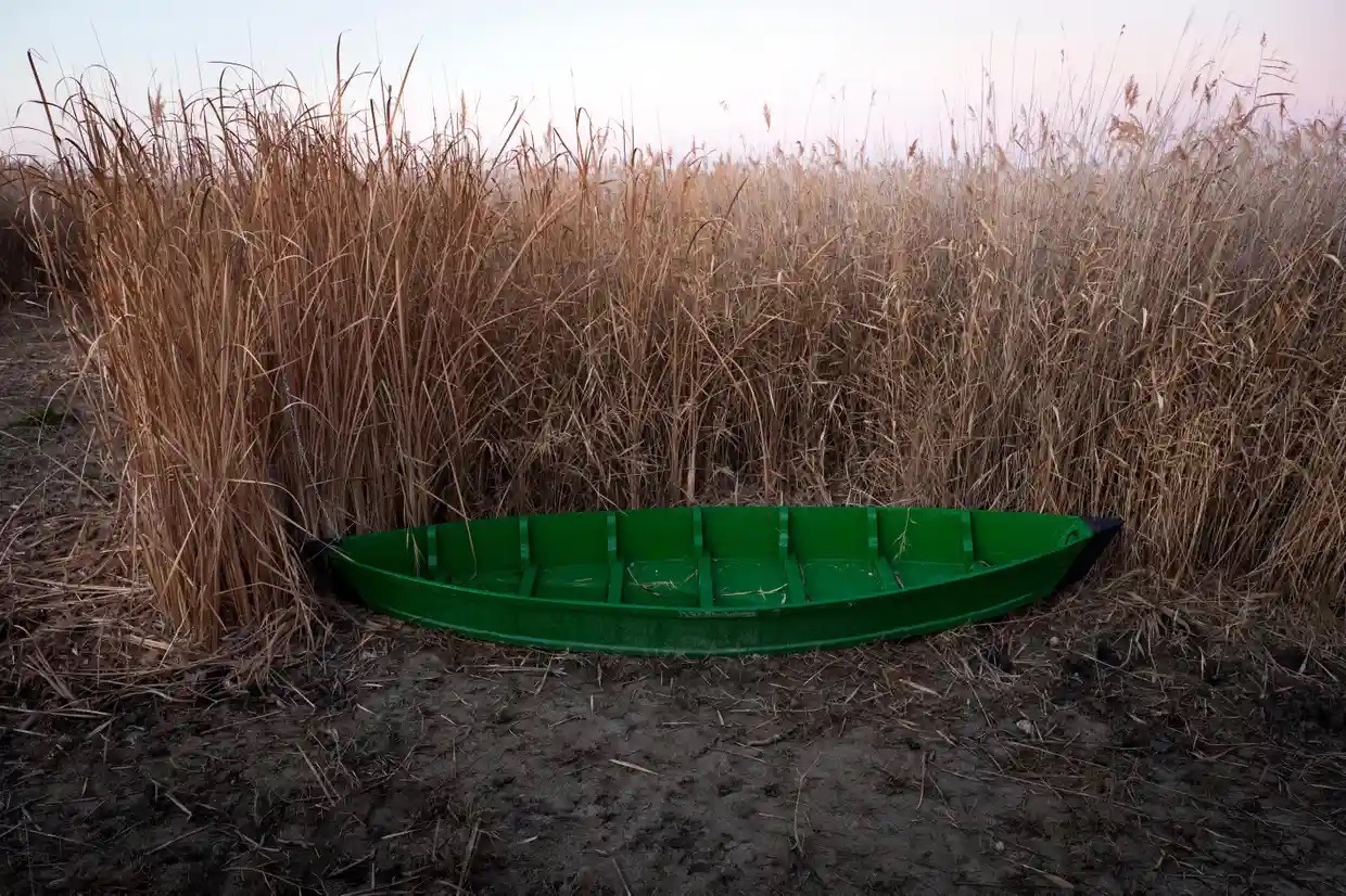
- More than two-thirds of freshwater supplies in Spain are used for agricultural irrigation, and much of this water is drawn from rivers and aquifers. The southern region of Spain is a major producer of crops. However, no major rivers flow through this part of the country. To solve this, officials have transferred water from nearby rivers. Several major rivers, such as the Guadiana in central Spain, and wetlands are being dried up from overuse (image below).
- Olive oil production has been directly impacted by the water shortage. Without sufficient irrigation, olive trees produce stunted or shriveled fruit. In 2022, olive crops were reduced by over 30% due to the drought.
Photograph of a dried-out marsh in Las Tablas de Daimiel national park, in central Spain, after the rainy season in 2021 (from Burgen, 2021).
Argentina
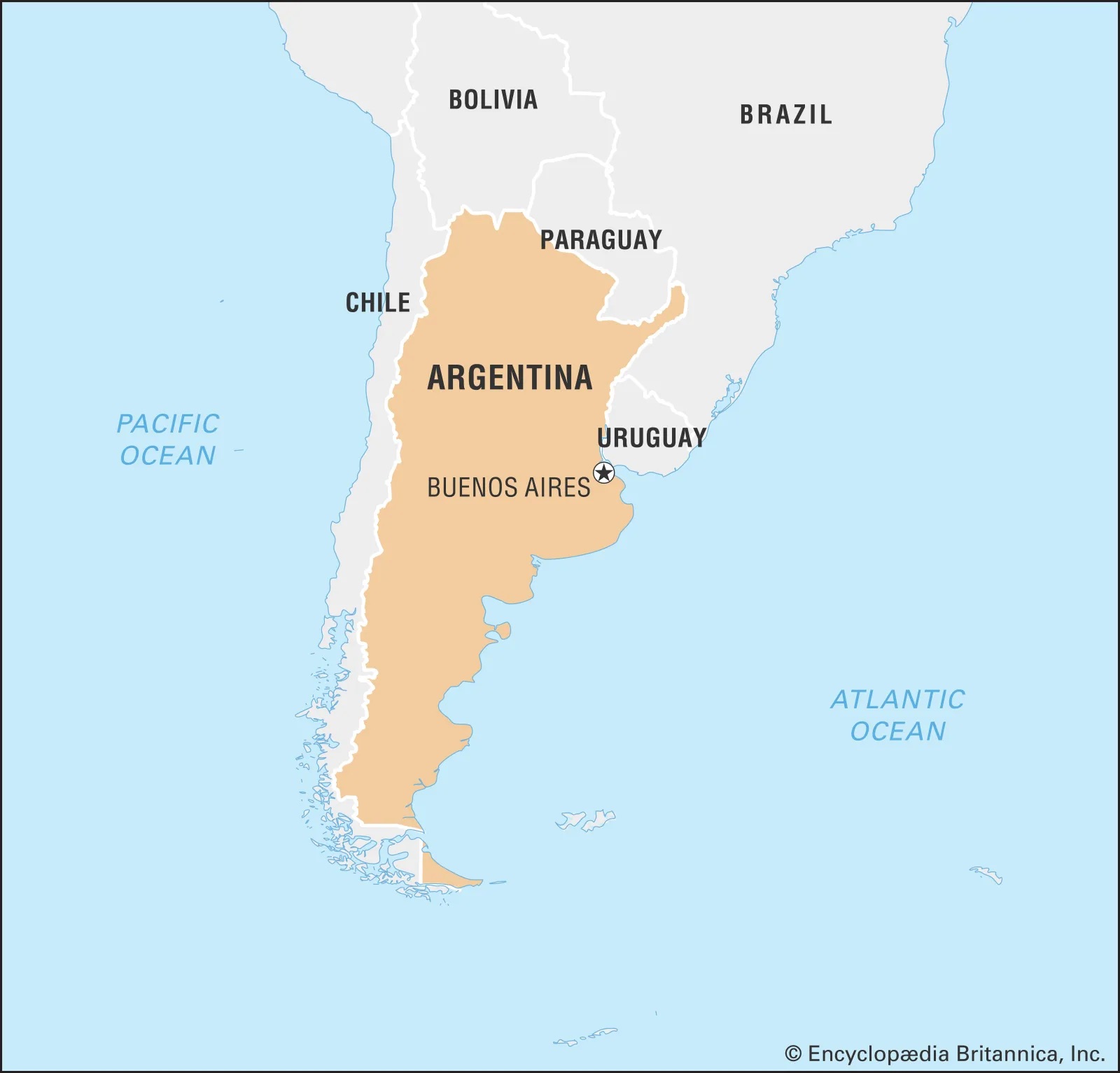
Map of Argentina in the southeastern tip of South America, west of the Atlantic Ocean (from Eidt et al, 2023).
- Argentina is home to almost 45 million native Spanish speakers, the third highest in the world. Spanish is by far the most widely spoken language in the country, though a significant number of Argentinians speak Portuguese, English, Italian, Levantine Arabic, and Indigenous languages.
- Argentina, unlike many other countries in South America, is dominated by temperate climate. The southern portion of the country, containing the southern tip of the Andes mountains, is more arid with tundra and polar characteristics. Overall, Argentina experiences moderate precipitation and frequent storm events.
- Like Spain, Argentina has seasonal agriculture which is important to the country’s culture.
- The Fiesta de la Vendimia (Harvest Festival) in the city of Mendoza is a celebration of local wine that takes place every February-March. This event includes a series of parades, local performances (image below), wine tasting, and the Queen of Vendimia beauty pageant.

Photograph of an amphitheater-styled performance in Mendoza, Argentina for the Fiesta de la Vendimia. Over 25,000 people attend the three-hour music and fireworks show (from Barnes, 2018).
-
- The Mendoza region produces the most wine in Argentina. Located on the eastern foothills of the Andes, this area is characterized by its high-altitude plains. Although this area is geographically a desert, its high altitude helps maintain moderate temperatures that foster local wineries.
- El Niño, a climate pattern of uncharacteristically high sea surface temperatures in the equatorial Pacific Ocean, has a great effect on the success of wineries in Argentina. During El Niño years, eastern Argentina gets more humid, precipitation increases and cold air anomalies occur in the spring and summer. These climate conditions are damaging to wine crops. In 2016, a strong El Niño year, the country lost 27% of its wine harvest, with the Mendoza region losing almost 40%. The harvest season was pushed back from February-March to April due to cooler temperatures and increased rainfall. Climatologists predict that anthropogenic climate change will make El Niño events twice as frequent and more intense.
Peru (Perú)
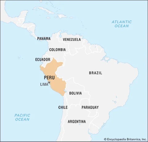
Map of Peru, located in northwestern South America, east of the Pacific Ocean (from Preston Moore et al, 2023).
- Over 28 million native Spanish speakers live in Peru. While Spanish is the official language of Peru, many Indigenous languages, like Quechua and Aymara are also widely spoken.
- Located just south of the equator, Peru is a tropical country with a variety of climatic conditions. Peru is divided into three main regions (map above): the arid coastal plains to the west, the high-altitude Andes mountains in the center, and the humid Amazon Basin to the east. Temperatures throughout the country range from 8°C to 35°C (47°F to 95°F), mainly depending on the region.
- Alpacas, a close relative of the camel and llama, are an important part of Peruvian culture and livelihoods. These animals are native to Peru and have been used for food and clothes since they were first domesticated 6,000 years ago. Today, alpacas are raised for their valuable fleece, which can be made into garments and blankets.
- Many herders raise alpacas in the Peruvian highlands (image below), where there have historically been persistent grasslands despite low annual rainfall. However, anthropogenic climate change is disrupting normal weather conditions and threatening alpacas in Peru. The Peruvian highlands usually have reliable moderate temperatures, but climate change is making temperatures more extreme. Sunny days are hotter than normal and cold snaps are becoming more common, killing young alpacas. The land is also becoming less productive as pasture land overtakes native marsh grasses that rely on glacial stream flows. Global warming is pushing back Andes glaciers and reducing stream flows during the dry season. As wetlands dry up, alpacas are left without their natural food sources.
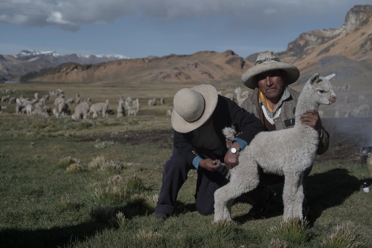
Photograph of alpaca herders with their livestock taken in 2021. The baby alpaca in the front was injected with medicine before the herd’s seasonal migration. Cold snaps brought on by anthropogenic climate change weaken alpacas’ immune systems, exposing them to fatal diseases (from Cinque, 2022).
Language Practice
In progress.
References and additional resources
- Azócar, G., Billi, M., Clavo, R., Huneeus, N., Lagos, M., Sapiains, R., Urquiza, A., “Climate change perception, vulnerability, and readiness: inter-country variability and emerging patterns in Latin America.” Journal of Environmental Studies and Sciences. vol. 11, 2020, pp. 23-36. https://link.springer.com/article/10.1007/s13412-020-00639-0.
- Barnes, A. “Vendimia & Visiting Mendoza’s Harvest Festival.” South America Wine Guide. August 2018. https://southamericawineguide.com/vendimia-visiting-mendozas-harvest-festival/.
- Barnes, A. “El Nino hampers Argentina’s 2016 wine harvest.” Decanter. May 2016. https://www.decanter.com/wine-news/el-nino-argentina-2016-wine-harvest-305057/.
- Burgen, S. “‘Farmers are digging their own graves’: true cost of growing food in Spain’s arid south.” The Guardian. November 2021. https://www.theguardian.com/environment/2021/nov/16/farmers-are-digging-their-own-graves-true-cost-of-growing-food-in-spains-arid-south.
- Carrington, D. “Spain and Portugal suffering driest climate for 1,200 years, research shows.” The Guardian. July 2022. https://www.theguardian.com/environment/2022/jul/04/spain-and-portugal-suffering-driest-climate-for-1200-years-research-shows.
- “CCE Country Profile: Colombia.” Monitoring and Evaluating Climate Communication and Education Project. 2023. https://mecce.ca/country_profiles/cce-country-profile-colombia/.
- “CCE Country Profile: Dominican Republic.” Monitoring and Evaluating Climate Communication and Education Project. 2023. https://mecce.ca/country_profiles/cce-country-profile-dominican-republic/.
- “CCE Country Profile: Mexico.” Monitoring and Evaluating Climate Communication and Education Project. 2023. https://mecce.ca/country_profiles/cce-country-profile-mexico/.
- Cinque, A. “The High-Altitude Quest to Save Alpacas.” National Geographic. January 2022. https://pulitzercenter.org/stories/high-altitude-quest-save-alpacas.
- “Climate of Argentina.” Wikipedia. June 2023. https://en.wikipedia.org/wiki/Climate_of_Argentina.
- “Climate Risk Profile: Colombia.” Climatelinks. July 2017. https://www.climatelinks.org/resources/climate-risk-profile-colombia.
- “Climate Risk Profile: Dominican Republic.” Climatelinks. June 2017. https://www.climatelinks.org/resources/climate-risk-profile-dominican-republic.
- “Climate Risk Profile: Mexico.” Climatelinks. May 2017. https://www.climatelinks.org/resources/climate-risk-profile-mexico.
- “Colombia: Climate Change Country Profile.” USAID. November 2022. https://www.usaid.gov/climate/country-profiles/colombia.
- “COP 27: Two Latin American teachers win global climate education award.” UNICEF. November 2022. https://www.unicef.org/lac/en/press-releases/cop-27-two-latin-american-teachers-win-global-climate-education-awar.
- David Bernstein, M., Cline, H. F., Willey, G. R., “Mexico.” Encyclopedia Britannica. August 2023. https://www.britannica.com/place/Mexico.
- Eckelkamp, S. “Everything You Need to Know About Spanish Olive Oil.” PJ Kabos. March 2021. https://www.oliveoil.com/everything-you-need-to-know-about-spanish-olive-oil/.
- Editors of Encyclopedia Britannica. “Azores high.” Encyclopedia Britannica. June 2012. https://www.britannica.com/science/Azores-high.
- Eidt, R. C., Calvert, P. A. R., Haperin Donghi, T., “Argentina.” Encyclopedia Britannica. July 2023. https://www.britannica.com/place/Argentina.
- González, N. L. and Wiarda, H. J. “Dominican Republic.” Encyclopedia Britannica. March 2023. https://www.britannica.com/place/Dominican-Republic.
- Jones, S. “Bitter winters for Peru’s alpaca farmers combating climate change.” The Guardian. December 2014. https://www.theguardian.com/global-development/2014/dec/24/peru-alpaca-farmers-climate-change.
- Louis Gilmore, R., Parsons, J. J., Kline, H. F., “Colombia.” Encyclopedia Britannica. August 2023. https://www.britannica.com/place/Colombia.
- Lowen, M.” Spain’s olive oil producers devastated by worst ever drought.” BBC News. August 2022. https://www.bbc.com/news/world-europe-62707435.
- “Mendoza Wine: Sub-regions of Mendoza.” Wine-Searcher. February 2023. https://www.wine-searcher.com/regions-mendoza.
- Mumma, T. “Maps Page on Peru.” NeoCities. March 2019. https://treymumma.neocities.org/geog3000/maps.
- “New environmental education guide for Latin America, Caribbean region on action for nature, climate and pollution.” United Nations Environmental Program. January 2023. https://www.unep.org/news-and-stories/press-release/new-environmental-education-guide-latin-america-caribbean-region.
- Pariona, A. “What Languages Are Spoken In Argentina?” World Atlas. September 2020. https://www.worldatlas.com/articles/what-languages-are-spoken-in-argentina.html.
- Posner, R. “Spanish language.” Encyclopedia Britannica. June 2023. https://www.britannica.com/topic/Spanish-language.
- Preston Moore, J., Pulgar-Vidal, J., Davies, T.M., Burr, R. N., Kus, J. S., “Peru.” Encyclopedia Britannica. June 2023. https://www.britannica.com/place/Peru.
- “¿Qué es el cambio climático?” United Nations. n.d. https://www.un.org/es/climatechange/what-is-climate-change.
- Rodriguez, V. Harrison, R. J. Smith, C. D. Carr, R. O’Callaghan, J. F. Koenigsberger, H.G. Viguera, M. J. Richardson, J.S. Shubert, A. Ginés, J. V. “Spain.” Encyclopedia Britannica. June 2023. https://www.britannica.com/place/Spain.
- Romero, T. “Number of native Spanish speakers worldwide 2021, by country.” Statista. November 2021. https://www.statista.com/statistics/991020/number-native-spanish-speakers-country-worldwide/.
- “What is Climate Change?” United Nations. 2020. https://www.un.org/es/climatechange/what-is-climate-change.