By Haley Schmidt ’22, with commentary from Tracy
I’m so excited that I finally got to work with the SAL in my last semester at Smith! Working with Jon and Tracy has been a great experience.
I have really enjoyed helping other students during my help hours with a wide variety of topics, ranging from environmental science to religion. It’s so interesting to see how everyone gets involved in the SAL from such different places, and I love hearing all the reasons that people are interested in mapping. It always feels like a comfortable and collaborative working environment.
Some examples of Haley’s help that draws from her SDS and ES&P training include: using R to create maps in Leaflet, visualizing potential farm-to-prison pipelines for a ENV312 capstone project, and symbolizing OpenStreetMap and LiDAR data for an emeritus GEO faculty for his continuous work with Historic Northampton
This semester, I was able to lead a workshop on data collection in the field using Field Maps. I was first introduced to using GIS in the field during my internship this past summer where I was collecting data and inspecting hydraulic infrastructure for the Minnesota DOT. I love going out in the field to collect data myself, so it was exciting to get other students interested in it as well! As an ES&P major, it’s not something we get to do very often because most of our coursework is centered around working with existing data and information. During the Field Maps workshop, we learned how to use a few different types of GPS devices and we went outside to map the streetlights around campus.
I’ve been wanting to learn how to fly drones and collect aerial imagery for a long time now, and I was finally able to learn this semester! Tracy and I were able to go out a few times once the weather was nice and practice flying. By supporting other students with their projects and practicing GIS myself, I became much more confident in my skills over the course of the semester I’m so grateful for this experience this semester, and I hope to have more GIS experiences in the future!
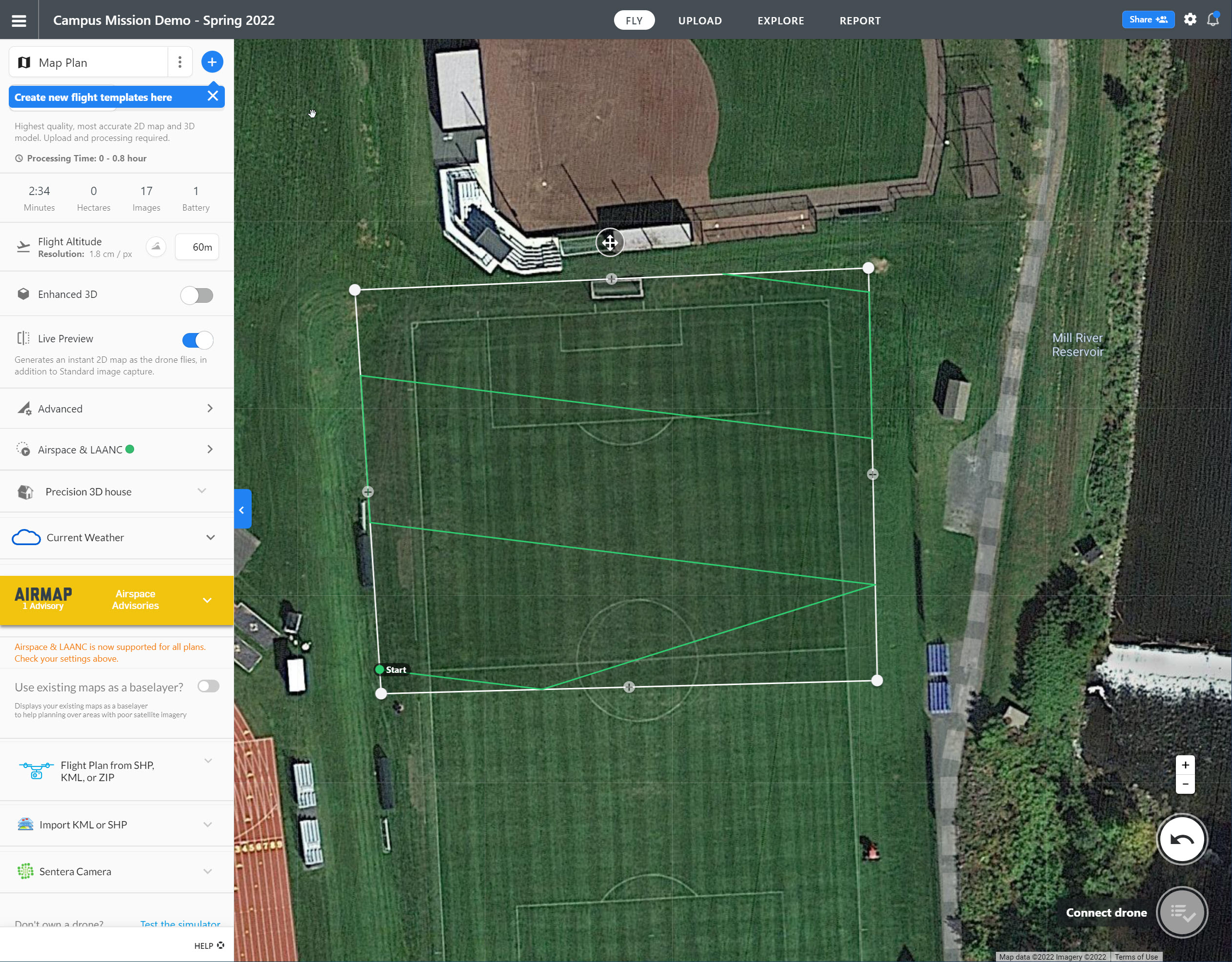
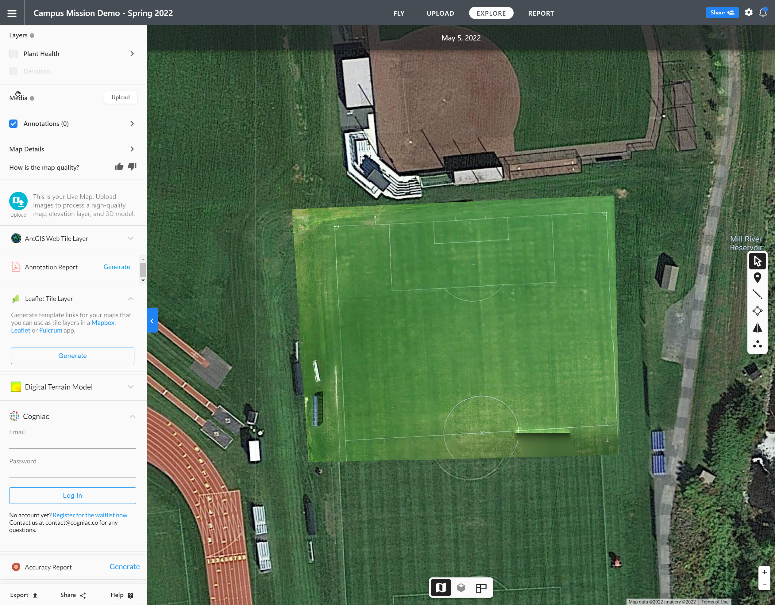
Haley used DroneDeploy to lay out a mission grid, and the program fills in imagery that gets captured during the flight for a low-resolution “live” preview.
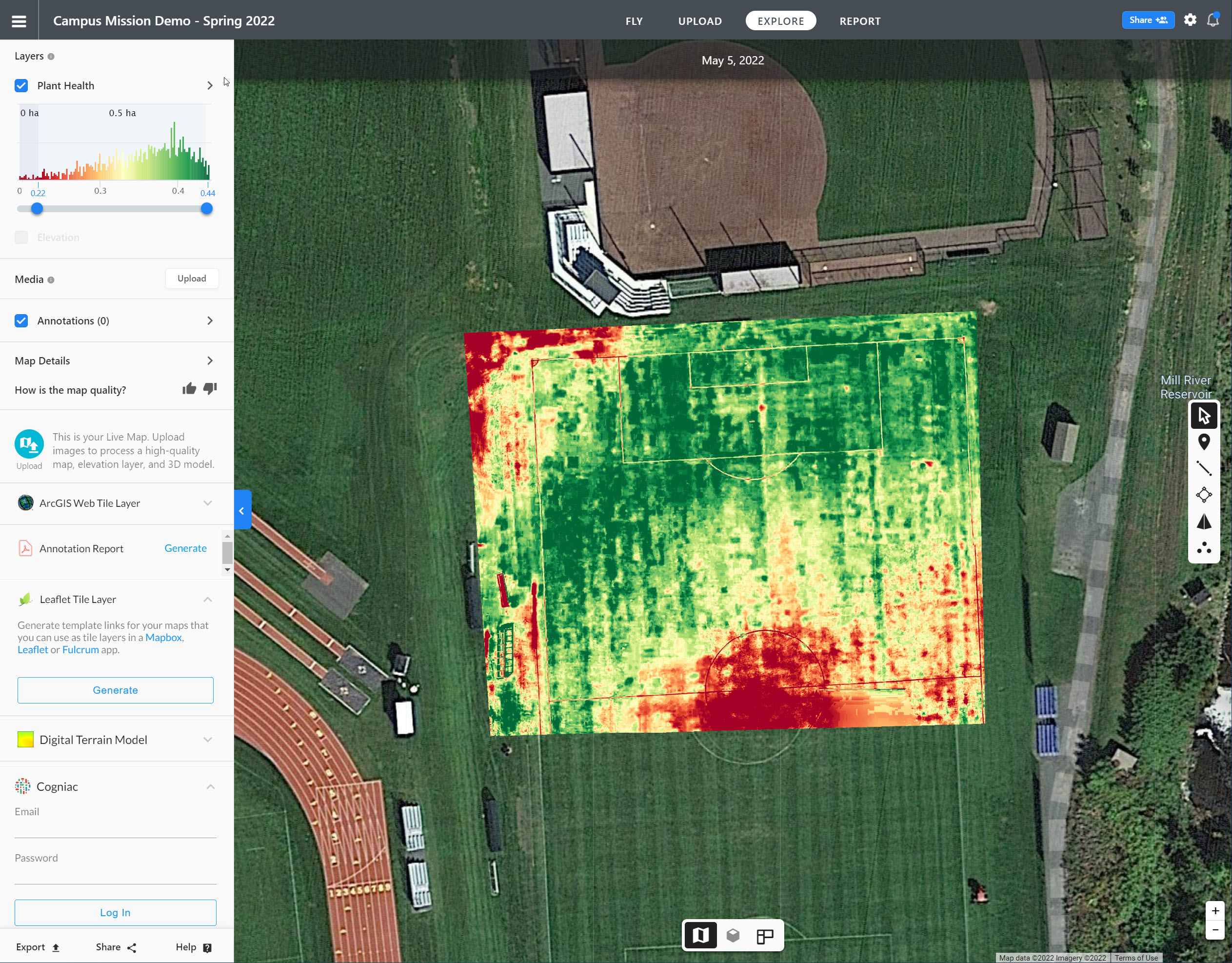
Once the mosaic imagery is completed, DroneDeploy also has a “plant health” feature that is essentially a pseudo-NDVI (Normalized Difference Vegetation Index), which looks at how “green” the Green band is in the RGB composite – the greener, the healthier. So it’s interesting to see the center field turf being most distressed as perhaps it undergoes most action.
In addition to free-form flying, we also tried several intelligent modes such as Point of Interest, ActiveTrack, Waypoints, and Course Lock. You can read more details on each here.