The October Mystery Map was perhaps unsurprisingly themed around elections. The map garnered 386 views and a dozen submitted guesses, with the superlatives as follows:
- Most Inconceivable: Don’t Tempt Fate – gender reveal parties that go wrong
- Most Puntastic: Smithtoral College – where Smithies have voted
- Most Accurate: Public Events by Presidential Candidates and VPs since the 2020 Conventions
- Most Poignant: We’re on a Road to Nowhere – presidential campaign trails
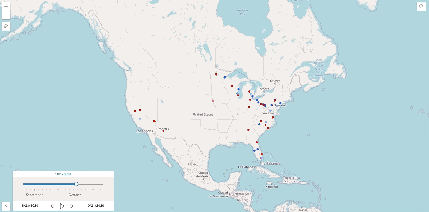
Additional to the splash screen hint: your voice matters, other clues might be geographic (the stops are predominantly in battleground states) and cartographic (varying hues for points to show qualitative difference – the candidates). There were considerable guesses that the map portrayed voter registration, with a wonderful discussion on the use of color to represent qualitative difference (party affiliation) and saturation to represent quantitative difference (magnitudes of voters).
This mystery map was inspired by the Chicago Tribune’s campaign trail tracker – while interactive in its pop-up information, provides a static temporal experience and its symbology only represents the bipartisan race, not distinguishing the president and vice president candidates.
The campaign stops were geocoded – converting a place to an x, y coordinate – based on their city and state, and the tabular data includes a date attribute that enabled the time-series to display the locations cumulatively. The Chicago Tribune dataviz team was vigilant in updating the map up to the day of the general election, while our map starts on the Democratic National Convention to the final presidential debate. The data sources included the respective campaign websites and the official White House announcements. The web map is then presented with the Minimalist app template to accentuate the time slider for the audience, and you can now click on the stops to see a brief description of the event.