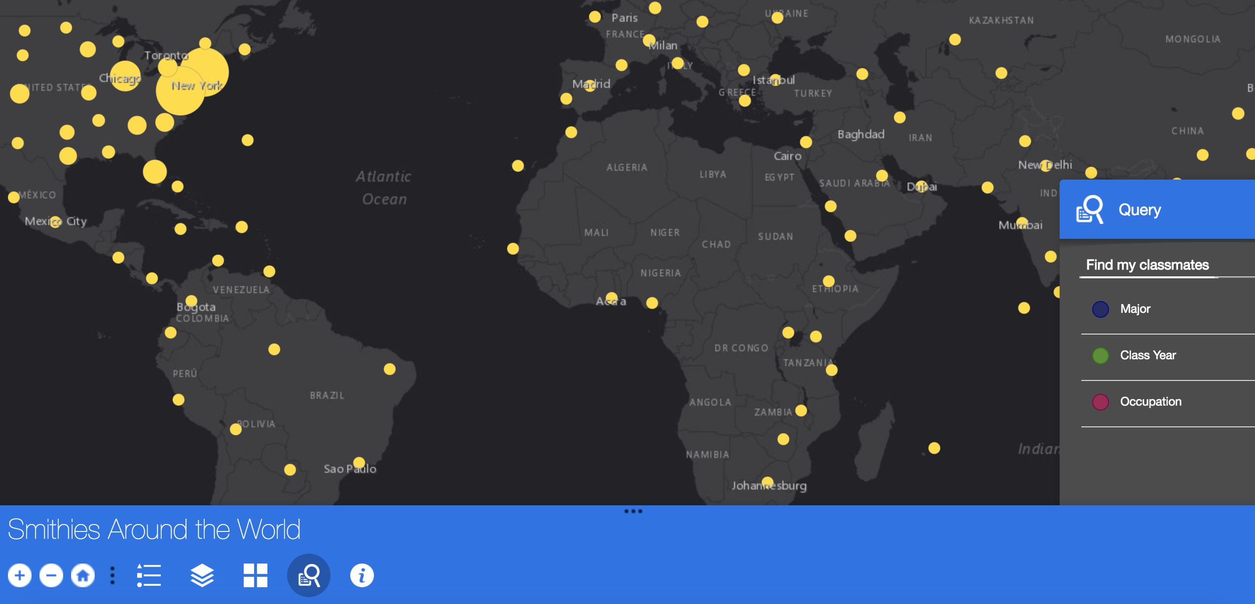
Are you a Smithie? Where in the world are you now? Well, that’s what the Smithies Around the World Map attempted to find out. In preparation for Reunion this past Spring, the SAL gathered data from the Office of Development to map the general locations of Smith alums’ current locations. Smith currently has information of active alums, including Ada Comstock students, who graduated between 1927 and 2018. The data represents 44,833 Smith alumnae! Majors associated with each alum were also cleaned up to represent our academic departments today, which allows users to find all iterations of majors over time to connect with fellow scholars. Timothy Enman, senior researcher and student assistant Nancy Yun who cleaned and organized the information from alums living internationally. Other information associated with the data are city, nation, class year, degree type, certificates, major, second major and current occupation. The data are gathered from student records, directory information from alumnae, and address updates from the US Postal Service’s National Change of Address (NCOA) database. Normally the data are used for mailing alumni information about fundraising, newsletters, and other college mail. Kathleen Foley in the Office of Institutional Research provided support in understanding how majors at Smith have changed over time.
To protect the privacy of Smith alums we decided to only use the zip-code for locating and creating coordinates for each address. This is the process of geocoding. What we thought would happen was that the addresses would map at the centroid of each zip code and addresses with zip-codes with the additional 4 digits would map along their delivery routes. But it turns out that those delivery routes get fairly specific! To ensure more privacy, we’ve fielded lots of ways to randomize the placement of the data within the larger zip-coded areas. At first we tried different tools to randomize the placement of the data within a grid overlay set by USGS for their topographic maps. But, of course that would only work for alums living in the United States. Then, we thought about using the geocode to our advantage. We could slightly alter the coordinates to shift them slightly from their true location! Aha!
We geocoded the data again and I trimmed each coordinate down to about 7 digits to obtain parcel level accuracy by using the field calculator to truncate the values. I went to check and compare my set of controls (me and friends in Northampton, New York City, New Orleans and Southern France!). The coordinate trimming worked! However, I noticed that I couldn’t find myself on the map… Turns out that there’s Northampton County in Pennsylvania that ArcMap was sure I lived. Back to geocoding. I set different parameters for this round of geocoding addresses and tested my controls. This time international addresses were not cooperating. It appeared that hundreds of alums had all moved to the same city in Namibia and some had even moved to Antarctica. Perhaps in a different universe, but not the one we live in currently. Stay tuned to find out more about the world of geocoding! The Smithies Around the World Map will be up again soon.