Excited voices bubbled in the basement of Forbes Library during a Monday afternoon teen after-school program:
“Let’s build the bridge there!”
“Oh! What if we planted some reeds and near the water?”
“Okay, the blue dashed line is where the bike path will go in Florence.”
I was invited to talk to the students about the environment and climate change, with of course, some maps. But instead of showing pre-made maps or even projects we had going in the SAL, we made one ourselves. This process, called participatory mapping, gives the power back to the people and creates a sense of ownership and agency within our own communities. Before the event at Forbes, I printed a large-scale map of Northampton showing a few different layers: basic infrastructure like buildings and roads, bike paths, rivers and streams, and the projected floodplain. We talked about what types of changes we would see in our own communities in response to climate change– the students talked about more people and more flooding and storms.
A major component to the participatory mapping process is the collective decision making about the different features to represent on the map, and how to display them. We talked about legends and symbols, and also the power those lines and arrows and pinpoints have– this helped the students begin to think about what they wanted for their communities, and also what their friends and family might need in the face of climate change. So, we proposed new a bridge, more bike paths to connect the neighborhoods in Northampton and Florence, and additional dikes and plantings in the floodplain to help quell future flooding. The students also thought about new power sources and dreamed up a hydro-power system that would be input on the edges of the Connecticut and Mill Rivers to harness power, but also let fish and aquatic creatures swim through. Of course in future-building there have to be outlets for fun– the students decided we needed more bowling alleys!
Learning with the middle and high school students at Forbes was essential for forming a cohesive participatory mapping workshop for the Inclusion in Action conference at Smith, we knew we had to help guide the participants through the maps. This shaped the way we wanted to conduct the entire workshop– we designed a series of questions to help people begin to think about their identities appearing in the campus landscape. Each question was paired with a different layer of campus to bring up new identifying features and places for participants. We included:
- Where do you feel at home? Highlighted residential houses in buildings layer
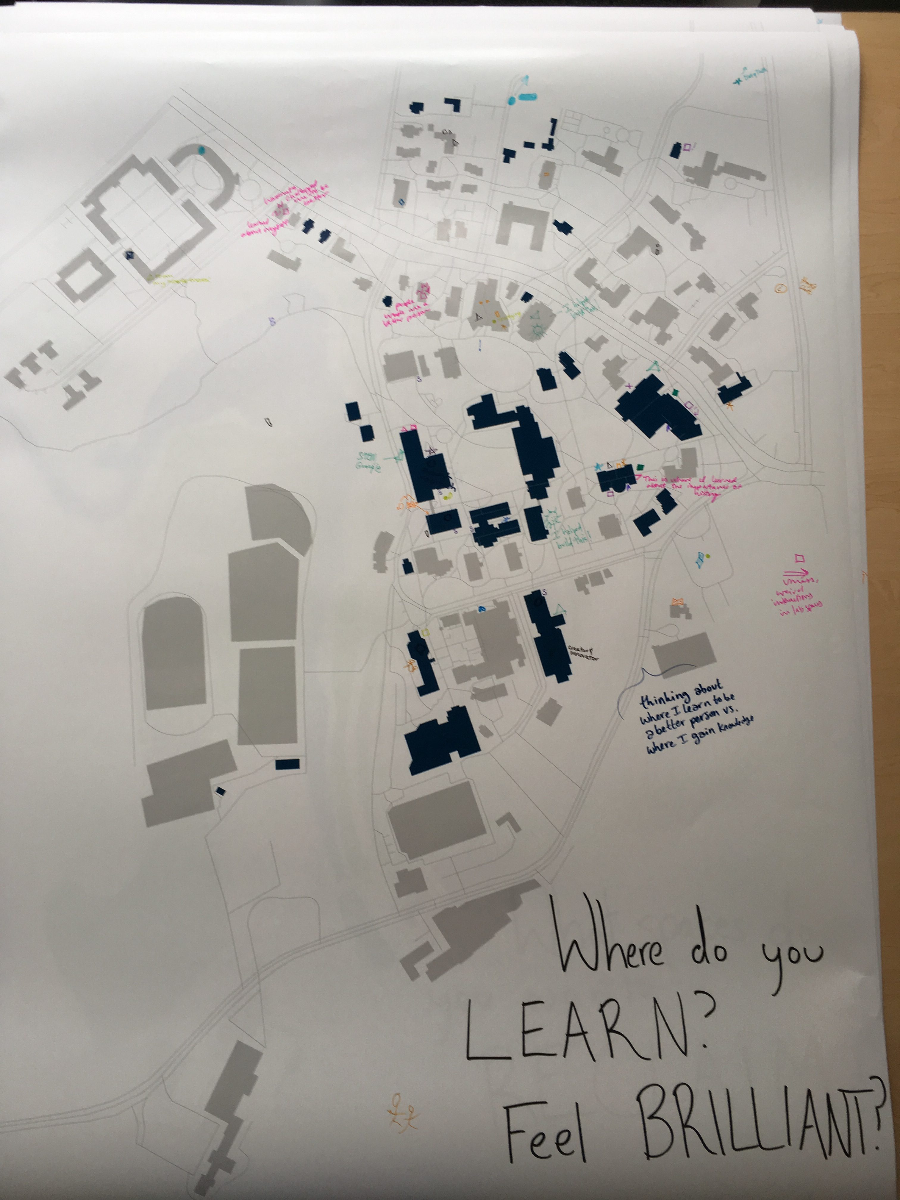
- Where do you learn? Feel brilliant? Highlighted academic buildings
- Where do you gather? Highlighted recreational spaces
- Where do you gather with people of shared identities? Highlighted affinity spaces
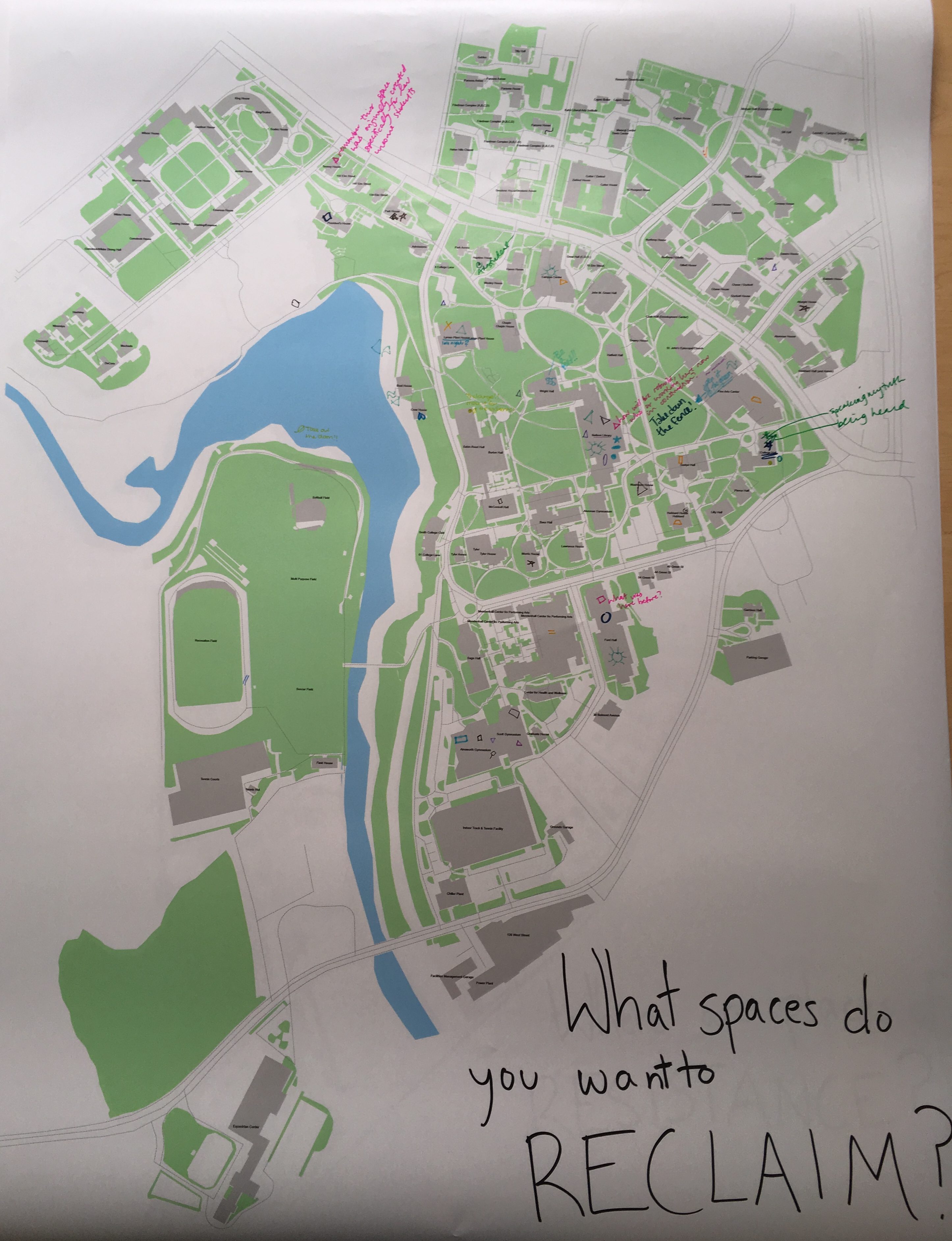
- What spaces do you want to reclaim? Why? Campus land-use layer with building names
- Where are places of resistance? Campus land-use layer
During the workshop we gave a small introduction and included our goal for the workshop: to see mapping as a tool to regain power absorbed by institutions and better understanding our social landscape through exploration of place-making and legend creating.
We started with a small hand-drawn mapping exercise before jumping into the larger discussion. Work-shoppers were asked to sketch a map of Smith and highlight important landmarks on their daily ventures through campus. Afterwards we all chatted about what similarities and differences we saw in our interpretations. In preparation for this workshop we focused on the student perspective of Smith, but even these quick sketch maps began to show us how different we connect to the landscape. Students gravitated towards places they or friends live, while staff could draw their workplaces and major academic buildings, or even parking, but no residential buildings.
This discussion of how we see the campus launched us into the legend-creating participatory mapping activity. Rewriting our own identities and experiences of place requires a deeper look into symbology and understanding the power of creating our own. On slips of paper we asked participants to create their own legend and symbolize different identities they wanted to represent on campus. Then we answered the guiding questions associated with each map by adding our symbols to the campus landscape.
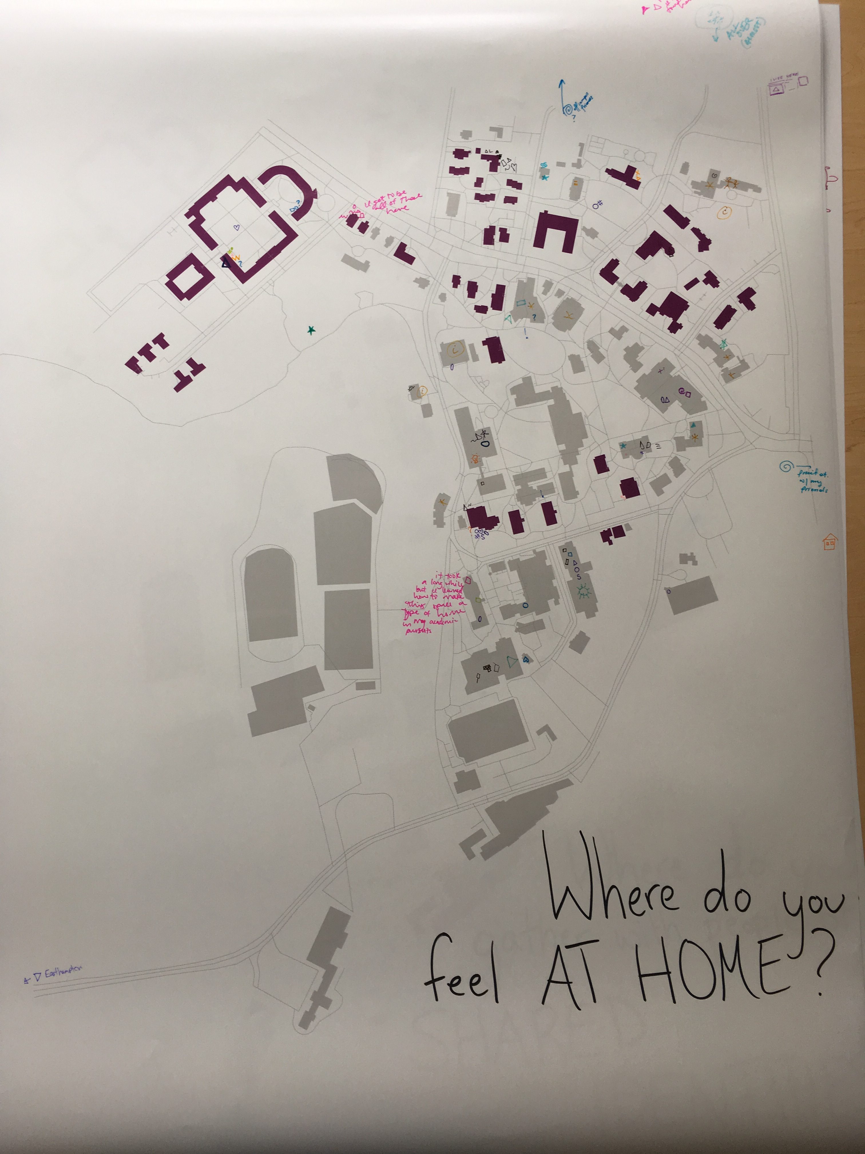
The energy in the room was contemplative and even nervous at some points– we are not taught to contend with our own interactions with the landscape, let alone change the written landscape to reflect ourselves. After everyone had a few minutes with their first map, some appeared more comfortable with the activity, but some still were apprehensive. Our conversation explained a bit more about people’s interactions with the maps. People began to voice and see their own privilege in the physical map. One person put this directly: they explained they included a symbol to represent whiteness, but never ended up putting it on the map as it would have used on every single building and space, except for perhaps, the Mwangi Center, they noted. Another person proposed that the questions be phrased in the negative, rather than the positive, to create opportunities for some of their symbols to be used, but this of course also highlighted to prevalence of whiteness and other majorities on this predominantly white campus. Overall, participants had less to say about places of resistance and reclamation, but this too, helped us convey the importance of this work.
These conversations were fruitful in sparking considerations of how we access the campus differently and the unbalanced landscape we call the Smith Community. Participatory mapping is an incredible way for this community to think deeply about how the history of this landscape and its construction shapes the way we interact with the campus today, while also providing new ways to reclaim power by rewriting ourselves into the landscape. In the future, we hope to hold more participatory mapping workshops for the campus in effort to encourage agency over student, staff, and faculty’s time at Smith. Our workshop complements and commences the counter-campus tours and online participatory mapping projects that aim to expose histories overwritten by the institution. Do you have ideas about this project or want to get involved with participatory mapping on campus? Contact eharnisch@smith.edu for more information!