Maps are increasingly popular as storytelling tools in the world of digital media – just a glance at the homepages of the New York Times, The Atlantic, or the Huffington Post confirms that. We’ve experienced this wave of mapping enthusiasm in the SAL, and it’s already started changing how we teach GIS. Moreso than conventional GIS maps, Story Maps challenge students to think critically like designers, tailoring the map’s design to its purpose and its intended audience. In the fall, we worked with three classes and several project groups using Story Maps. Here’s some of the maps they created:
GEO 150: Modeling our World: An Introduction to Geographic Information Systems
For their final projects, students in Prof. Jack Loveless’s introductory GIS class used their mastery of GIS to help local conservation nonprofits. Many created Story Maps to help these nonprofits publicize the recreational opportunities they offer.
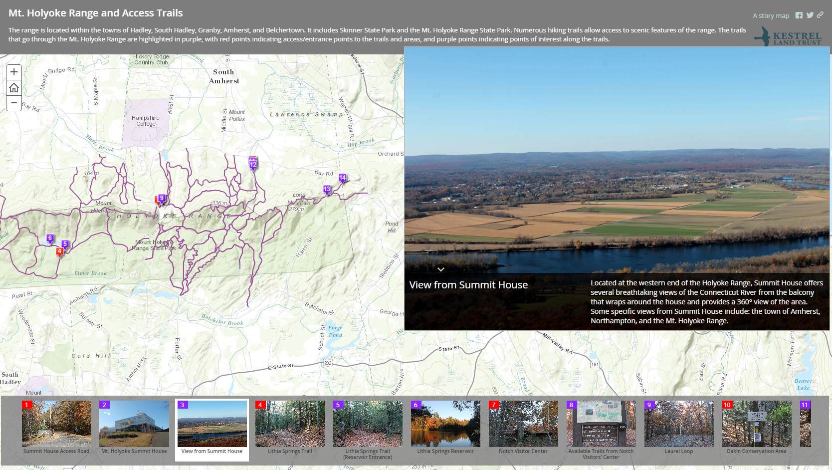
Aixin Li, Zoe Mitrisin, and Dulce Mora Flores made this Story Map showing trails in the Mount Holyoke Range for the Kestrel Land Trust. Besides just showing the trails, the Story Map includes points showing access locations and scenic views. Click on a point, and you’ll find a picture and a description of what’s there. By including these features in their Story Map, Aixin, Zoe, and Dulce aimed to make this map more useful to someone who had never visited the trails before than a traditional static map.
REL 266: Colloquium in Buddhist Studies: Buddhism in America
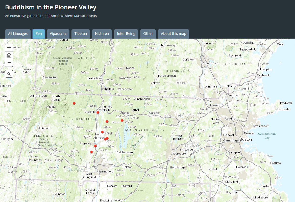
Though most had no experience with GIS or mapping, students in Prof. Connie Kassor’s Colloquium in Buddhist Studies collaborated to make a map showing Buddhist sites in the Pioneer Valley. Here’s what Connie had to say about her class’s experience:
Last fall, students in my class (REL 266: Buddhism in America) used Story Maps to create an “Interactive Guide to Buddhism in Western Massachusetts.” Professor Jamie Hubbard had previously compiled a database of the many Buddhist organizations in the Pioneer Valley and surrounding areas, and with the help of the Spatial Analysis Lab, we inputted this information into the Story Maps platform. Students then interviewed these organizations, collected images, and wrote brief reports on their histories and current activities. We integrated these images and reports into the Story Maps platform, allowing users to obtain both “at-a-glance” and more detailed information about each of these organizations.
Students thoroughly enjoyed having the ability to create content that would be made available to the general public, and Story Maps was intuitive enough to use that no one was intimidated by learning to use new technology. This project is expandable, so that future classes can continue to contribute to this map, adding more locations and more detailed information as time goes on. Eventually, the collection of sufficient information about the histories and locations of individual organizations in the area will lead to the ability to construct a history of Buddhism in Western Massachusetts as a whole.
If you’re interested in using Story Maps in your classroom, we have great news! Next Thursday, Feb 18, from 4-5:30pm, we’re hosting a workshop in the SAL (Sabin-Reed 104) to introduce the Story Maps platform and strategies for using it in the classroom. Whether you’ve used Story Maps or have never heard of it, you’ll leave with a better understanding of how Story Maps can be used in virtually any discipline to promote spatial thinking and digital media literacy. The first half will be a presentation and discussion of Story Maps. In the second half, attendees will make their own Story Map. Attendees are welcome to leave after the first half.