This fall, the Smith Spatial Analysis Lab will be offering a series of GIS and GPS workshops to Smith and Five College students, faculty, and staff. Whether you are taking or teaching a class that involves spatial data, interested in using geospatial technologies in research, or just want to know what all the fuss is about, these workshops will prepare you for some of the most useful applications of GIS and GPS. Both beginners and old hands will get something out of the workshops, so check out the schedule below.
Note: we will be offering two GPS Workshops: Collecting Data with GPS (GPS Part 1), and Processing and Displaying GPS Data (GPS Part 2). We recommend that you sign up for both parts, as GPS Part 2 builds on the skills from GPS Part 1. The GPS workshops are the only ones that build on each other; all other workshops stand alone!
Schedule
- Tues, Sept. 10, 4:15-5pm: Collecting Data with GPS (GPS Part 1)
- Weds, Sept. 11, 12:15-1pm: Collecting Data with GPS (GPS Part 1)
- Weds, Sept. 11, 4:15-5pm: Processing and Displaying GPS Data (GPS Part 2)
- Thurs, Sept. 12, 12:15-1pm: Processing and Displaying GPS Data (GPS Part 2)
- Tues, Oct. 1, 12:15-1pm: Collecting Data with GPS (GPS Part 1)
- Weds, Oct. 2, 12:15-1pm: Processing and Displaying GPS Data (GPS Part 2)
- Tues, Oct. 29, 4:15-5pm: Communicating Data with Maps
- REGISTRATION OPEN: Sign up here
- Thurs, Nov 14, 4:15-5pm: Using Spatial Statistics
- Weds, Dec 4, 4:15-5pm: Communicating Data with Maps
About the workshops
GPS Workshops (Part 1 and Part 2)
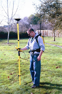
Collecting Data with GPS: This workshop discusses collecting data with GPS systems– students will learn about the GNSS satellite network, understand sources of error and mission planning, and finally use the Terrasync program on the Trimble Juno GPS unit to collect a set of GPS data in the “field” (i.e. Smith Campus)
Processing and Displaying GPS Data: This workshop builds on the skills from GPS Part 1. Students will process the GPS data they collected in the previous session, learn to correct the data post-fieldwork to enhance its accuracy, and prepare their sample data set for use in a GIS program (either ArcGIS or Google Earth).
Communicating Data with Maps
 This workshop focuses on the principles of cartography: understanding maps as representations that are the products of subjective choices, using colors and symbols to display quantitative and categorical data on a map, and creating “complete” map layouts with a title, legend, scale, etc. After a brief introduction to these three key facets of cartography, students will discuss the cartographic choices made in some famous maps, then practice making their own map layout with pre-existing data.
Understanding Spatial Statistics
 This workshop is aimed as an introduction to Spatial Statistics for people who either have an intermediate understanding of spatial data/GIS, or an intermediate understanding of statistics, though of course beginners in both fields are welcome too. Students will learn about the principles of spatial autocorrelation, use an interactive tool (GeoDa) to explore spatial statistical relationships on a map of United States counties, and learn how and when to apply a few common spatial statistical tests.