Back in June, I had the pleasure of spending a week in San Pedro, Ambergris Caye, Belize, assisting the Coral Reef Edventures program, known as Coral Ed for short, with their marine ecology research. For the past 14 years, adventurous Smith students interested in marine science and education (among other topics) have ventured to Belize […]
Category Archives: Updates
Wrapping up Web GIS at UMass
Throughout this semester, we’ve been working with a Five College class at UMass called “Community Service with Web-Based Geographic Information Science and Technology (GIST)” that Jon was co-teaching. The five Smith students in the class worked on two semester-long projects for their community partners. We encountered many bumps along the way, but despite it all […]
Flying Drones in Popham Beach
Two weeks ago, the SAL team headed to Popham Beach State Park, Maine, with Prof. Bob Newton’s Geomorphology class. Bob has taken his Geomorphology class there for several years to assess erosion at the beach. A major erosion event in the mid 2000s threatened the park’s facilities and nearby homes, which were previously shielded from […]
May Mystery Map Wrap-up
After a series of mystery maps that were cracked within a day, it looks like we finally stumped you! Believe it or not, nobody solved our most recent Mystery Map. We had some good guesses: several people guessed it was simply distance from Northampton in miles. This is on the right track, as it offers a plausible […]
April Mystery Map Solved!
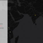
Our past two mystery maps (showing the locations of carillons in North America and showing the path of zika) were solved within 24hrs after unleashing them into the wild. With this Mystery Map, we were hoping to stump our blog readers, but alas, this map was no match for your spatial thinking prowess. The first […]
Learning from the Favorite Places Project
By Karen Yu ’16 One of the older projects that we have worked on at the SAL is the Favorite Places Map on our website. The goal of this project was to see where students, alums, and others saw as their favorite places on campus. Are there parts of campus that students aggregate more towards […]
April Mystery Map
Put on your spatial thinking caps – the next Mystery Map Competition is a go! Click on the image below to see the full, interactive version. Two hints to get you started: First, this maps relates to an event which took place in early March. Second, we could have shown data for the US in this […]
Collaboration with the Art Museum!
by Karen Yu, Spatial Analysis Lab Assistant Despite its physical appearance, the Spatial Analysis Lab (SAL) is more than just a computer lab in Sabin Reed. Behind the scenes, we’re often busy with new projects, teaching, and always thinking spatially. Recently, the Art Museum reached out to collaborate with the SAL on a new exhibit […]
Two upcoming workshops on web mapping
Tomorrow, 3/22 from 4:15 to 5:30pm, we’ll offer our workshop “Teaching with Story Maps” for a second time this semester. The workshop will introduce ArcGIS Online’s Story Maps platform and strategies for using it in the classroom. Whether you’ve used Story Maps or have never heard of it, you’ll leave with a better understanding of how […]
March Mystery Map Solution
With almost 600 views, our most recent Mystery Map proved to be one of our most popular. And perhaps one of our easiest as well – of the 14 submissions received, all correctly identified the theme of the map as the spread of the zika virus. Here’s our official winner list, in order of submission: […]