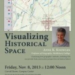
Great opportunity to learn about Historical GIS (HGIS) from one of the leading thinkers in the field. Anne Knowles from Middlebury College will be on campus this Friday, November 8th to discuss her work on visualizing the Battle of Gettysburg. Explore the online map for a little preview: A Cutting Edge Second Look at the Battle […]
Category Archives: Teaching
Fall 2013 Spatial Analysis Lab Workshop Series
This fall, the Smith Spatial Analysis Lab will be offering a series of GIS and GPS workshops to Smith and Five College students, faculty, and staff. Whether you are taking or teaching a class that involves spatial data, interested in using geospatial technologies in research, or just want to know what all the fuss is […]
Geospatial Sciences Program gains approval at Radford University
This emerging field is transforming the way that geographic data is analyzed for scientific research and applications as well as the way business is conducted globally.
Interterm 2011
GIS Interterm Course January 2011 Course – proposal submitted and details coming soon.
Pests and Plagues
View as Google Earth File In the BIO110 seminar, Pests, Plagues, and Profligates: The Biology of Invasions students interact and explore John Snow’s London Cholera, 1854 data. They can do their own analysis, explore distance, proximity, and density among other metrics.


