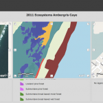
Comparing aerial photos: Google Imagery Bing Imagery If it doesn’t automatically load the Sattelite/Aerial imagery, find the option in the menu bar to switch to this view. Questions to talk about with your partner: What happens as you zoom in and out? Do the Bing and Google imagery adjust at the same zoom levels? What […]
Category Archives: Classes
News Update: November 27, 2012
November was a busy month in the Smith Spatial Analysis Lab! (Aren’t they all…) At the start of the month, environmental justice was an academic theme. Since this area of sociology and environmental studies pulls in elements of demography, law and policy, natural resources, public health, and social justice, it is truly a rich subject […]
News Update: October 29, 2012
With the fall semester halfway over, things have been pretty hectic in the Spatial Analysis Lab! We are gearing up to provide regular support to two additional Environmental Science and Policy classes in the coming months. Students in a core course in the major, Collecting and Analyzing Information, will be working with GIS data to […]
Intellectual Inquiry 2006
In the summer of 2006, the Spatial Analysis Lab participated in a pre-orientation program titled “Intellectual Inquiry” Files Google Earth File (kmz) showing painting and artist’s approximate location from the Northampton Dome. Google Earth File (kmz) showing 1831 Map of Northampton, published by Pendleton’s Lithography, Boston, MA


