On Wednesday night the Spatial Analysis Lab hosted workshop instructor Teresa Clary to lead an 90 minute session on Ebola First Responder Mapping with OpenStreetMap. The workshop was heavily attended, pushing the SAL and its computer capacity to the limits. The Humanitarian OpenStreetMap Team has developed a project called MapGive, which encourages volunteers to help […]
Category Archives: Cartography
Smith College Rail System
Geo-artist Elena Terhune ’14 created this awesome map of an imagined Smith College Subway System. Check it out, and read what she has to say about the process of creating it: “Especially in the colder winter weather, we have all idly wished for some way to travel quickly and warmly. Smith’s Spatial Analysis Lab heard you, […]
An Interesting Map For Your Friday Afternoon!
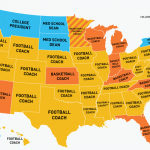
Food for thought over the weekend: a state-by-state map of the highest-paid public employees. (via Deadspin – click map to enlarge) This map is a great example of why maps are an efficient way to communicate data. Could this data be visualized using a bar graph, or a pie chat? Yes. Absolutely. But putting it […]
NATIONAL GEOGRAPHIC AWARD IN MAPPING
Undergraduate students and master’s-degree candidates are invited to apply for the National Geographic Award in Mapping. This award recognizes student achievement in the art, science, and technology of mapping and seeks to encourage student research. The first place award consists of a cash prize of $900 (U.S.) and the second place award is $300 (U.S.). […]
Food Bank Mapping
The Food Bank of Western Massachusetts sought mapping and analysis support from the Spatial Analysis Lab during the summer of 2010. The project is currently on hold, but you can view some of the initial map products below. Sarah Motti ’10 provided assistance on the project during her summer employment in the SAL. In many […]
Bike Trail Mapping
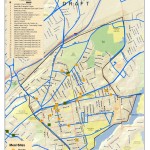
The Spatial Analysis Lab (SAL) recently finished the 2011 version of the “Easthampton ~ Northampton Trail & Bicycle Map” for the Friends of Northampton (MA) Trails and Greenways (FNTG) organization. The 2011 series marks the third iteration of the map series which started back in 2006. The Bike Map series represents countless hours of effort […]
Animation of US Settlement
Animating Spread of European Settlement in the US 1790-2000
Cartograms
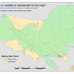
A cartogram is a thematic map in which some variable (e.g. population) is substituted for land area. The alternate variable is conveyed through a distorted geometry of the map. This example displays the state origins of the Smith Class of 2012. December 2008 Mystery Map displaying class of 2012 as a cartogram View as a […]
The Power of Maps
I’m just starting to track who looks at our webpage and in particular the maps that are posted. I never dreamed that such fist-o-cuffs would erupt over our animated map showing the history of US settlement. I (add some of the students who work with me) created this map for a political science instructor. I […]
