Have you ever considered what a rock does all day? Where do they live and where do they go?
In the past few months we’ve been assisting a team of sedimentary geoscientists studying these very questions– where do rocks move in the Mill River? We’ve been assisting their work by flying drone missions above their study locations. Super high resolution images allow them to identify individual rocks to track their movement. Why you might ask? To better understand the effects of increasing storms on our local watershed, and other river systems!
The project location extends between the Lamont Bridge, past the Paradise Pond dam, all the way upstream to a bend in the river where a gravel bar has formed. There are a few important study locations along the river where the team uses Radio Frequency Identification (RFID) technology and inserts Passive Integrated Transponder (PIT) tags into individual rocks to track their movement. Typically wildlife biologists use this technology to monitor animals, but geoscientists studying fluvial environments have begun to use PIT tags to track the movement of sediment. So far, the team has tagged about four rocks and are looking for patterns in the sediment movement. We’ve gone out with their team a few times to capture high resolution imagery of their study locations to help visualize these areas and locate the changes in the gravel bars.
We learned quite a bit in this process and have added an important question in our pre-flight checklist– did you account for any change in elevation of your surroundings? Elevation change got the best of us during one of our missions and caused us to crash into a tree. Before the mission we checked the height of the trees on one side of the bank, but didn’t notice the steep incline further up the river on the other side of the bank. Python the tiny robot didn’t make it after the crash, but its legacy will live on in aiding the SAL teach about the anatomy and engineering of drones. Look at the topography before you fly!
Severe storms are on the rise as the climate continues to change, and we must take into account the effects on the Mill River. The life of a rock can help us better understand these changes and create plans for resiliency. The research will extend to The Bahamas– a completely different ecosystem and relationship to climate change. Emma will be joining the research team in San Salvador, Bahamas to fly over study sites on the island to track the movement of boulders after major storms. We know that climate change has vastly different and disproportionate connections to different regions of the world, especially island nations. Islands, such as The Bahamas, are hit hard during hurricane season, which is only getting stronger. By understanding the movements of sediments after these storms we learn the intricacies of their destruction and can create powerful resiliency plans. More on The Bahamas in January!
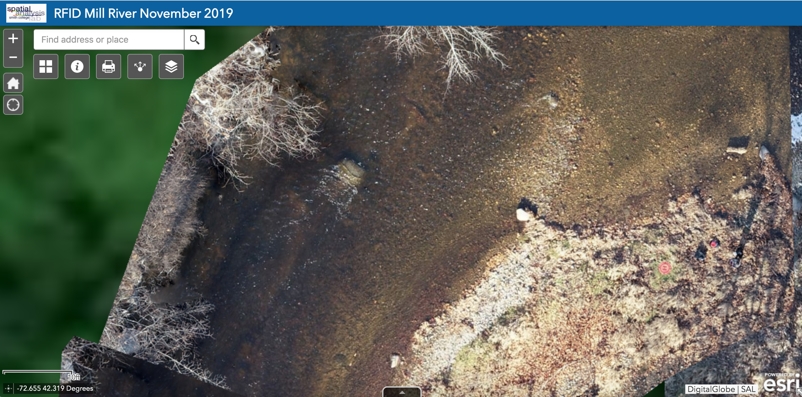
Drone imagery of the gravel bar upstream in the Mill River. High resolution photos of the study site allow for researchers to identify the exact locations of specific rocks and track their movement.
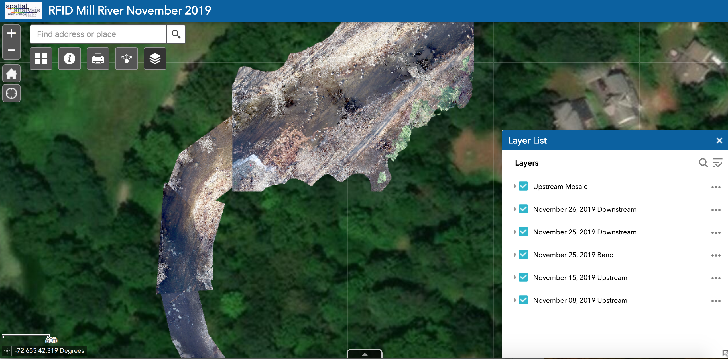
The full study location upstream the Mill River. Multiple missions were flown and the images were subsequently mosaicked in ArcMap into one single image.