** Note: the post-bac position is now filled **
– fall 2017 –
Loyal readers, it is almost time for me, Scott, to bid you farewell! After two years serving as your Post-Baccalaureate Spatial Analysis Fellow (try saying that ten times fast – or fitting it on a resume!), I’m moving on to graduate school next fall. Which means, the SAL is now looking for a new Post-Bac! And while the official job description is a real page turner, I wanted to share with you some of the most rewarding experiences that I’ve had at Smith that you won’t find there. One of the amazing aspects of the position is that you have the flexibility to hone in on your particular interests by taking advantage of the many opportunities that Smith College offers. This is by no means a comprehensive list, but I hope it conveys the amazing variety of projects that I’ve been fortunate enough to be part of.
Drones
This is perhaps the trendiest part of my job. I used to introduce myself at parties by saying “I work with GIS, or Geographic Information Systems,” and at that point my interlocutor would usually excuse themselves to use the bathroom. Eventually I realized that not everyone thinks GIS is as neat-o as I do, so now I just say that I fly drones and people seem to actually want to talk to me!
When I came to Smith, I was aware of how drones could be used for GIS – to conduct small-scale aerial surveys – and I had seen a drone fly and used drone imagery for a class on archaeological GIS. But, I had never flown one. The first time I did was last April, during a geomorphology trip to Popham Beach in Maine. In the year since, I’ve helped to teach an interterm (January session) workshop on flying drones, I obtained my FAA Remote Pilot Certificate, and I’ve traveled to Ambergris Caye, Belize, and St. Catherine’s Island, Georgia, to fly drones in support of research on mangrove, coral reef, and sea turtle conservation. (Oh, and I’ve gotten a few drones stuck in trees….) Plus, the issues surrounding drones, especially the issue of privacy, and the opportunities to democratize the collection of aerial imagery, has really helped me to understand where I want to go next: coordinating the collection, analysis, and dissemination of big data to improve environmental planning practices.
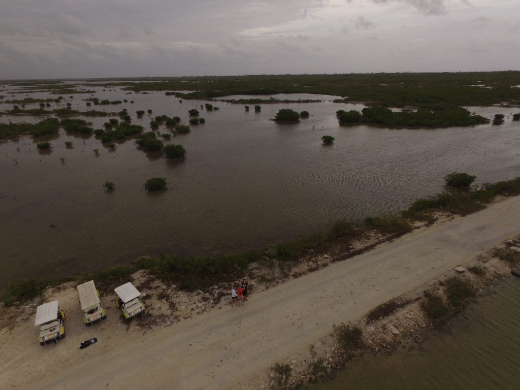
Mangrove drone team in Ambergris Caye, Belize: from left to right, Laura Henry ’16, Ziqiu Zhang ’17, and me (Scott)
Web mapping
I came to Smith with a budding interest in web mapping, and it ended up being a much larger part of my job than I ever expected. Many professors in the humanities and social sciences are eager to incorporate ArcGIS Online and specifically Story Maps into their curricula for a few reasons: because the platform has a lower barrier to entry than desktop GIS, because Story Maps are a great way to integrate narrative and other kinds of media with cartography and spatial analysis, and finally because a lot of community organizations are interested in having students develop interactive web maps for them. I’ve worked with classes ranging from “Buddhism in America” to “The World Water Crisis” to “StoryMapping Bioenergetics” to teach them how to build Story Maps. I also had the opportunity to dig deeper into Story Maps, specifically how they can be customized with HTML, CSS, and Javascript, by working with the staff of the Museum of Art to create a digital supplement for their Fall 2016 exhibit “When In Rome”.
But working with the open-source world of web GIS has been even more exciting for me. I’ve used CARTO to create several maps for the SAL’s periodic “Mystery Map” competitions. I really started to get deeper into web GIS as part of a class at UMass last spring. I convinced Jon to let me help out as a “teaching assistant” in that class, which meant that basically I learned the class material a week ahead of the students, put on my best poker face, and pretended to know what I was talking about. But, I was able to harness my shaky web development skills to create a crowd-sourced map for the Undesign the Redline exhibit that was on display in Neilson this semester. It took a while to put this together because I didn’t entirely know what I was doing. Very conveniently, though, I dislocated my shoulder and was in a sling so I could blame my slowness on typing one-handed.
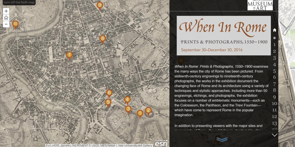
Screenshot from the “When In Rome” online exhibition, created using Esri Story Maps
Blended learning
A major benefit to the post-bac program is that it helps to cross-pollinate ideas between schools, and that’s especially true for the SAL since using GIS in a liberal arts context presents unique challenges and opportunities. I learned GIS through a blended curriculum, meaning that my GIS professor recorded video tutorials that we completed as homework, and class time was reserved for questions and project work. I was a blended learning convert when I came to Smith, so when Jon took a beach vacation during my first interterm here, leaving me in charge of the week long GIS class, I tried to teach the class exactly how I learned GIS. But, I quickly learned that this learning style was not suited for the shorter workshops and labs that constitute many Smithies’ primary exposure to GIS. So, last spring, I started designing GIS blended learning materials that adapt the blended learning style I encountered to the unique way that GIS is taught here.
This project has been especially satisfying for me because I’ve overseen every aspect of it, from writing the grant application to recording the video scripts to supervising student web developers working on the interactive maps. And, the amount of support that I have received for this project has been truly astounding, from the funding to video editing to project management to web development. If you know where to look, Smith has so many resources to initiate innovative projects like this one, and the post-bac position is a unique platform that gives you access to resources that many recent grads do not have.
This job has challenged me every day to keep up with the ever-changing landscape of geospatial technology and the creative ways that Smithies seek to use GIS. It’s not easy, but encountering these challenges in an environment that is so supportive of learning has helped me grow a lot in my two years here.
If, after reading this you:
- are feeling inspired;
- have substantial experience with and even more enthusiasm for GIS; and
- will graduate with a Bachelor’s this year or have graduated within the past few years;
I hope that you will consider applying for this position! Please reach out to me (sgilman [at] smith [dot] edu) or Jon (jcaris [at] smith [dot] edu) if you have any questions.