What do the Bahamas make you think of? Maybe beautiful beaches, nice resorts, and possibly coral reefs? I know that my first associations with the Bahamas were definitely not drones and hurricanes, but this January I got to see how these things all fit together. I had the privilege of joining a crew from the Spatial Analysis Lab that was conducting research on the effects of Hurricane Joaquin on the island of San Salvador in The Bahamas. San Salvador, or “San Sal” as we called it, is a small island with one main road that circles it. Hurricane Joaquin hit the Bahamas in October, 2015 and the eye of the storm traveled directly over San Salvador. The hurricane was especially slow moving and just sat above the island wreaking havoc. The aim of the research was to see what effect the storm had on the coastal systems.

Sand overwash from the storm that is covering the road.
My role on this trip was to be part of the “Drone Team.” The drones were equipped with high-resolution cameras that could take pictures of the research areas and document the changes to the coast. We used software that allowed us to input the area that we wanted mapped and the application would figure out where the drone should fly and take pictures. We then used other software to stitch the images together into one large image, say of an entire beach. The software can even take these images to create a surface elevation model from the images. It’s amazing! The quality of the aerial photographs is so good that it allow us to pick out individual boulders that are being researched. I loved seeing the drone imagery where the rocks below the water are visible near the shore. The biggest challenge with the drone mapping was that we wanted to get as much imagery as possible, but we only enough batteries for three flights about 10 minutes long and so we had to prioritize the most important areas. The wind got in our way too. There was one location we returned to three times before the wind died down enough for us to fly the drone.
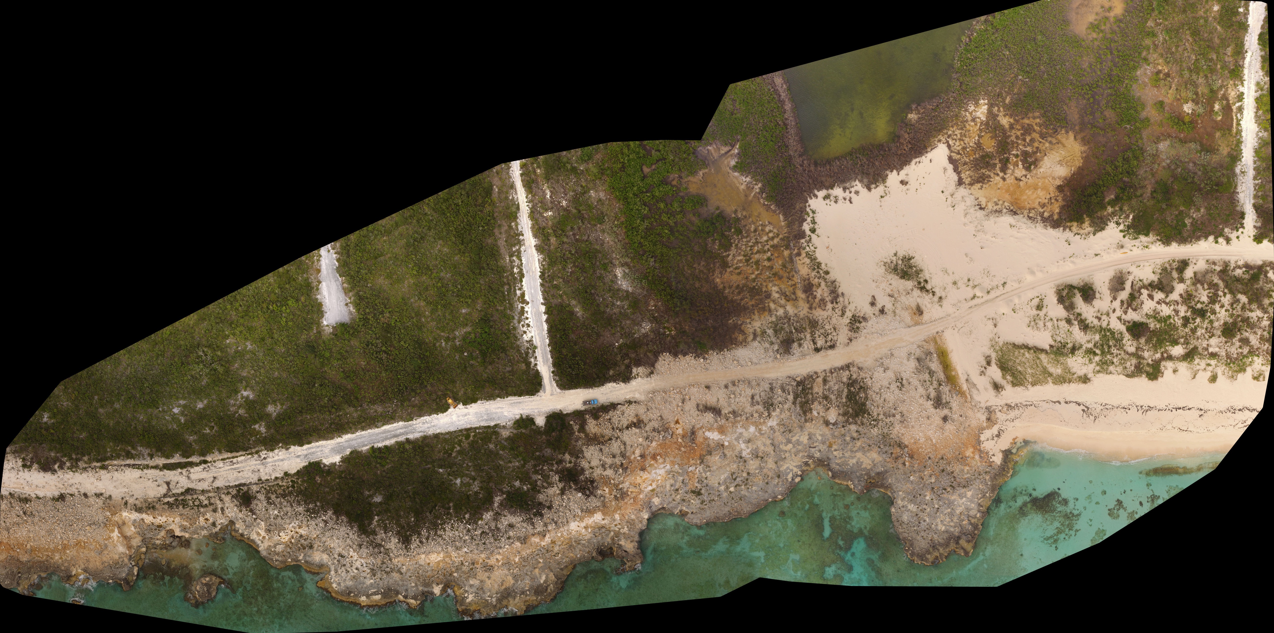
Drone imagery of a section of the southern coast of San Salvador. The sand overwash from the image above is in the upper right corner of this image.
This research trip was a collaboration between Smith College and three other schools. It was a lot of fun meeting the other professors and graduate students and getting to see what other research was going on simultaneously. I learned about creating beach profiles to see whether the beach had eroded and how ground penetrating radar can unveil features like scouring from past storms even when the features are under layers of sand.
A dramatic erosional feature battered by the storm.
I am interested in learning about the effects of natural hazards and extreme weather on society, so this trip was especially interesting from that lense perspective as well. A significant number of the houses had tarps on their roofs and were visibly under construction to fix damage from the hurricane. The road had also taken quite a beating with sections that had simply washed away. A road on the south coast of the island had been completely inundated with boulders (see below). A container ship, El Faro, sank in the storm as well and the beach was covered with assortment of goods like shampoo bottles, parmesan cheese shakers, flea treatment for dogs, and m&m’s. Still, the island was clearly recovering. Much of the airport was rebuilt in just the week that we were on the island.
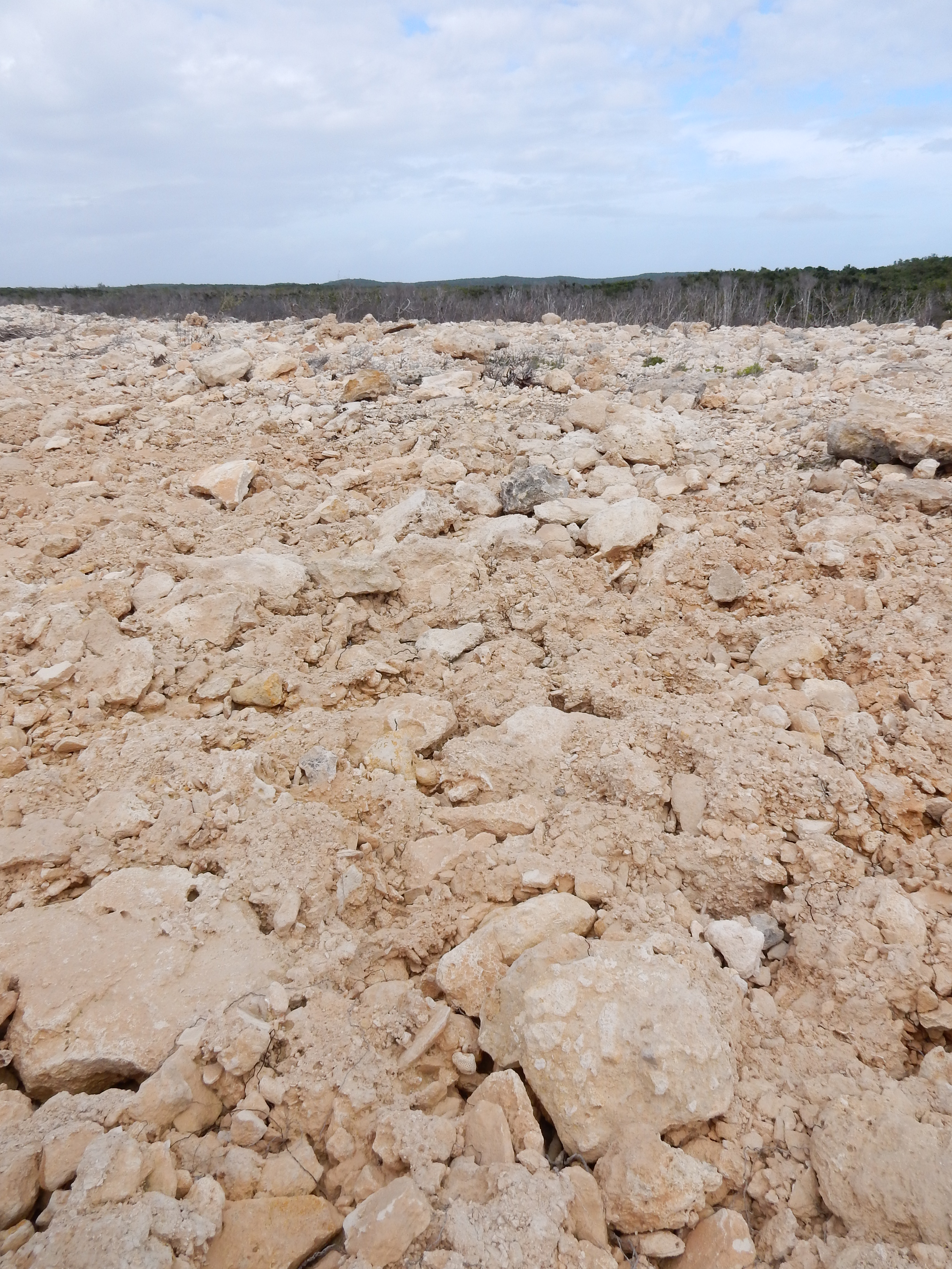
A field of boulders where a road used to be located.
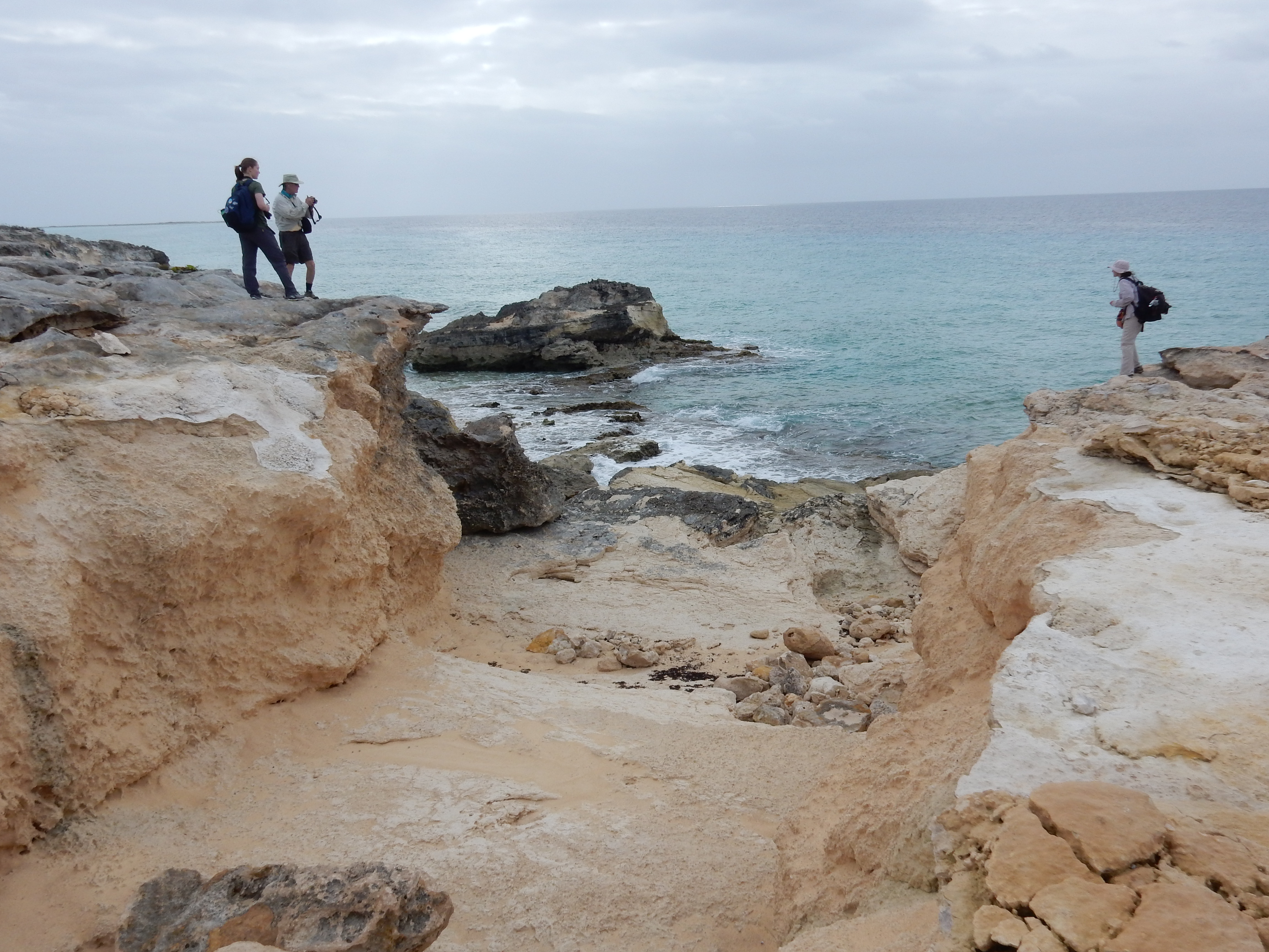
It was nice getting to explore the island as well. The research station where we stayed was near a beautiful point that was jutting into the ocean with wonderful little seacliffs. As a geology nerd I really enjoyed the rocks. The point was made of sand layers that had been turned into rock, and they made beautiful shapes as the layers eroded. Another highlight for me was seeing a pair of dolphins playing in the waves as we were packing up our equipment after a long day in the field. Now that I am back at Smith I am very excited to see what the data can tell us. I’m looking forward to seeing how the work done by the various researchers integrates together to provide more insight about the storm.

Exploring near the research station.
by, Eliana Perlmutter, ’16