November was a busy month in the Smith Spatial Analysis Lab! (Aren’t they all…)
At the start of the month, environmental justice was an academic theme. Since this area of sociology and environmental studies pulls in elements of demography, law and policy, natural resources, public health, and social justice, it is truly a rich subject matter for mapping and spatial visualization. The mid-level Sociology course Environment and Society spent a day in the Spatial Analysis Lab investigating patterns in environmental injustice in Massachusetts. The students began by looking at spatial patterns in the MassGIS “Environmental Justice Populations” layer and comparing the location of these neighborhoods to the distribution of both health hazards (TRI sites) and safe green spaces across the state. Despite the fact that many of these students had never used GIS before, they were able to create maps showing the spatial correlations between these environmental variables, and many even began developing their own spatial criteria for areas of environmental justice concern.
At the same time, the Environmental Integration Methods class began an in-depth lab on a related topic in environmental justice: food deserts. These students conducted background research to develop their own spatial definitions of a food desert, then dug into some dense census data and pulled in geographic layers representing everything from grocery store locations to bus lines to farmers markets to map the location of food deserts in Smith’s hometown of Northampton and a neighboring city, Springfield. It was impressive to see 16 students who had never so much as run the buffer tool begin to embrace model builder and the true complexities of high-level GIS analysis.

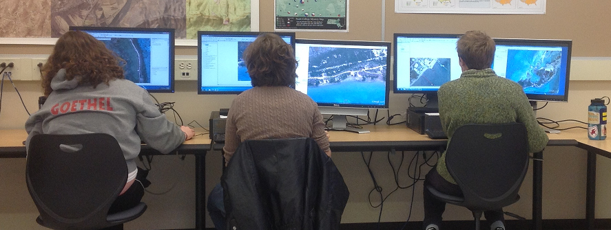
How many screens with imagery do three students need?
Speaking of GIS analysis, the Intro GIS class is in full swing on their independent projects and it will be exciting to see how they turn out! The 19 students in the class are taking this project in about 19 different directions– really representing the versatility of GIS as an analytical tool across disciplines. And in other project news, a group of students from the Environmental Science and Policy capstone course are working with the Hol Chan Marine Reserve in Belize to create a high-resolution habitat map for the entire island of Ambergis Caye. To get going on this important but occasionally tedious task, they spent an entire day having a “mapping party” (pictured above).
As for the behind-the-scenes activities that go in here in the SAL, Cory has wrapped up another Mystery Map and released another video, and Jon is getting deeper into the digital humanities through the Kahn Institute while also continuing support of the transition of campus GIS data to a geodatabase model and integration of Botanic Garden data with ArcGIS. We both attended the recent GIS & Spatial Thinking in the Undergraduate Curriculum Conference at Bucknell University, where Jon presented on facilitating digital and spatial humanities at the Five Colleges and participated in the accompanying panel on qualitative GIS. It was a great weekend that highlighted the ways that our peer institutions are getting students excited about spatial thinking, and we heard some interesting ideas about sprucing up GIS classes that we are keeping in mid as we develop our upcoming 1-week GIS interterm course.