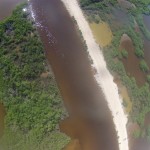
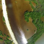
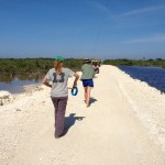
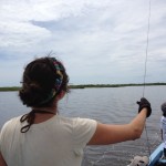
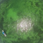
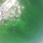
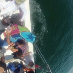
I now have a good answer to that common question – “What did you do on Summer Vacation”? The answer is “I flew kites in Belize”. A fun answer, but this was no vacation. It was actually quite a bit of work, but our efforts at capturing aerial imagery from a kite platform worked better than expected.
Back story – The SAL is developing a variety of platforms for low altitude aerial photography. Some of the more advanced and popular platforms are known as “drones” or “UAVs” (unmanned aerial vehicle). Balloon mapping is also becoming quite popular and kite aerial photography or “KAP” is closely related. We are working to develop techniques and expertise in all three platforms, but most of our experience and success to date is kite based.
Why Belize?
Smith’s ongoing Coral Reef Ed-Ventures Program in San Pedro on Ambergris Caye begins its 13th year with efforts to identify new research opportunities. One such opportunity may be the incorporation of low altitude aerial imagery to support the management and protection of the Hol Chan Marine Reserve, located south of Ambergris Caye. Kite photography offers several advantages over traditional (airplane based) aerial photography:
- low cost,
- simple setup and operation, students can begin capturing images within minutes of deployment,
- timely image acquisition – many areas in Belize are undergoing rapid change, and these changes can be documented and quantified,
- acquisition at altitudes not accessible by plane (~ 50 – 200 meters),
- high resolution, cloud free imagery, and
- fun!
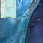
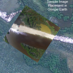
We flew kites with attached camera rigs to capture aerial imagery in three general areas (see image above):
1. Along an access road for a proposed 1300 unit development approximately 6 km north of San Pedro
2. In a large lagoon on Abergris Caye ~ 14 km north of San Pedro
3. In the Barrier Reef ~ 10 km south of San Pedro
We are still processing the imagery, but initial results indicate high quality imagery can be obtained quickly with minimal setup. Eventually, our images will be geo-referenced and incorporated into a geodatabase for inventory and analysis. More on that process in the future…..
Note – these sample images are unprocessed with no correction for lens distortion.
