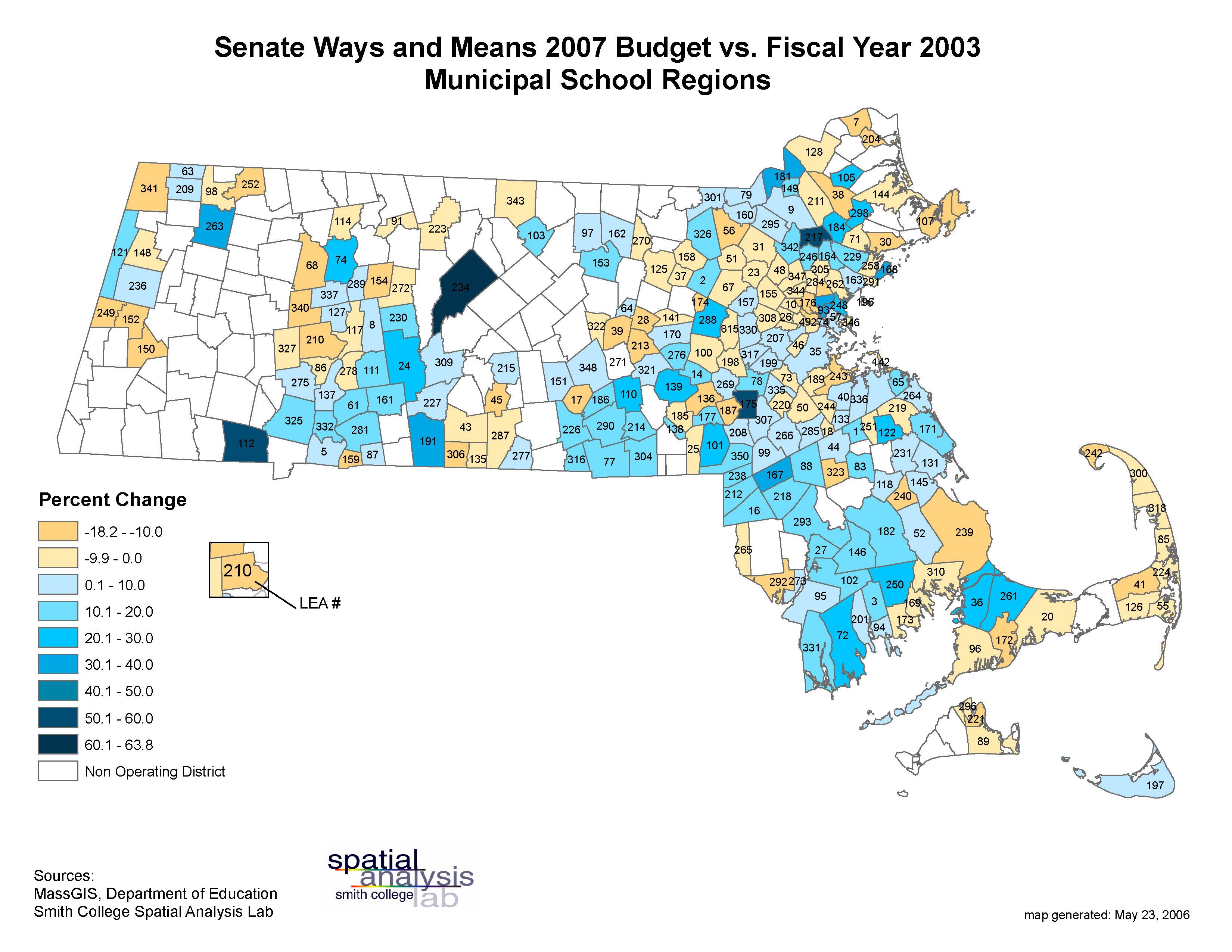
Summary
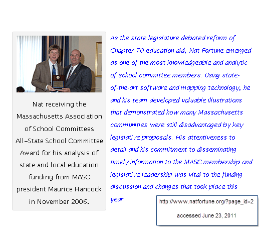
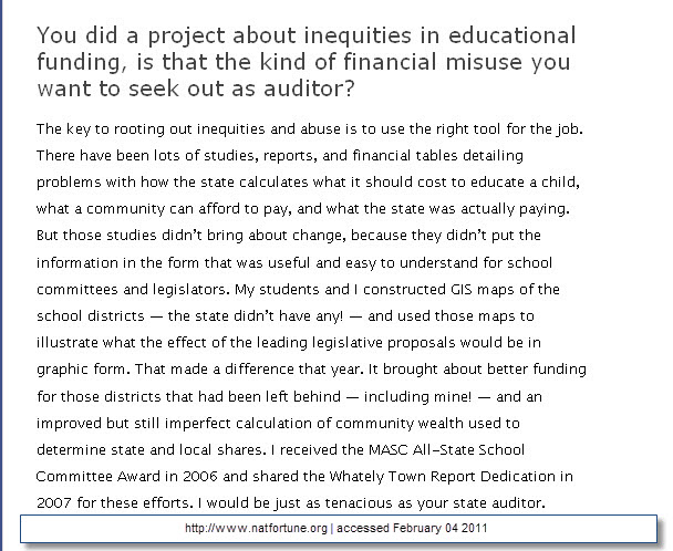
Back in 2006, Nat Fortune, Associate Professor in Physics, worked with me and my student lab assistant, Amanda Nyren, to develop a series of maps for the Massachusetts legislature. These maps depicted legislative proposals to reform state aid to local schools. As Nat found out, plenty of studies, reports, and financial calculations failed to bring about change. Illustrating those same data on a map, which ironically, had not been done before, demonstrated the inequities of the proposals and actually helped generate better funding for the disadvantaged districts. In this case, GIS changed the user’s perspective and unified science and policy.
Below are some images and maps (some draft) that demonstrate and document process.


Fortune