Put on your spatial thinking caps – the next Mystery Map Competition is a go! Click on the image below to see the full, interactive version.
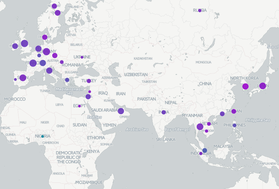
Click on the image to see the full Mystery Map
Two hints to get you started: First, this maps relates to an event which took place in early March. Second, we could have shown data for the US in this map, but the numbers in the US would be much larger and would overshadow the rest of the data in comparison.
Thanks to SAL Assistant Kalynn Kosyka ’19 for her help designing this map! She’ll explain how she gathered these data and displayed them in CartoDB in our wrap-up post.
So, what exactly does this map show? If you think you have the answer, use the form below to submit your response!
[123-contact-form i1915011]