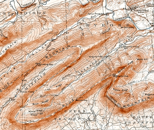
Label all the major structural features: For folds draw the fold axes and show with an arrow the direction of plunge (if any). Write the type of fold on the fold axis line. Place and orient appropriately strike and dip symbols along any resistant rock ridges. For faults, draw lines along the fault, label the upthrown and downthrown sides if dip slip motion dominates or with arrows show the relative direction of fault movement if strike slip movement dominates.
Label all the major structural features: For folds draw the fold axes and show with an arrow the direction of plunge (if any). Write the type of fold on the fold axis line. Place and orient appropriately strike and dip symbols along any resistant rock ridges. For faults, draw lines along the fault, label the upthrown and downthrown sides if dip slip motion dominates or with arrows show the relative direction of fault movement if strike slip movement dominates.

Label all the major structural features: For folds draw the fold axes and show with an arrow the direction of plunge (if any). Write the type of fold on the fold axis line. Place and orient appropriately strike and dip symbols along any resistant rock ridges. For faults, draw lines along the fault, label the upthrown and downthrown sides if dip slip motion dominates or with arrows show the relative direction of fault movement if strike slip movement dominates.

Label an example of the following features on this map:

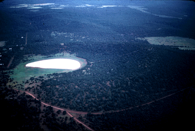
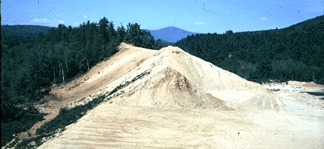
Draw contacts around and label the stratified drift features shown on this map. Note that the adjoining photo was taken from the gravel pit marked on the map. What is the evidence for your classification?
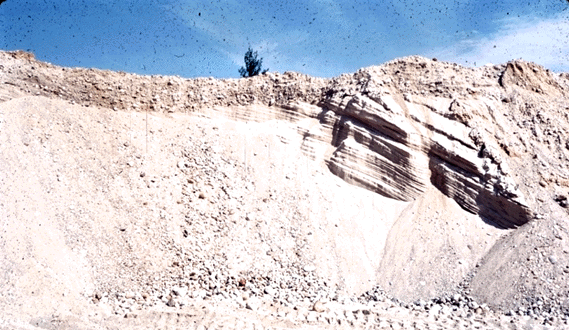
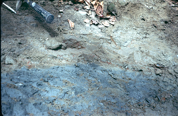
This photograph was taken from the gravel pit marked on the adjoining map. What sedimentary features do you see in this exposure and what do they tell you about the geologic history of this area?
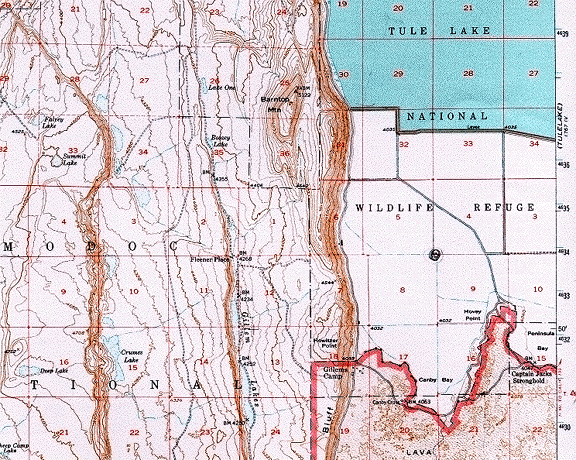
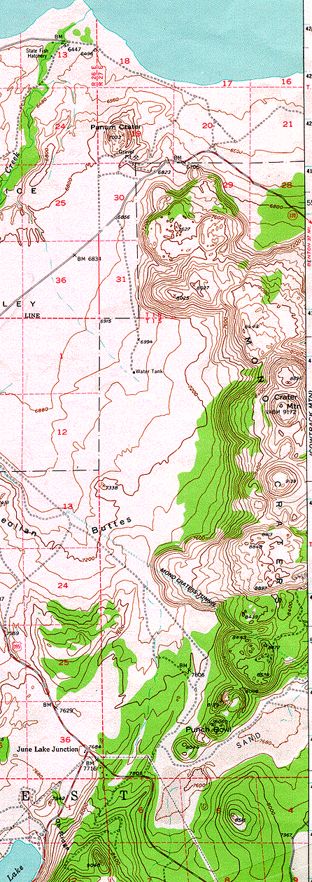
Label the principle geomorphic features on this map and write a brief explanation of the sequence of events which created them.

Label all the major structural features: For folds draw the fold axes and show with an arrow the direction of plunge (if any). Write the type of fold on the fold axis line. Place and orient appropriately strike and dip symbols along any resistant rock ridges. For faults, draw lines along the fault, label the upthrown and downthrown sides if dip slip motion dominates or with arrows show the relative direction of fault movement if strike slip movement dominates.
Write a brief explanation of the sequence of events which created this landscape.
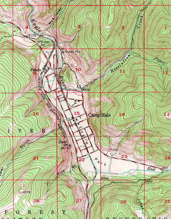
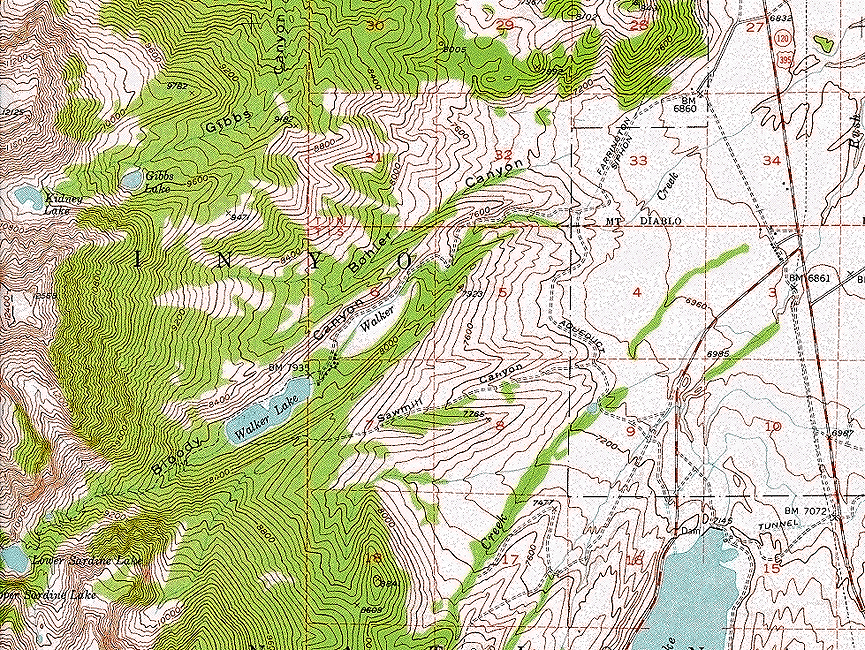
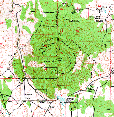
Label the principle geomorphic features shown on this map. What processes created them?
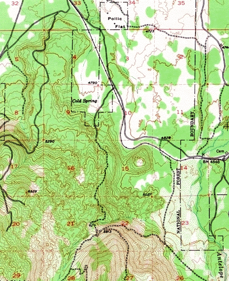
Label the principle geomorphic features shown on this map. Write a brief explanation of the sequence of events which created this landscape.
Map 10
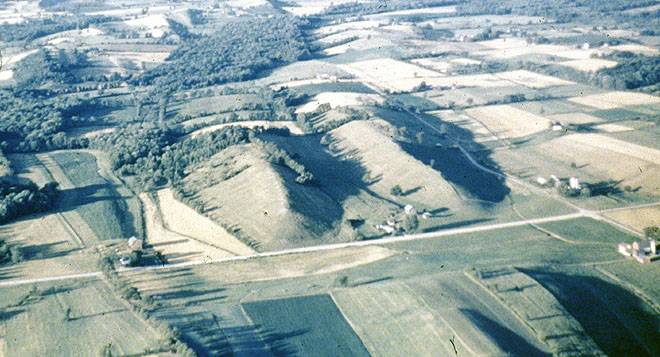
What is the principle geomorphic feature shown on this map? How was it formed?
Map 11

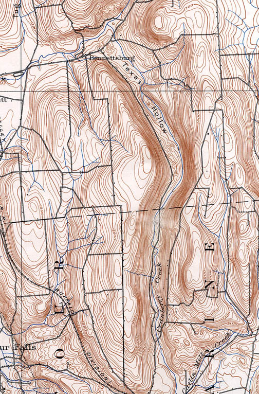
Describe the sequence of events that led to formation of this stream pattern.
Map 12
How did this landscape form? What is your evidence?
Map 13
Describe the geomorphic history of this area.
Map 14
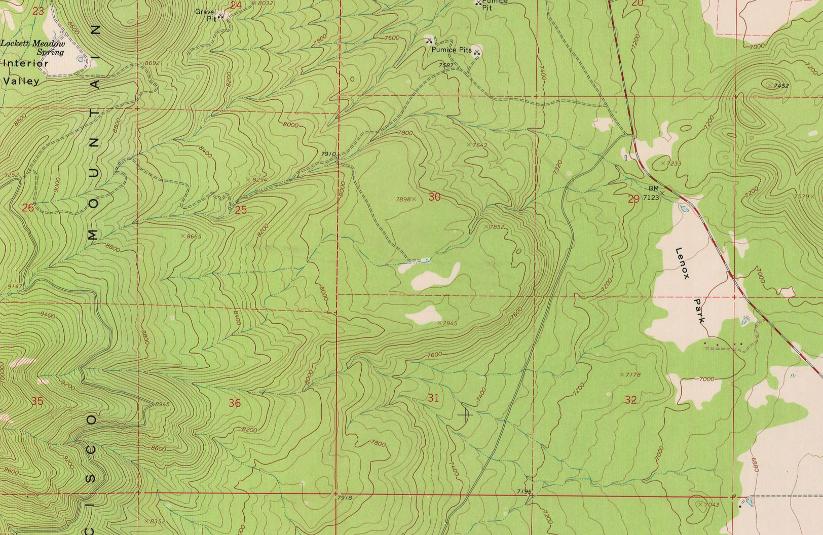
Map the principle geomorphic features and completely explain how this landscape was formed.
Map 15
Map the pinciple geomorphic features and completely explain how this landscape was formed.
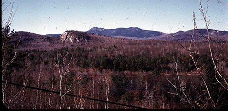
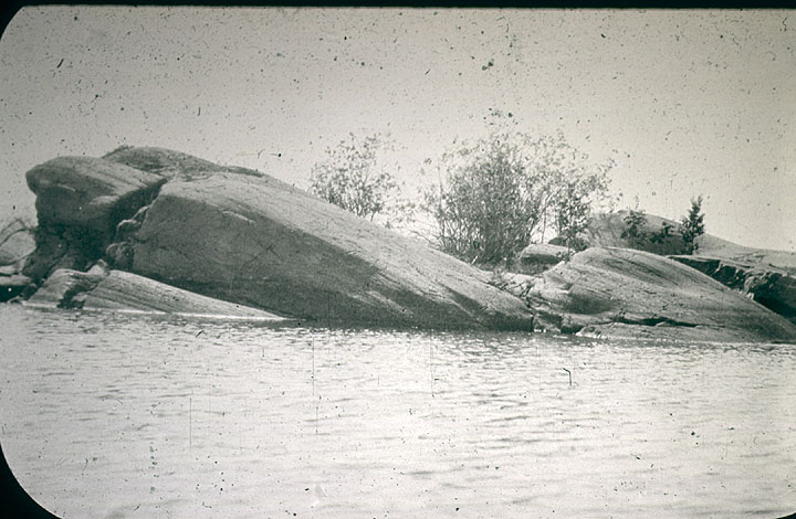
What is the principle geomorphic feature shown in this photograph? How was it formed?
Label the principle geomorphic features shown in this photograph? How were they formed? Write a brief explanation of the sequence of events which created this landscape.
What are the principle geomorphic features shown in this photograph? Explain how this landscape formed. Include a cross-sectional sketch in your answer.
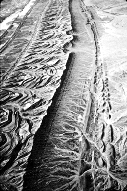
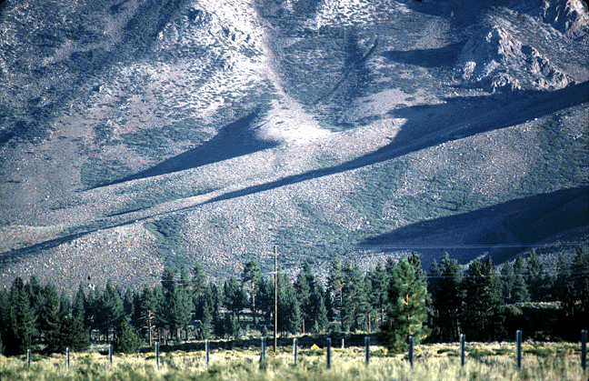
What is the geomorphic term for the features shown by the letter W in this photo? How were they formed?
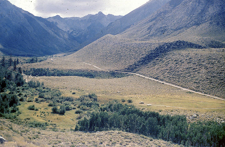
What are these features? How did they form?
How did this feature form? Include detailed observations of the geomorphology in your explanation. Make sure you give a complete answer. A single word is not sufficient.
What is the term for the principle geomorphic feature in this photo. Give a DETAILED explanation as to how it formed and what it tells you about the geomorphic history of this area.
What is the principle geomorphic feature in this photo. How did it form? What does it tell you about the geomorphic history of the region?
Photo 9

Describe the geomorphic features shown in this photo. What has happened here?
Photo 10
Describe all the geomorphic features shown in this photo. What is the geomorphic history of this area?
Photo 11
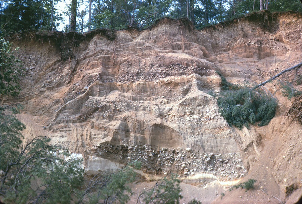
What is this sediment and what does it tell you about the geomorphic history of this region?
Photo 12
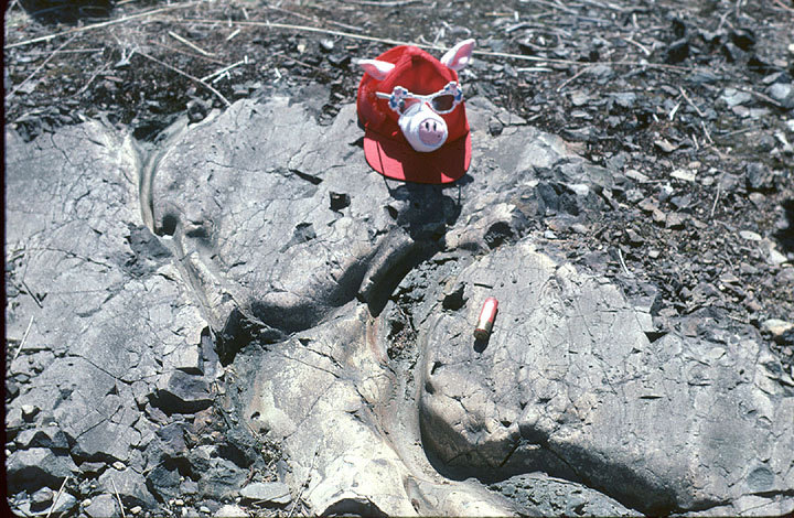
What are the features shown on this bedrock exposure and how did they form?
Photo 13
What is the term for these features and how did they form? What do they tell you about the geomorphic history of the area?
Photo 14
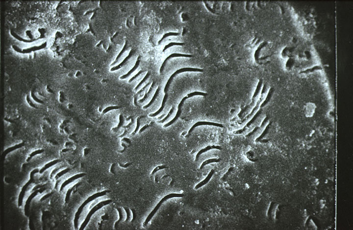
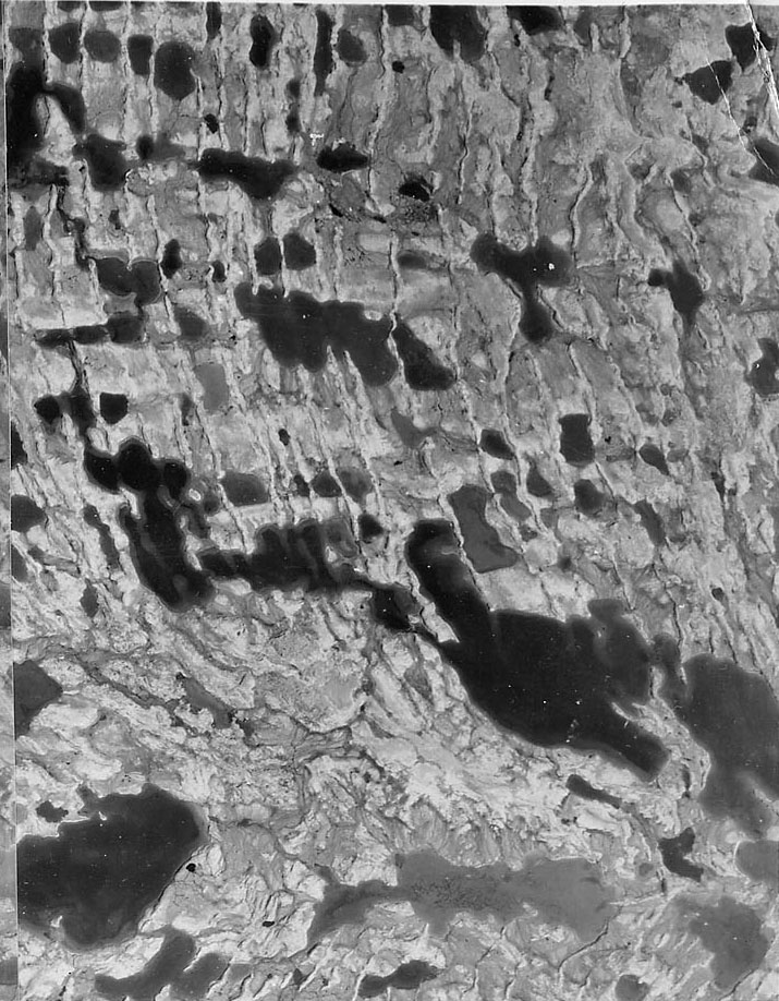
This is a photomicrograph of a garnet grain taken by a scanning electron microscope. What does this tell you about the sediement from which this garnet was derived?
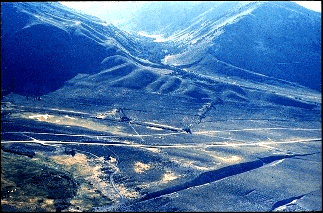
Carefully label ALL the geomorphic features on this photo. Write a detailed history of the sequence of events which created this landscape. Make careful observations and give complete answers.
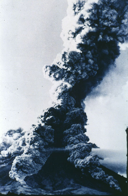
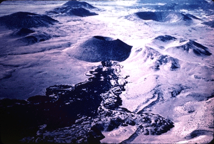
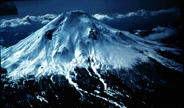
Describe and classify the type of eruption that is occurring. What is the likely composition of the magma?
Photo 17
This is an exposure in a geomorphic feature. Use your observations of the nature of the sediments and sedimentary structures to classify this feature. Justify your classification based on your observations.
Photo 18

Describe the geomorphology of this area and explain how the landscape was formed.
Photo 19
What are the principle geomorphic features shown in this photo and how were they formed?
DEM 1
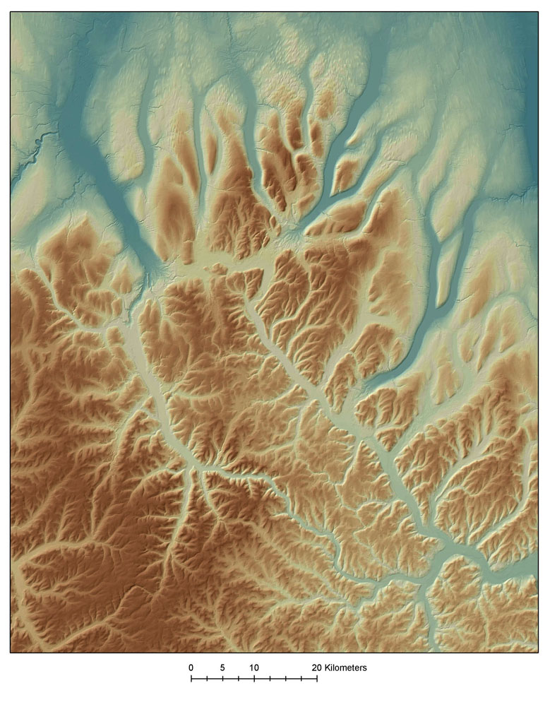
Describe the geomorphology of this region and explain how the landscape was formed. Note any unusual features.