Much of what we do with drones is help others understand and use drone technology in ways that help supplement their research. Here are some examples of the work that we’ve done, using drones to capture the aerial imagery and process that imagery into high-resolution maps and digital surface models.
Smith College Campus
Videos
Bringing Back Paradise – Smith College Paradise Pond
Mapping
Selected Missions
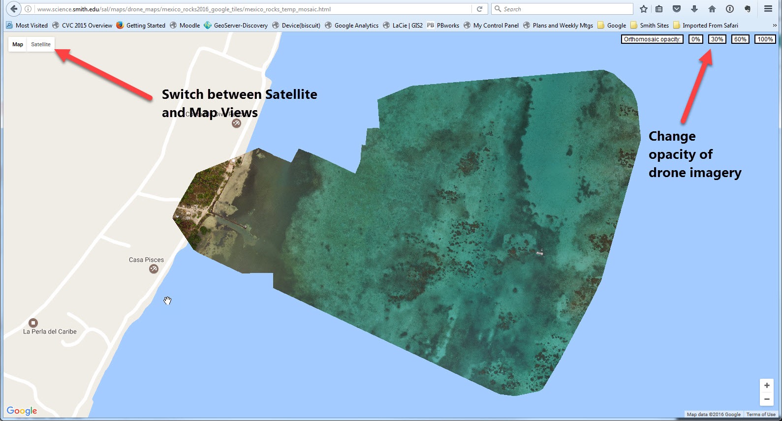
Instructions for using Google Map Overlays
Google Map Overlays
Seawall Marsh, Popham Beach, Maine April 25 2016
Mexico Rocks, Belize, June 2016
Gulf Coast, San Salvador, The Bahamas, January 2016
North Pigeon Creek, San Salvador, The Bahamas, January 2016
Salt Pond, San Salvador, The Bahamas, January 2016
Stream Restoration, MacLeish Field Station, Whately MA, Fall 2016
Invasive Species, Fitzgerald Lake, Northampton, June 08 2017 (70 meters)
ArcGIS Online Interactive Maps
| Popham Beach, Phippsburg, Maine, April 2018 | 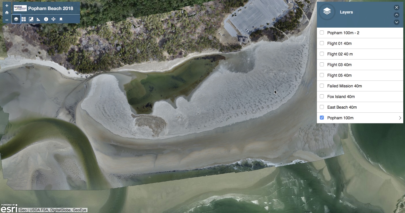 |
| Grow Food Northampton, Northampton, MA May 2018 | 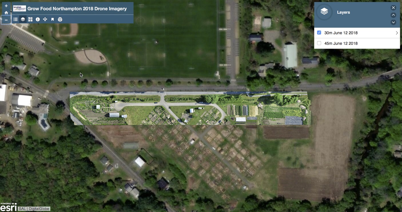 |
| Fitzgerald Lake, Northampton, MA May/June 2018 | 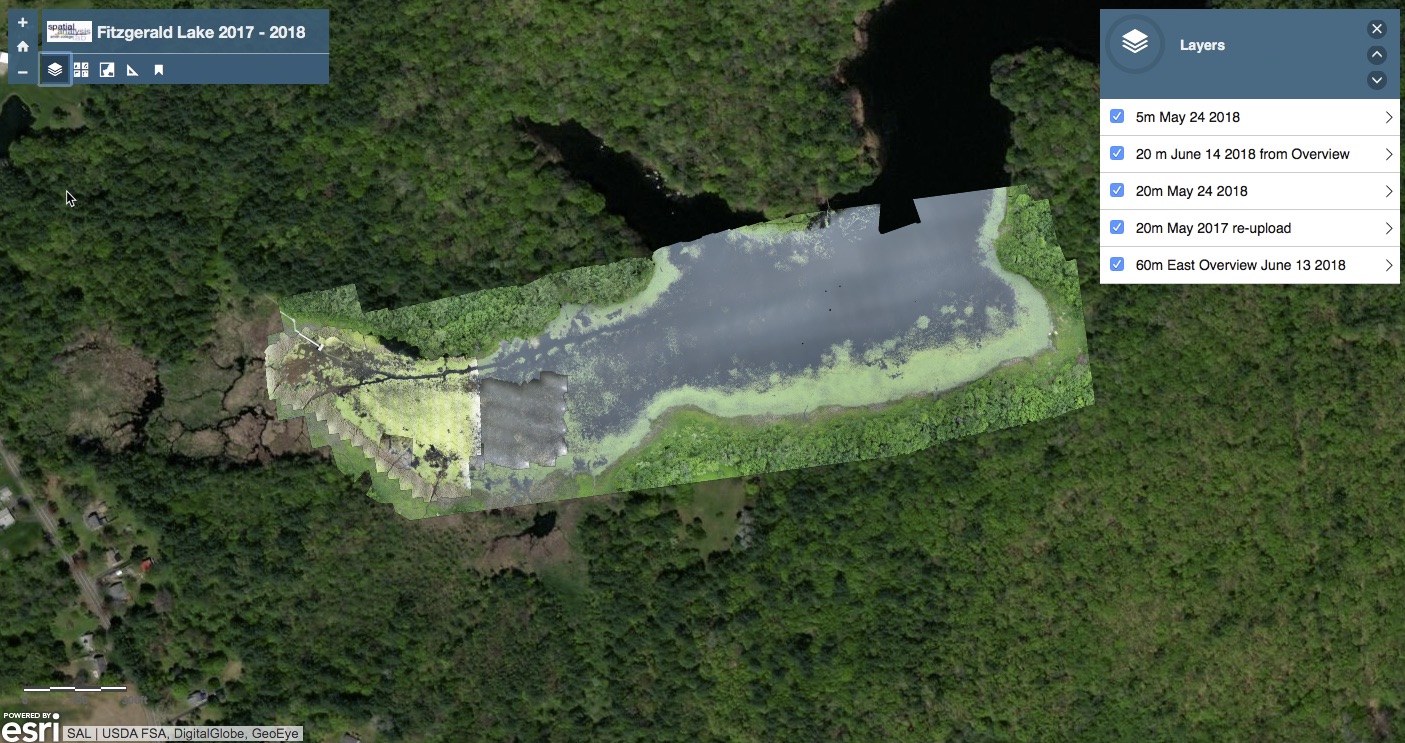 |