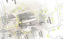
Settlement Progression shown with Dot Denisty Technique
Attribution:
Caris, J. & Stearns, C. (2006). Smith College Spatial Analysis Lab. [U.S. Historic Settlement Patterns
1790-2000 animation]. Data sources: TeleAtlas and US Census Bureau, ESRI Data and Maps, 2006.
Thanks and acknowledgement to ESRI's George Dailey and Ray Carnes for data discovery and to SAL assistant Abby Mannelin for data processing.